
Map | Download | Other hikers | Thanks
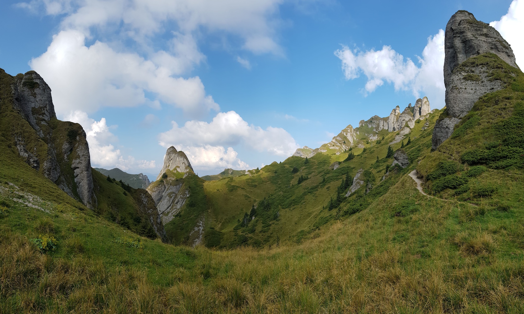
There is not a single trail across the Carpathians at some parts the main ridge is obvious (Făgăraș) while in other sections a hiker can choose from different mountain ranges.
Some have already tried to chart Via Carpatica or The Carpathian Divide Trail but these plans are materializing slowly and have not been completed. Meanwhile handful of people are walking across the whole range every year. From the conversations I have had, most of them would love to keep Carpathian thru-hiking as it is without an official trail in place. The reasons are simple: 1) charting an “official route” invites sports(wo)men who feel the need to compete and bend everything to their achievement not respecting the fragile nature and relationship with the locals; 2) while charting a route means taking responsibility towards nature, local communities and hikers, it also takes some responsibility from the hikers and invites less experienced characters; 3) official route enables comparison but takes away uniqueness of the individual experience; 4) the official routes are usually someone’s business projects, the less commerce we see at the expense of the mountains and the locals, the better.
While planning my trails in the Carpatians I try to avoid civilization as much as possible and stick to mountain ranges. The trails are walked-thru, not planned on a screen, that is why the datasets are a bit larger than the computer-generated ones.
The 2019 thru-hike started at Pálava – the westernmost point of the range, where Carpathians collide with much older Hercynian platform. Through Slovakia I followed footsteps of Svetozár Krno, Ľuboš Calpaš and Pavel Mach who traversed the Arc in 1984. Unlike most other hikers, I did not finish in Orșova, but reached the Danube in Coronini walking extra 100 km to the west. As there are Czech settlements in the area, it made the magic of hearing my mother tongue at both ends of the Carpathian journey.
Map of the thru-hikes
Click the upper-right corner to enlarge the map, click upper left corner to choose points of interest (water, shelters, shopping options, …).
To download:
- the 2019 trail in gpx format based on my smartwatch treklog, most of the detours, searches for water etc. are erased, added are 40 km across Parâng I unfortunately missed
- alternative trails: Bratislava–Góry Leluchowskie and Vlădeasa-Orşova
- water sources coordinates collected along the trails by Michal, Chemlon and other hikers
- shelters – it is always good to know if there is some dry place across the hill
- comprehensive database of POIs for hiking in Slovakia can be found here (in Slovakian), e.g. campsites, shelters and chalets or water springs (here as of December 2023)
- other points of interest (hiking advice, bear areas, shopping, electricity..)
- and of course, see the blog from the journey or look at map sources links
Download instructions: based on several feedbacks the download does not work by clicking the link in some browsers (Chrome, Safari). In this case, right-click the link and choose the save-as or download option. Based on your online safety settings you might receive a warning that the file is not secure. The reason is the browser/antivirus cannot see inside the zip files containing gpx. Here is an alternative link to a Google Drive folder.
Your inputs to points of interest are very welcome. You can mail them to michal@skaut.cz in order to be integrated in the datasets. And of course, you can buy me a coffee if you find this work helpful.
Other hikers
Pages of (reference to) other hikers who walked across the whole Carpathian mountain range:
- VI-IX 1980 Andrzej Wielocha, Piotr Kurowski, Jerzy Montusiewicz, Zdzisław Pecul, Wiesław Tomaszewski, PL
- VI-VIII 1984 Svetozár Krno, Ľuboš Calpaš & Pavel Mach, SK
- XII 1995-V 1996 + V-IX 2004 József Mályi, H
- 2004 + 2013 Łukasz Supergan, PL
- 2011 Simon Dubois, F (link to his trail)
- VI-IX 2013 Piotr Baranowski, PL
- V-XI 2015, VII-IX 2021 Viktorie Hlaváčková, CZ
- VII-X 2015 Andrei Dumitrescu & Vlad Spiru of the SKV tourist club, RO
- summer 2015 + XII 2017- III 2018 Weronika Łukaszewska & Sławomir Sanocki, PL
- V-IX 2017, Dominik Księski, PL (link to pictures)
- VII-IX 2017 Lina Hallebratt, S (link to her blog)
- 2019 Jean-Marc Souchon, F
- IV-VIII 2019 Michał Kulanek, PL (link to his trail)
- VI-VIII 2021 Ewa Chwalko, PL
- VI-IX 2021 Bohdan Oslavskyj, UA (link to his trail)
- VII-X 2021 Jiří Chemlon Glonek & Marek Štencl, CZ (link to their trail)
- VII-X 2021 Peter Jankovič, SK
- VII-X 2022 Jiřina & Rosťa Gregorovi, CZ
- VI-VIII 2023 Pavel Löbl, CZ (link to his trail)
- VII-X 2023 Marysia Chrostowska & Iga Łukaszewicz, PL
- VI-IX 2023 Goulven (link to his FB page)
Łukasz Supergan manages this more comprehensive list of hikers in Polish.
I must note that “walk across Carpathians” can mean different things depending on the trail and philosophy you choose so I would be very cautious making any comparisons. Weather plays significant role while on the hike. Starting and finishing points differ. Some walk highest peaks only, some also walk valleys or lower ridges. Some avoid civilization, some pay for accommodation in mountain chalets and villages or make detours to cities. Some have support teams, some depend on local resources. Some walk fast, some slow. Some collect thousands of Euros for their journey, some set their survival limit to 1€ a day. Some sell their experience, some keep it for themselves; I decided to make these webpages to inspire others to fall in love with the Carpathians.
If I was asked to set rules for what “Carpathian thru-hike” means, I would say: 1) walking at least 2000 km touching all the Carpathian countries in a single trek, 2) walking the highest ridges or the ones connecting them, 3) at least two thirds of overnights without touch with civilization, 4) no support team following the hike.
Thanks

I am grateful to my friend Horaţiu Popa – a keen tourist from Cluj for tips regarding Northern Romania, updates on snow conditions in Făgăraș and help with the support parcel during the 2019 thru-hike. Joachim Bungert for his superb Quo Vadis software I used for planning and processing maps, POIs and the final version of the trail. Jiří Chemlon Glonek added extra POIs he gathered along his 2021 thru-hike.
And of course Miloslav Nevrlý for his inspiration.