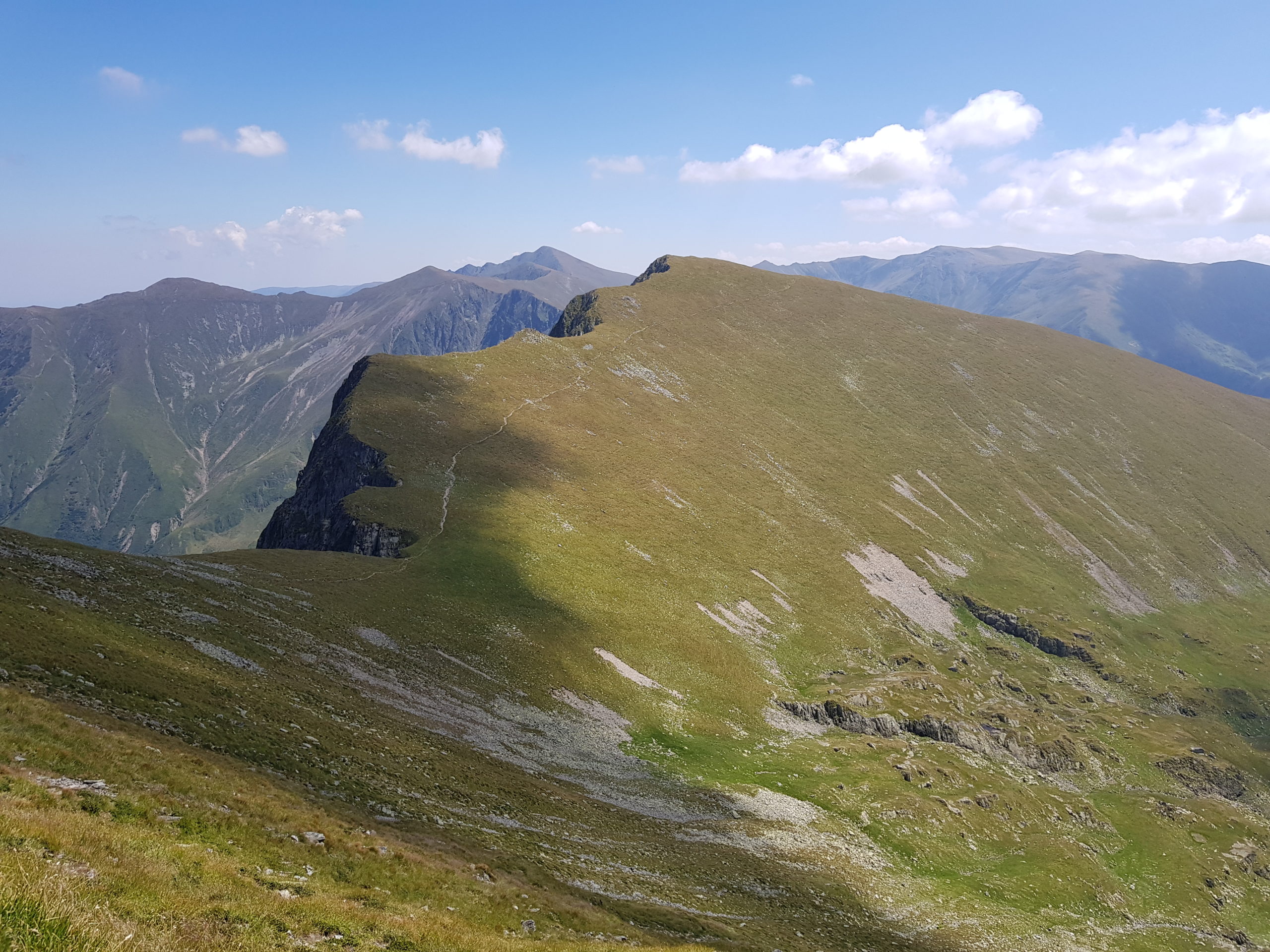
Făgăraş full of tourists
I misscalculated my water reserves in the morning on Monday 12th August and gave one liter to Romanian hikers I shared refugiu Zarna with. So I started without drinking my usual amount of water and I could feel it the whole morning.
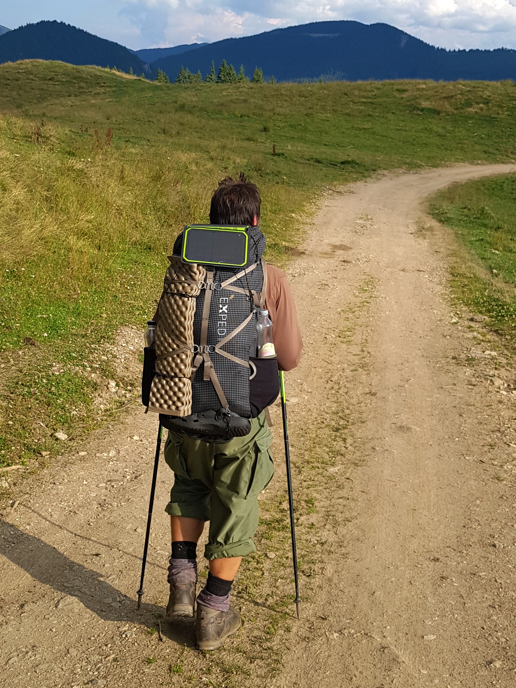
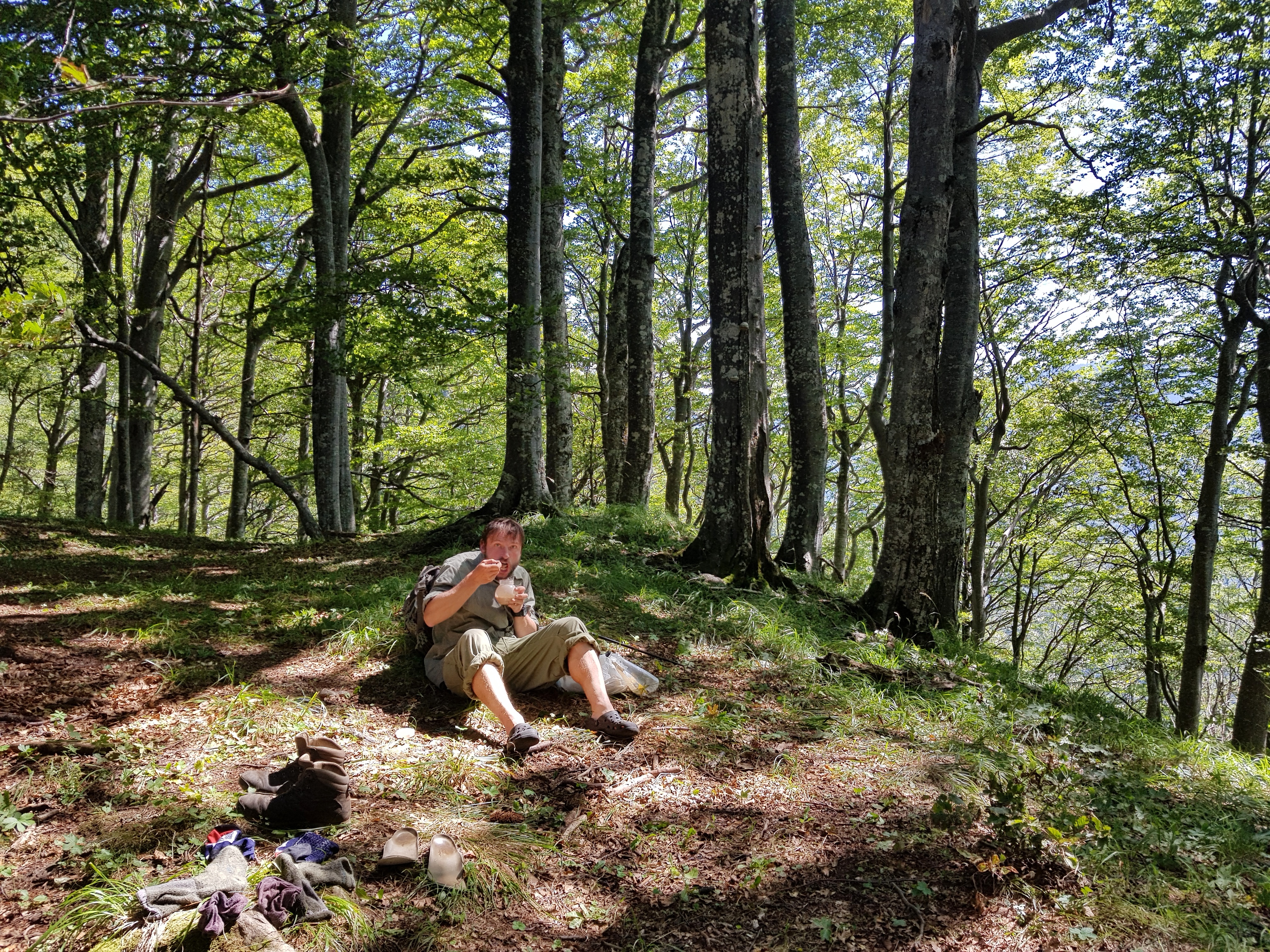
The point is I am taking two 700 ml bottles with me for the hike in the sidepockets of the backpack: one with approximately 500 ml of water mixed with sugar, vitamins or some soft-drink and another one filled to approximately 250 ml with plain water. Before I start walking I drink about 700 ml of water. While hiking I keep a small foldable cup with me and drink from water sources along the way. Thus I need not overload my backpack with water. Before the journey I spent hours weighing every piece of my gear and thinking about basic weight reduction (= weight without water and food). But at the end of the day the real weight is lot about food and water management on the hike. However, if I cannot expect much water ahead, I fill both bottles for the hike. About 1 hour before camping I fill extra 1,4 – 2,4 liters plus the two 0,7 bottles. This provides me with enough water for dinner, breakfast and morning of the next day.
There were not many tourists in the mountains early in the morning but one older man gave me a tip for a water source I used at about 11 am for early lunch in the Sâmbăta shelter that provided shadow from the scorching sun.
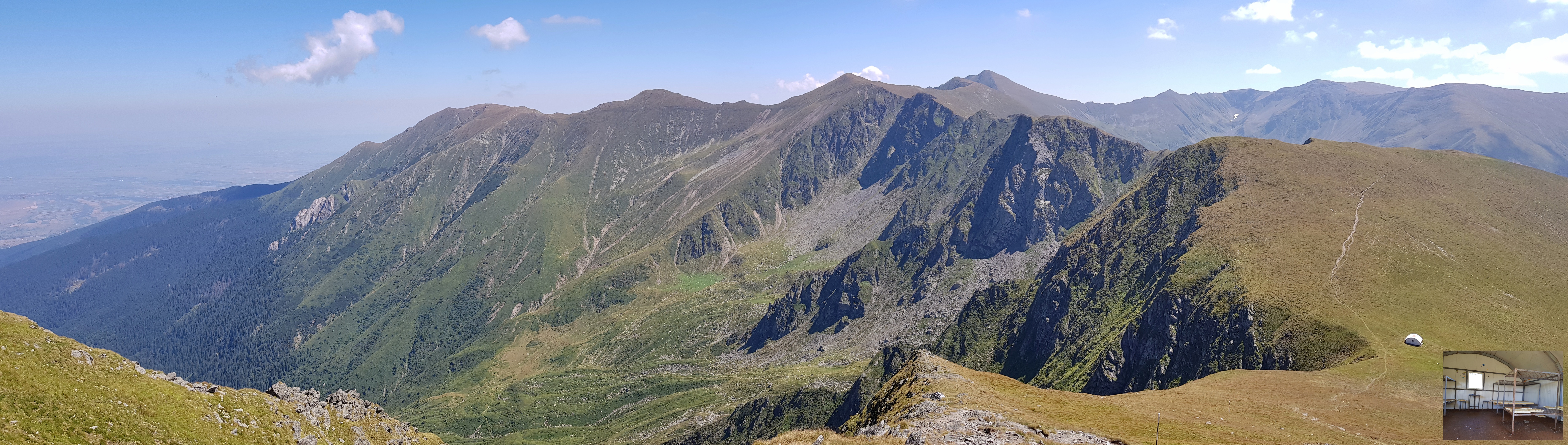
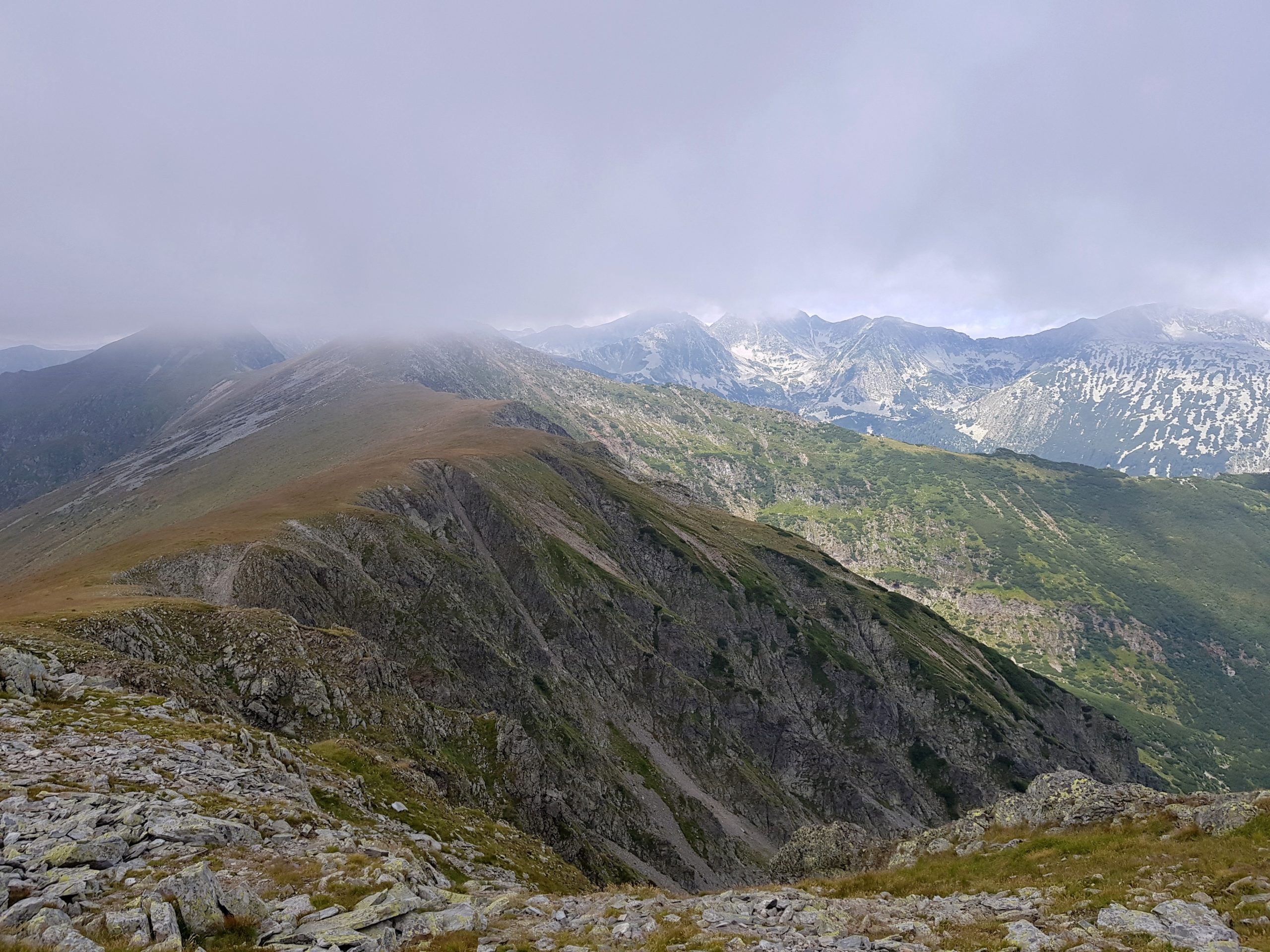
Number of hikers was increasing as I was coming closer to the highest peak of Romania and my journey – Moldoveanu (2544). Apart from Romanians there were lot of Polish folks but I also met Germans, Czechs and hikers from Lithuania. In the evening I chatted with two Romanian scouts going opposite direction as we had common friends.

Moldoveanu was the only Romanian peak with a logbook so I left there one of the poems by Jan Skácel Pája gave me for the journey on a small pieces of paper and a short notice. I must admit I felt a bit emotional reaching this peak. I was well aware of the fact how lucky I am with such a weather on Fagaras – being here few weeks earlier I could have reeled from a shelter to shelter in rain, fog and thunderstorms. Crosses along the trail tell stories of less lucky ones.

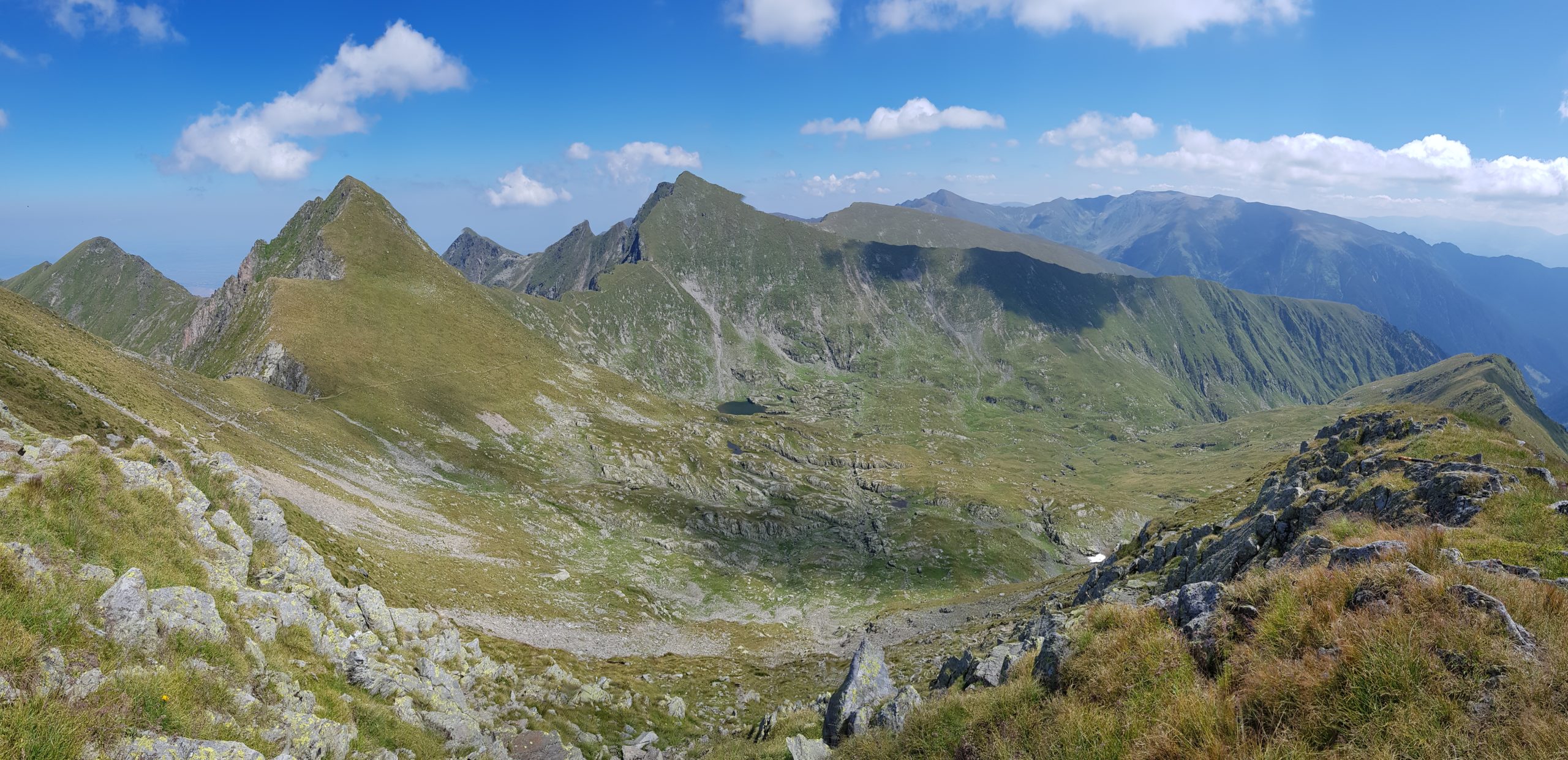
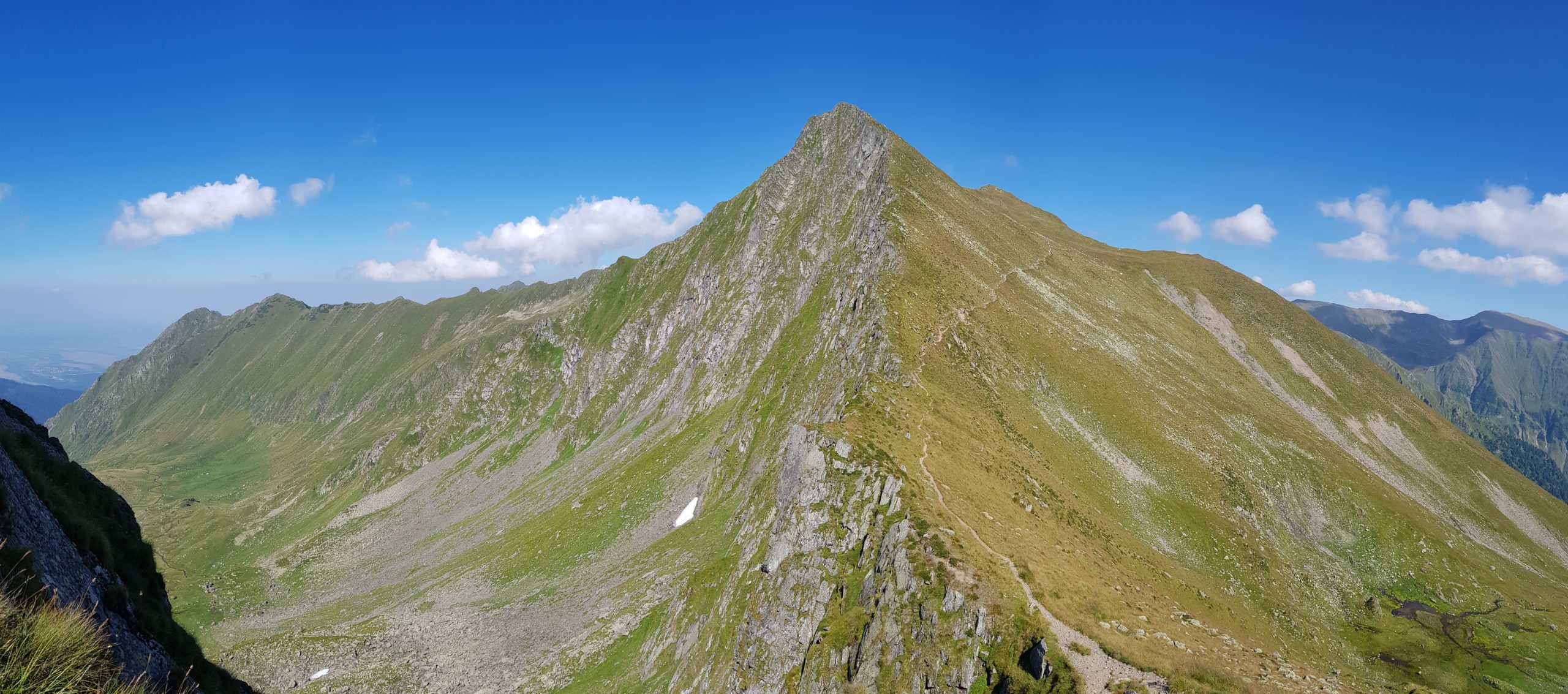
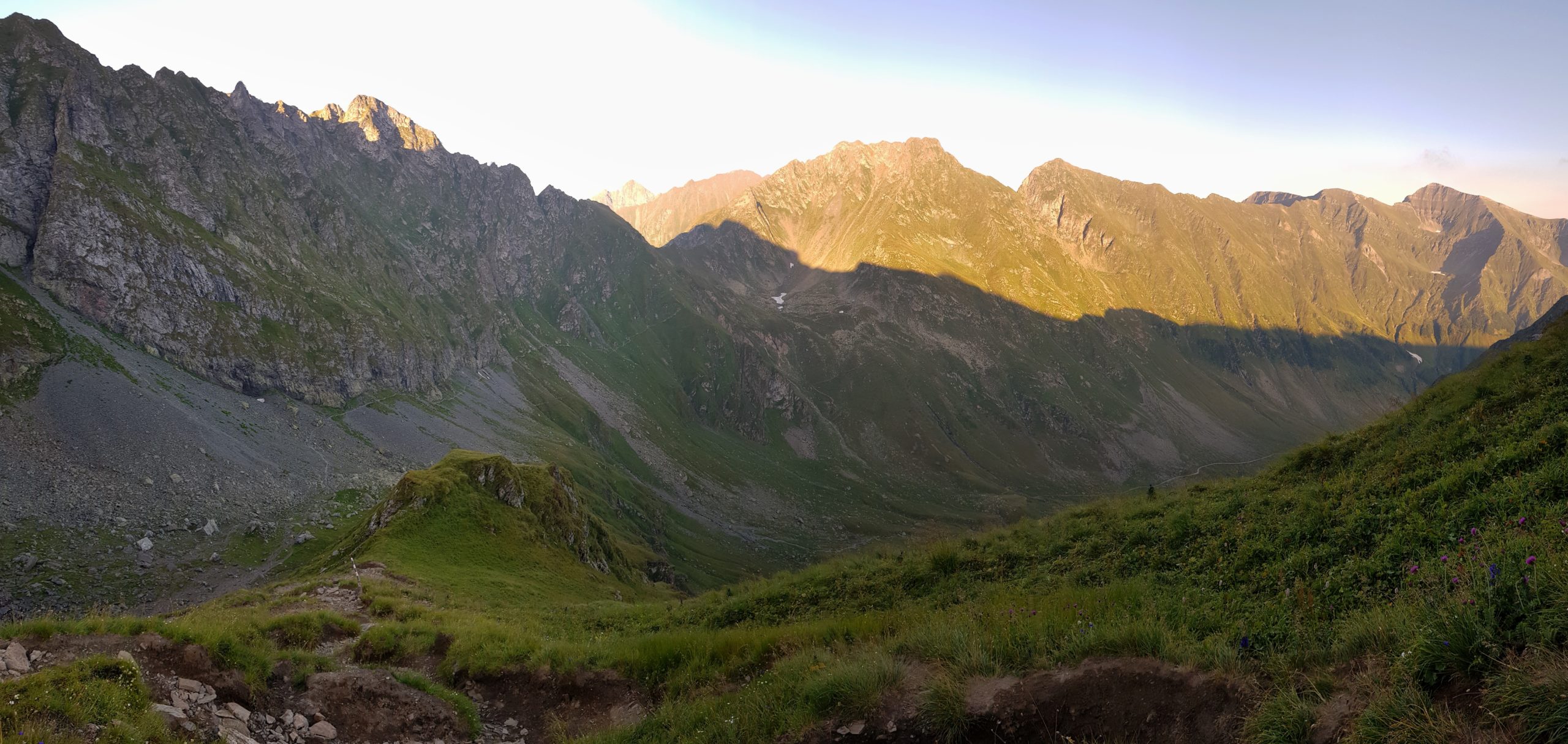
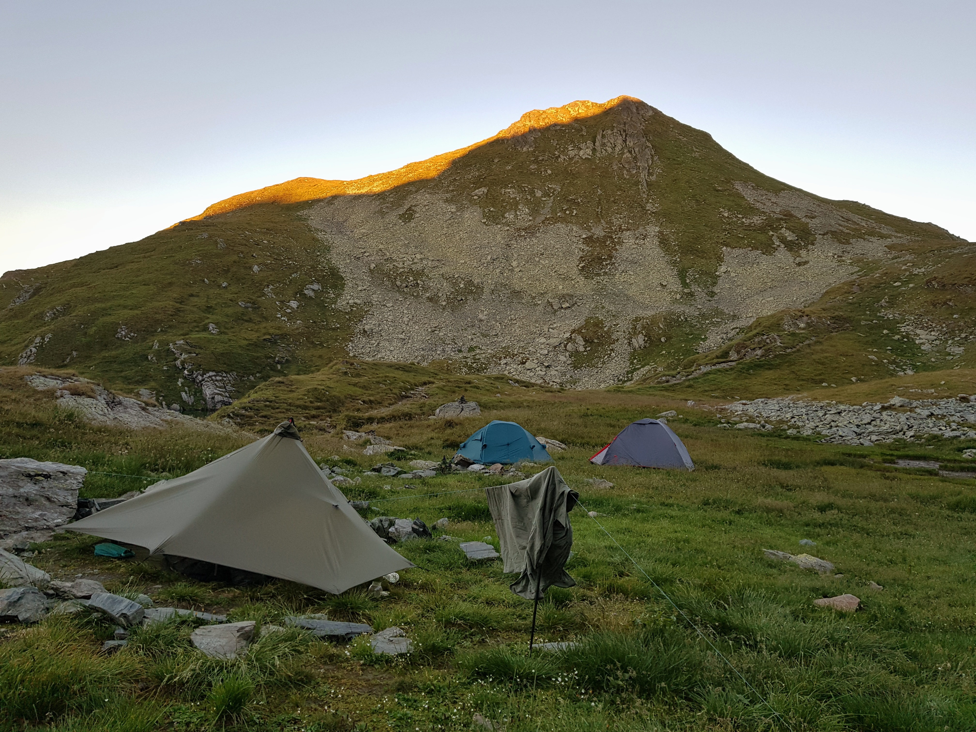
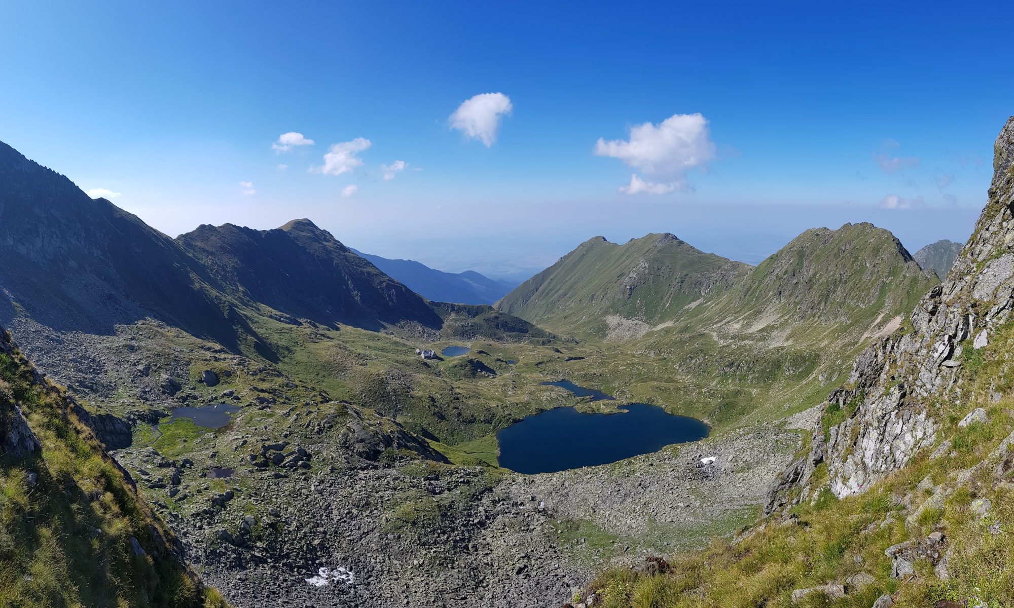
Lake Capra was my destination as I thought this was the place we made it 20 years ago with my wife in one day from the refugiu Zarna. Walking in the evening meant I could see lot of marmots. I came to the lake when it was almost dark and found a nice camping spot near 4 Czech scouts. Unfortunately we had no time to chat more as I was busy building the tarp and preparing my dinner till the dark. I must admit I was also a bit tired after more then 4000 meters altitude difference on this day. Another Czech group came later that night from the west being a bit noisy on the descent to the campsite from Iezerul Caprei (2418).
Short but demanding trail
I was already packed and fed when the Czech scouts started cooking their breakfast on Tuesday 13th August. I traded the food with walnuts with them for other items and continued to the west wondering if this was really the spot we stayed overnight 20 years ago as I was missing the mountain rescue hut there.
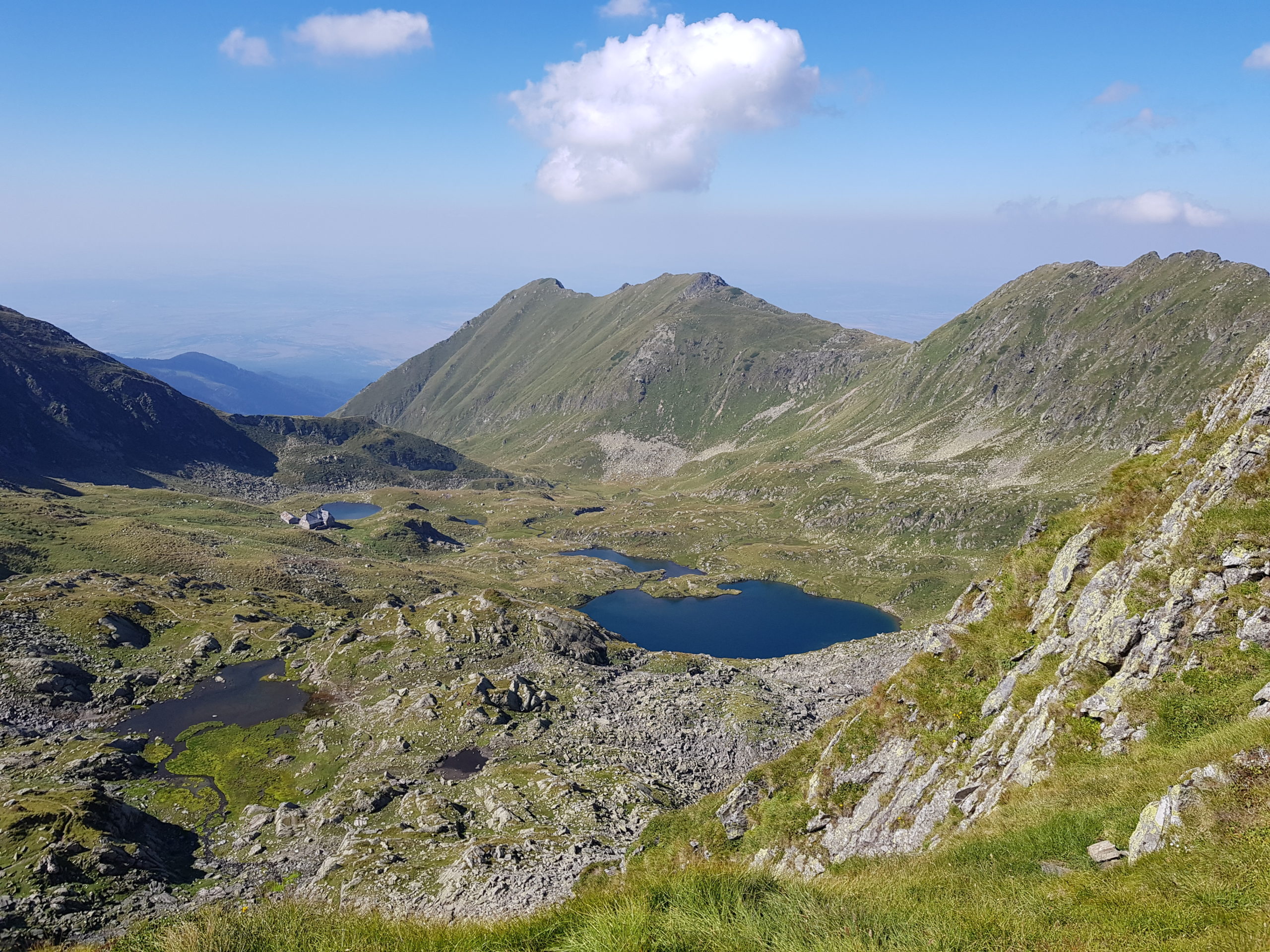
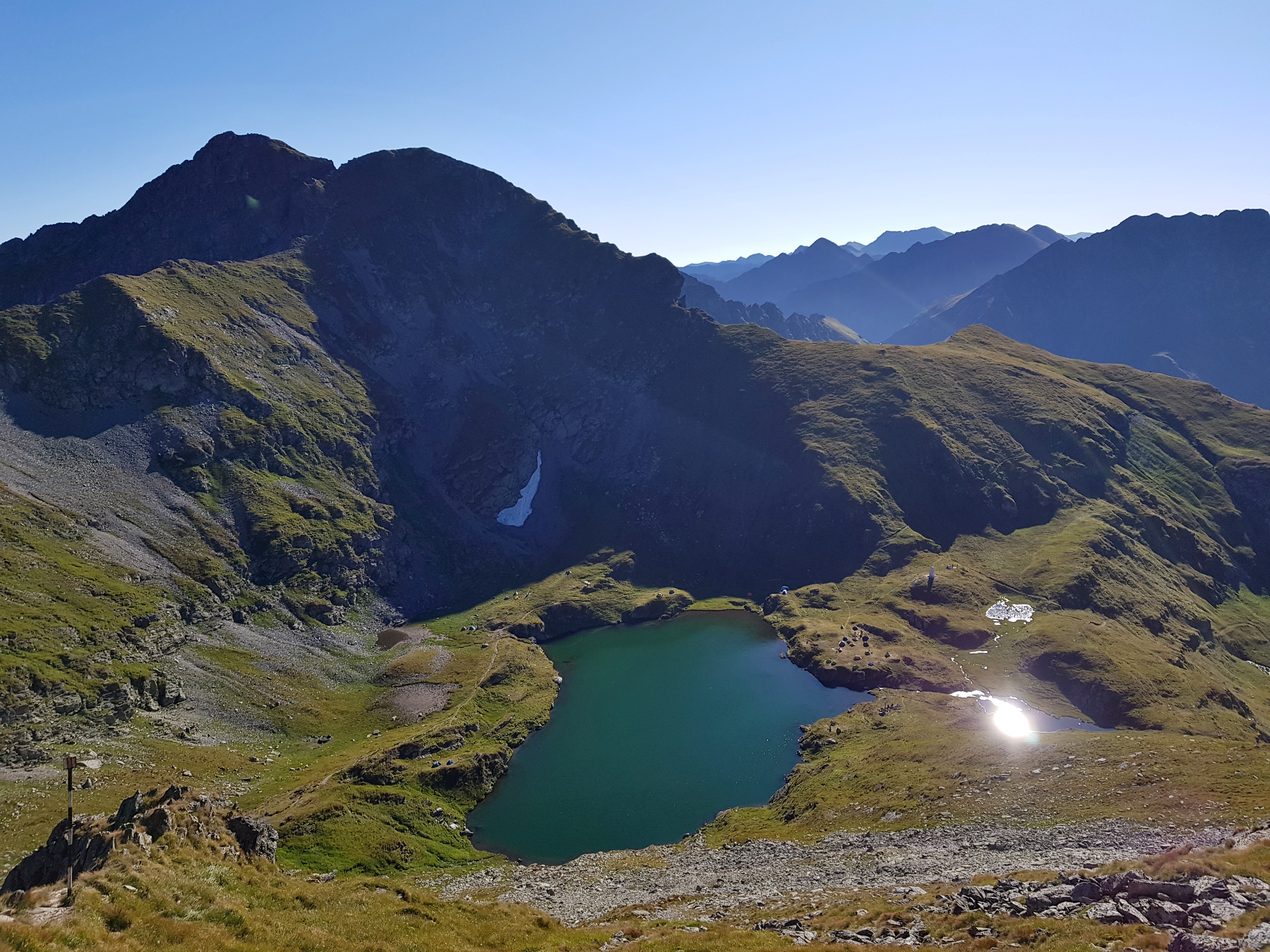
I crossed the tunnel of the trans-Făgăraş road, one of the biggest tourist attractions of Romania and made early lunchbreak at Lake Călțun realizing this was the place we made it then. I could see the age is taking its toll as this time I could not make it so far in one day.
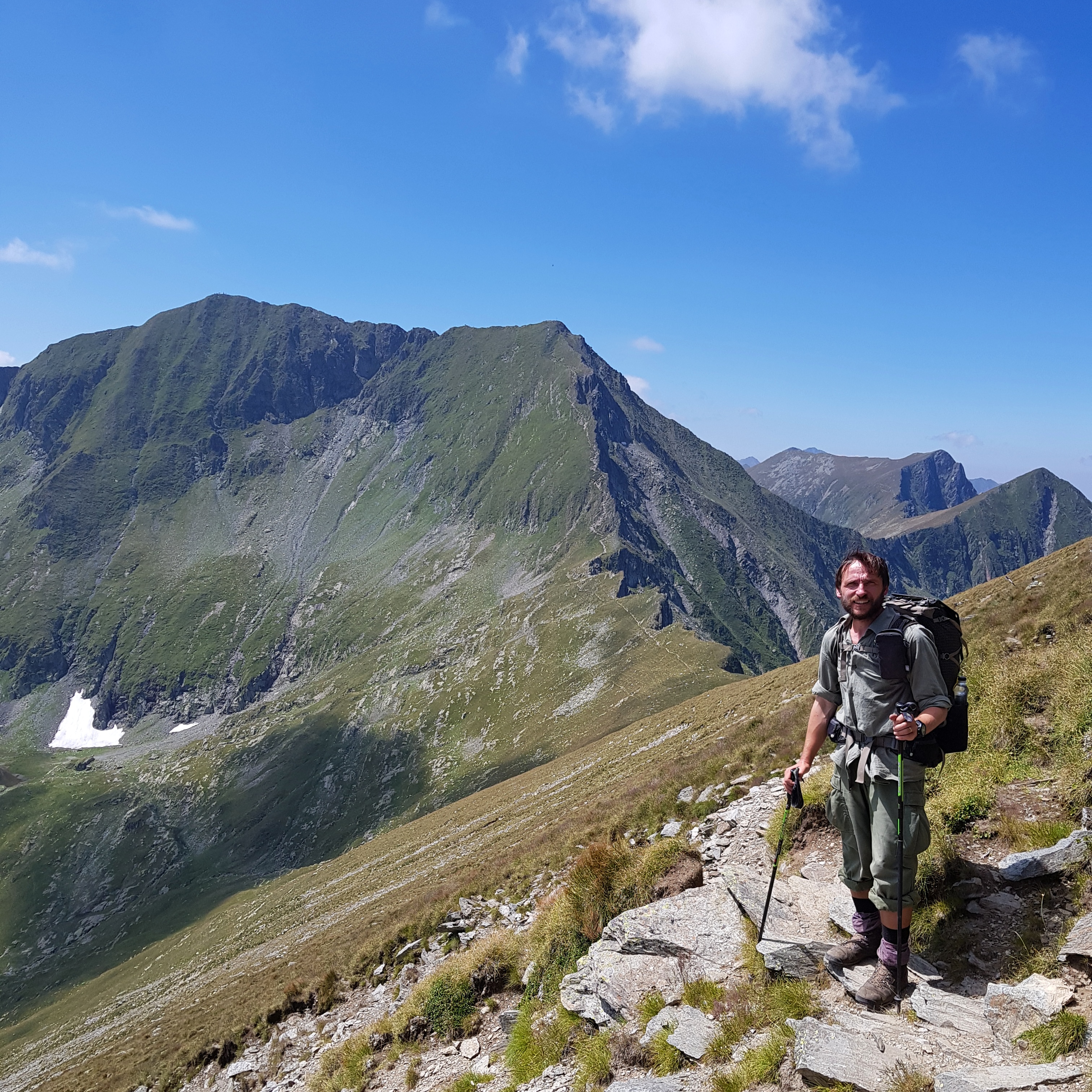
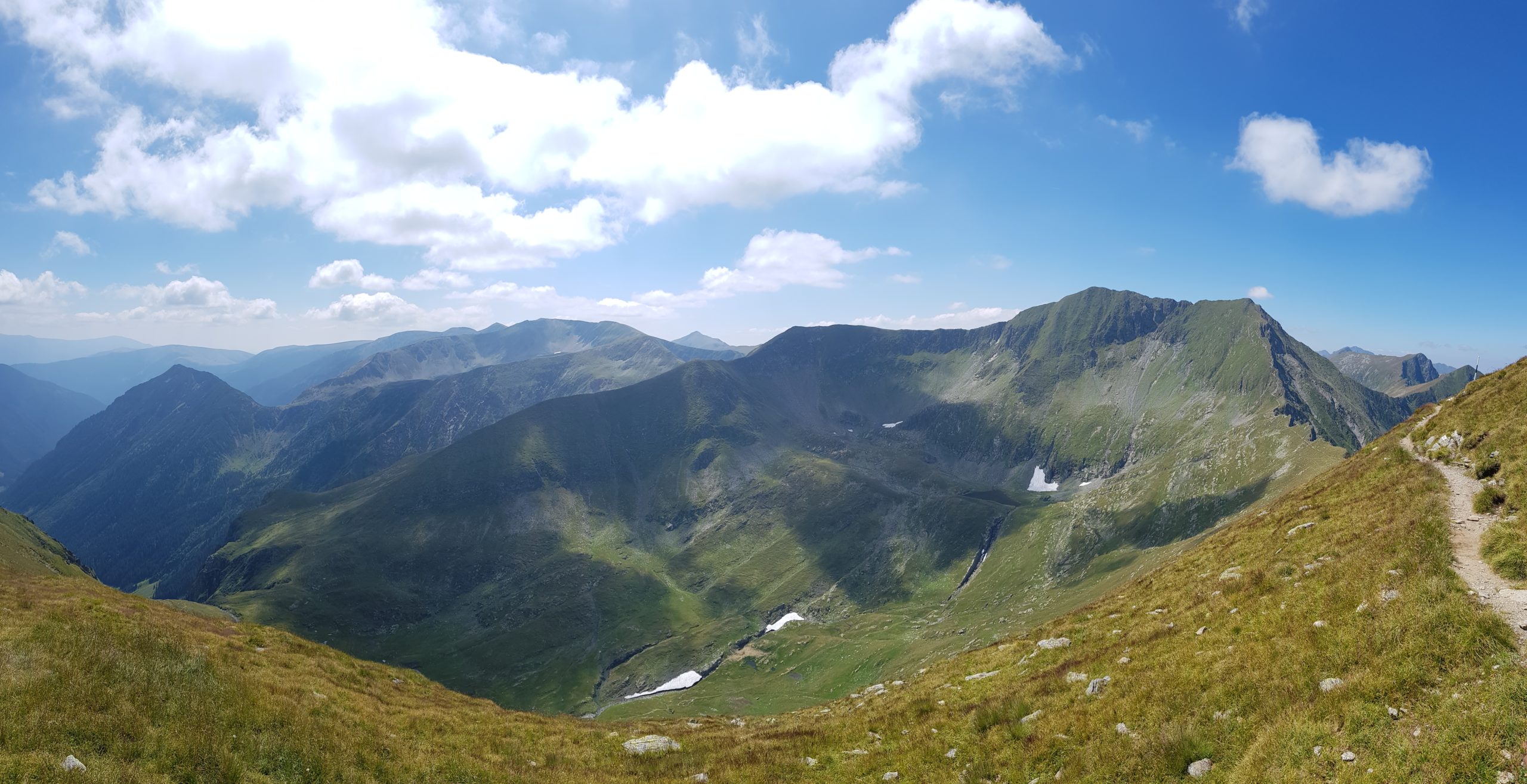
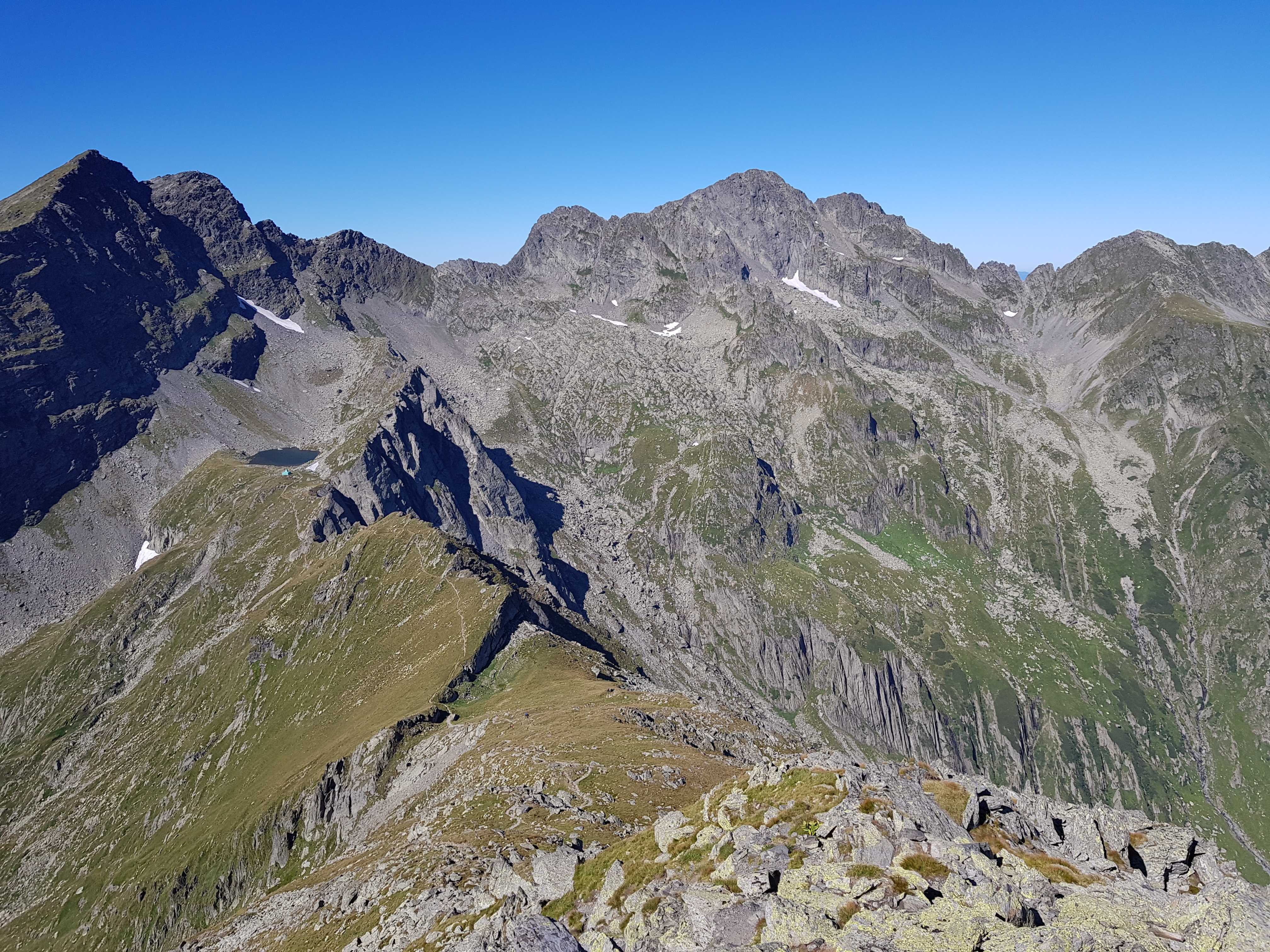
Though I planned to approach Negoiu peak (2535) through the Dracula gorge, I decided not to do it this year. I could well remember, how risky was climbing through the gorge especially while giving way to people coming the opposite direction. When I came to the division of the trails there was a sign that the Dracula gorge is closed and a Romanian tourist (actually the only person who took me over along the whole journey) explained to me that there was a stone ready to fall through the gorge and that some chains were damaged. Negoiu offered beautiful views across the mountain range.
The trail following main ridge is quite demanding west from Negoiu requiring climbing at some point. I met a Czech group telling me this part took them 3 hours. Though I crossed it in an hour, it was quite exhausting.
I should mention I met couple of destructed shelters in Făgăraş, one of them was in Scării pass. However, the simple mountain rescue metal box is still there.
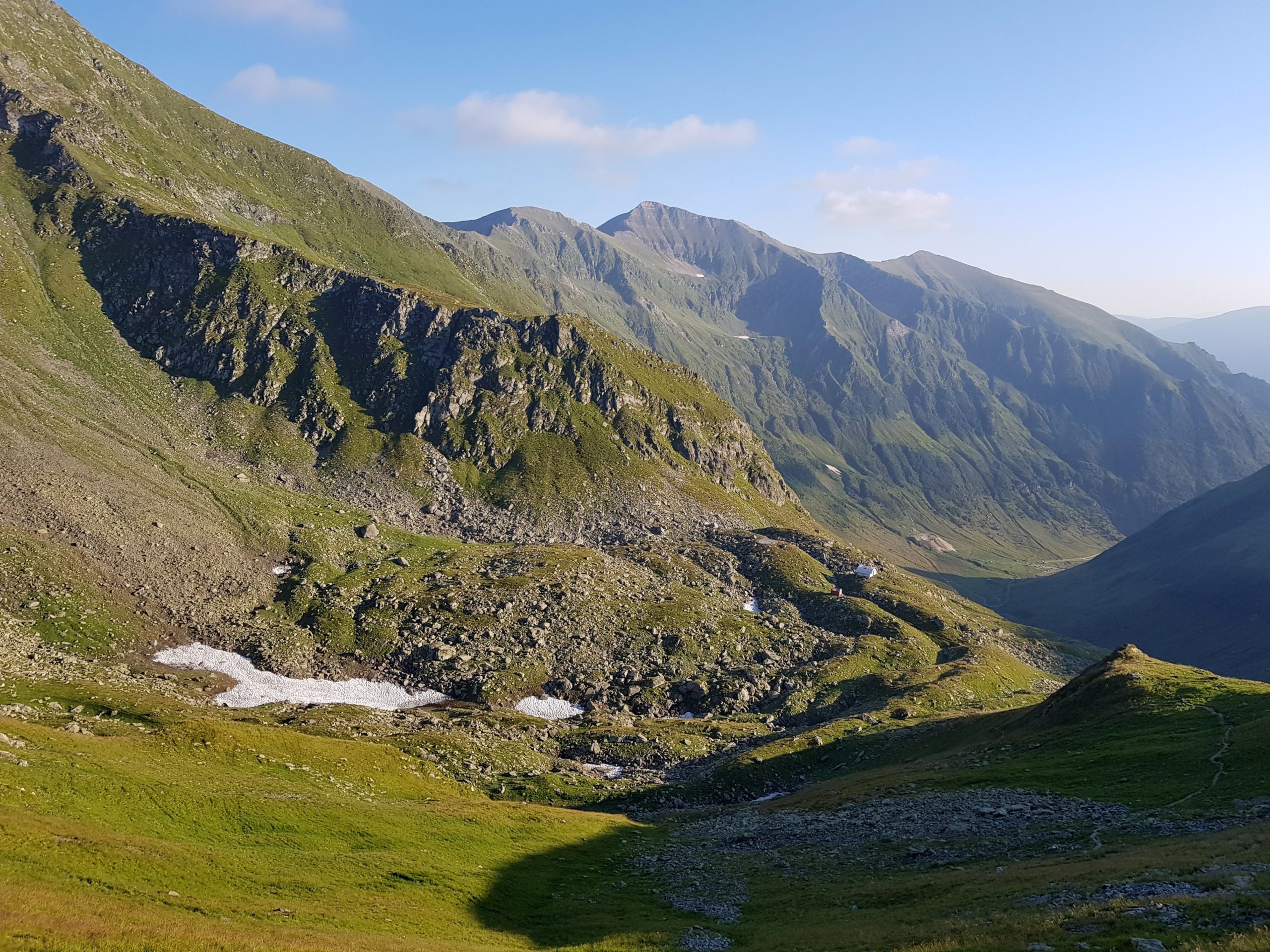
At about 6 pm I approached lake Avrig (2010). Though my smartwatch showed only 17 km distance walked that day, I decided to stay overnight and use the water to laundry and have a bath. Since it was quite cold evening, I left the water for tomorrow and enjoyed conversation with a group of 3 Romanians already camping there.

They asked me if it was true that it is not possible to camp anywhere in Tatras or other high Carpathian ranges in Poland and Slovakia. My answer made them cherishing Romania for the hiking freedom.
As there was no wood and my alcohol fuel reserves were low, I used the dry sheep droppings instead. It worked great, smelled nice and the ash kept warmth longer than wood.
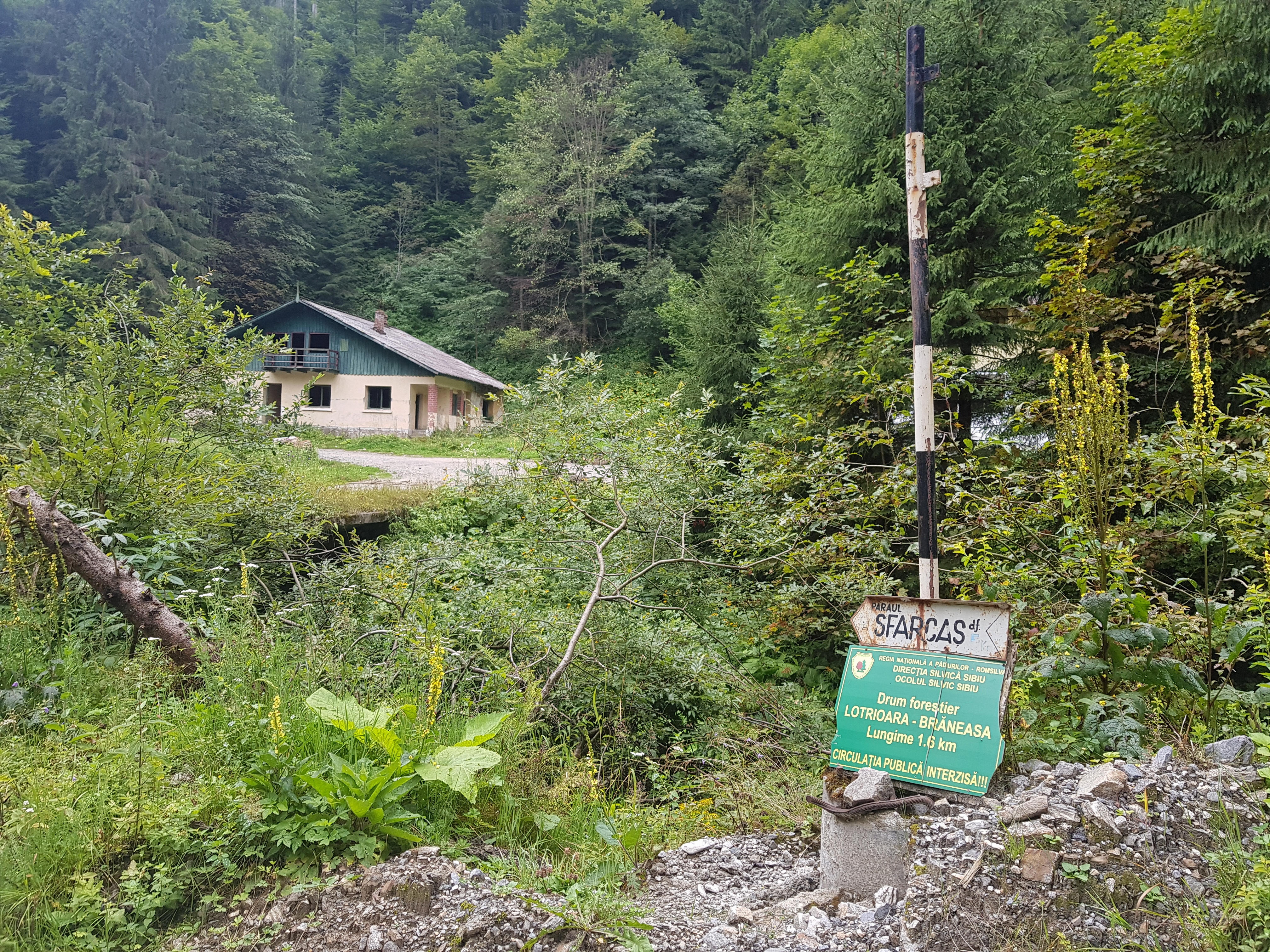
Lotrioara = nomen omen
The Romanians were just getting out of their tent when I started walking on Wednesday 14th August having my laundry and bath done earlier in the morning. They gave me some chocolate bars for the journey, which was great help. I decided not to waste time restocking in Turnu Roşu and rather going through Lotrioara village to buy some sugar, oil and instant noodles for the Lotru and Parâng mountain ranges.

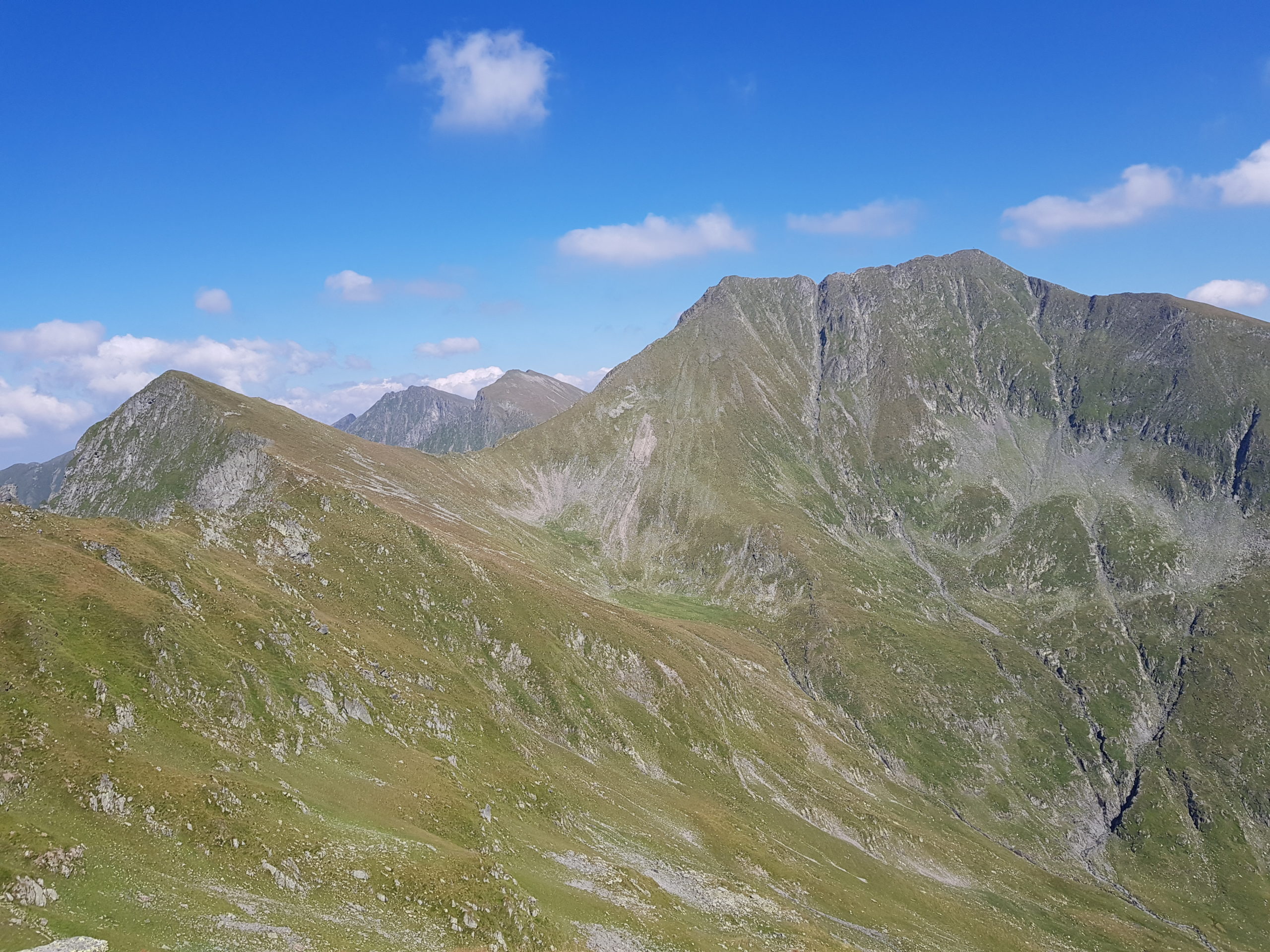
Much fresher than yesterday I soon climbed up on Budislavu (2343) enjoying views towards the east. The descent from altitude of 2300 to 370 meters was long and tiring. The moments when I needed to climb up in order to go down few minutes later were especially deadening.
Most tourists who come to this part of Făgăraş start or finish in Turnu Roşu so my trail was not so used and at some points hardly visible.
Near the Olt river I washed my hair in one of its tributaries to look nicer in “civilization” and followed the busy road running through the valley to the turn-off to the Lotrioara village. There I bought some cheese from people merchandising along the busy road, which soon turned out to be a good decision.
The road to Lotrioara leads through a quarry and chatting with a worker after a skirmish with his dogs I learnt there was no shop in the village, “but you can try the hotel” he told me.
Soon I came to a hotel and asked if they cook meals. The lady served me some meal worth about 15 lei in a Romanian restaurant. I also asked for 330 ml of oil and 10 small packets of sugar you receive for free with a tea or coffee. She got no chocolate bars or anything else I could use but it was actually to my good as the bill for the meal, two soft-drinks and some oil and sugar was 85 RON – the price for which you get a meal for the whole family in an ordinary Romanian restaurant. Nevertheless, when you are hungry and really need sugar and oil, you do not care about the price.
Further in the village was a punk-style hostel and a campsite, where I asked for ice-cream and chocolate bars. They sold me Twix bars from the not-for-resale pack each for the price of half of the whole pack. Later I learned they all were beyond their expiration date. Meaning of the word “lotr” the name of both the mountains and the village is similar in both Romanian and Czech = blackguard. So the village (surprisingly full of German and Romanian tourists) actually honored its name selling me the overpriced stuff.
As a cold front was forecasted for the night I decided to follow the valley deeper to the mountains. Cold fronts are often associated with strong and hours lasting thunderstorms in the mountains. I also realized that for the first time during my journey the rain was forecasted for night and not during daytime (bright nights and rainy days drove me crazy in Eastern Romania and Ukraine).
When I was following a small river, already out of the village searching for a place to stay overnight during the rain, I met a German speaking woman with a huge dog. The dog ran towards me barking and I stepped back a bit. This added to the aggression of the dog its master apparently was not able to control. She even blamed me it was my mistake I stepped back and told me she could not do anything otherwise the dog would think it is serious situation and attacked me. The dog followed me for one kilometer leaving its master behind and was so aggressive I was pointing my pepper spray to it.
Dogs are real threat while hiking in Romania. Though shepherds’ dogs might seem semi-wild, they are organized in a certain way. They defend their herds and 95% of them follow commands of the shepherd if he is close enough. Their attacks were not surprise for me as I had been in Romanian mountains many times before. What I had not expected was the real difference in treating a lonely pilgrim in comparison with a couple or a group. Dogs are attacking in packs and the more overpowered their target is the more they dare. In mountains visited by tourists (Rodna, Bucegi, Făgăraş, Retezat) the dogs do not consider hikers such a threat as in the less visited areas and the attacks there are often just symbolic. Each attack is different so it is difficult to give general advise how to resist. Sometimes a hiker can sneak unspotted, sometimes it is better to ignore the dogs and leave the scene, sometimes showing determination and attacking from 10-20 meters keeps them in distance. Seeking shepherd’s protection is always the best way, if possible. See my advice on that in the chapter on Risks while walking the Carpathians.
It was getting dark soon in the valley when I could see a flat place on the other side of the river and a wooden footbridge leading there. I searched for the best spot while the woman with the dog passed by walking the road on the other side of the river. The dog was crazy barking towards me but they continued upstream leaving me wondering if there was some other settlement.
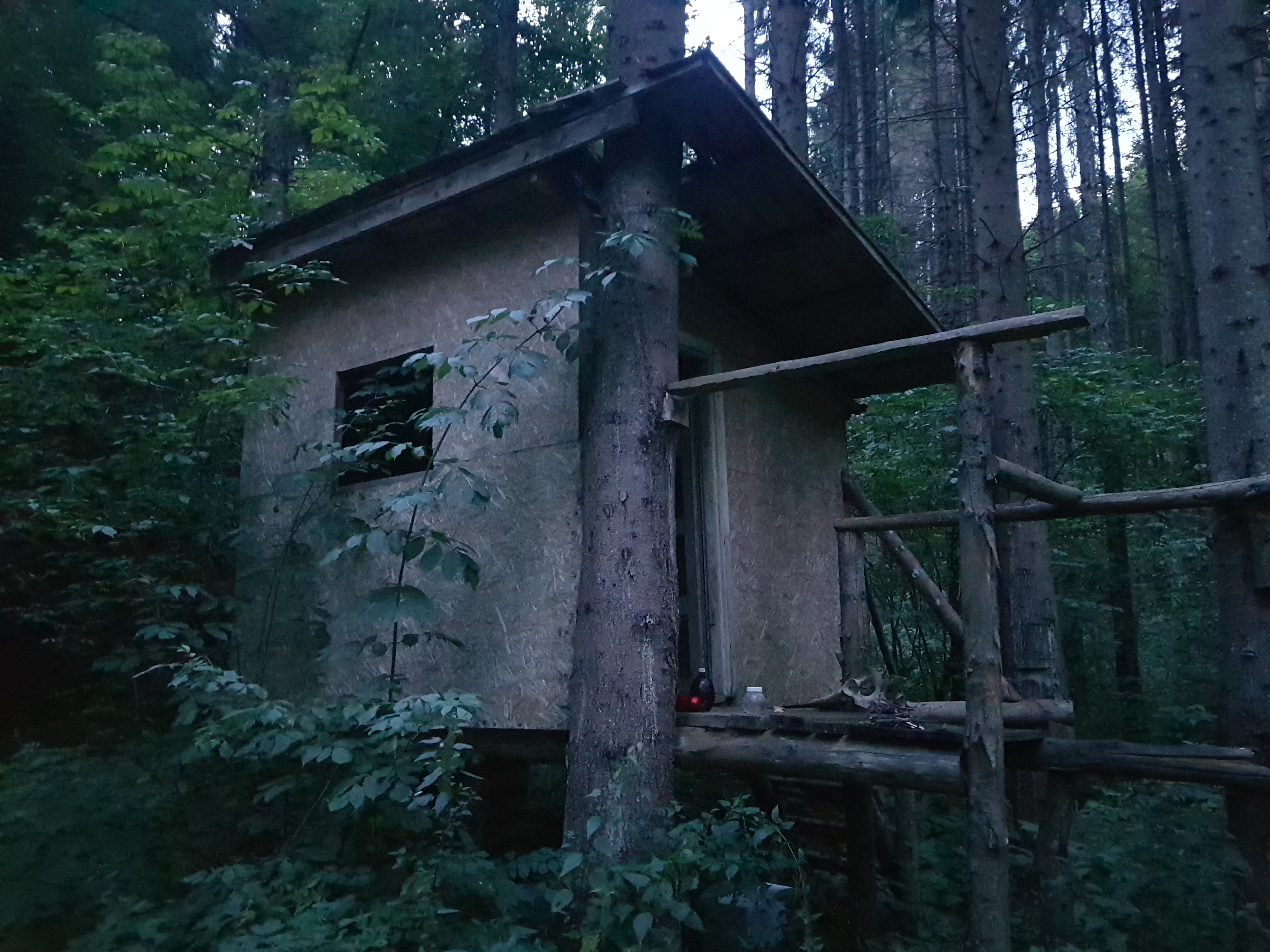
I built my tarp and went for water when I learned there was a hunters’ hide nearby. Hunters’ hides in Romania are about 3×2 metres large with a bed along one wall. They are just a meter or so above the terrain. So I packed my tarp and moved to the hut. While going for water I found many skulls and antlers, presumably outcomes of hunting activity at this place.
In the wilderness again
I could hear some thunderstorm overnight but considerably weaker than what I had experienced during other cold fronts’ transitions. The sky was overcast and vegetation wet but it was not raining in the morning of Thursday 15th August. I walked the forest road singing to distract bears. After a mile I came to a cottage in the woods supposedly used by the German lady with her dog. I sneaked by unnoticed.
At one point there were ruins of some chalets and a sign towards pass under Sfarcas peak (2034). It seemed to me as a good way how to get on the ridge for there was a forest road in my maps from the other side of the pass so I supposed these are connected. Unfortunately, after two kilometers the promising road turned into a forest road going through a stream with tree trunks fallen over it. So I returned to the original road losing about 50 minutes of time.
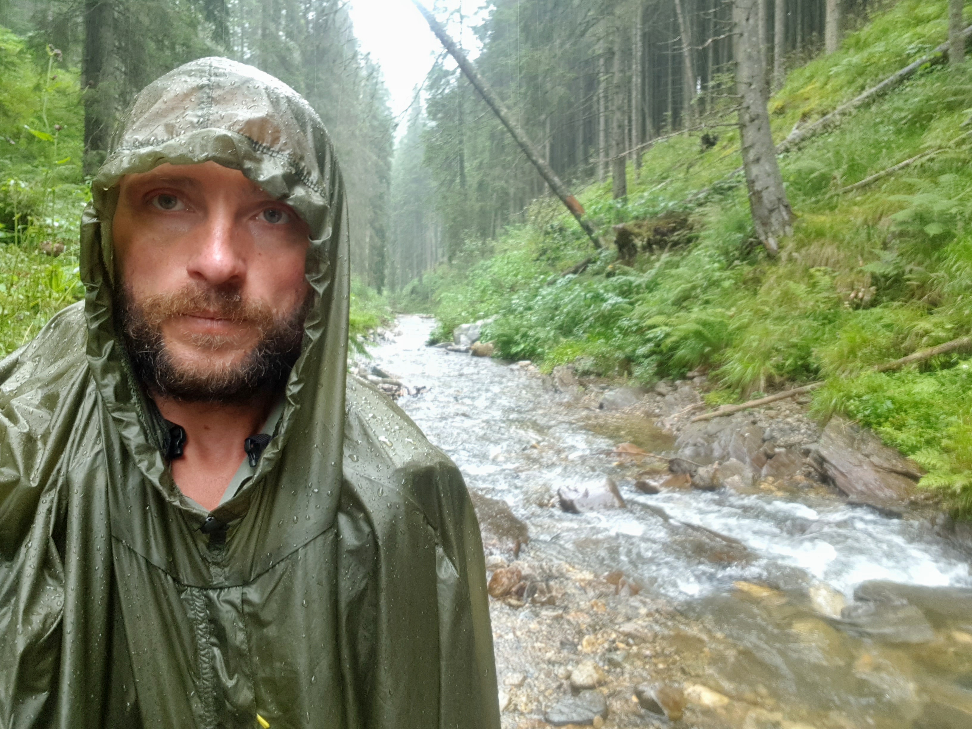
I could track, that meanwhile someone in trekking or working shoes passed on the forest road in the opposite direction. As I expected, the road did not finish at the point it finished on my map but turned into a road running along and through a stream. Sheep tracks persuaded me I am on a good trail towards the main ridge, though I needed to go through some dense wet vegetation. It started raining so I put on poncho and changed hiking shoes for crocs as the “road” went through a stream.
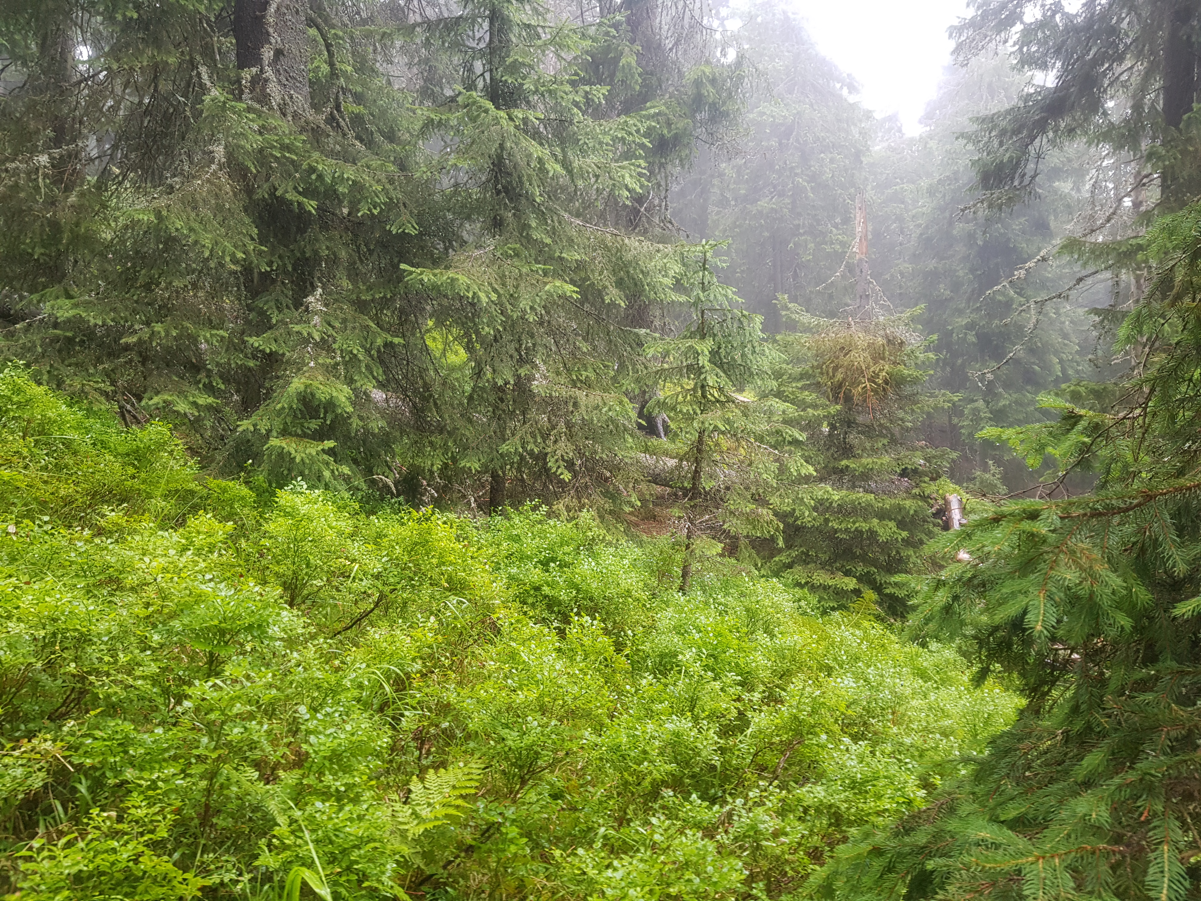
After few kilometers the sheep tracks left the valley without me noticing the point and I was again in wilderness without roads or trails, in the rain, soaked and with thunderstorms passing in the sky. The approaching sound of thunder was indicating when the rain turns into a downpour. I put on hiking boots again and went through forest and blueberry fields towards the main ridge. Across a valley I could see a shepherd’s house while on my side tracks of bear activity kept me vigilant.
The ridge was in the fog but I found a way to the mountain pass west from Cocacii (2008) peak. This ascent was way worse than I had expected leaving me both physically and mentally exhausted. I was wondering if I should have rather follow the marked trail from Lotrioira to Cabana Prejba (1630). I would had been exposed to thunderstorms but on a trail. (Later I learned from satellite maps I could have turned right at one crossing and get easily on the main ridge. I have put this easier way into the trail to download).
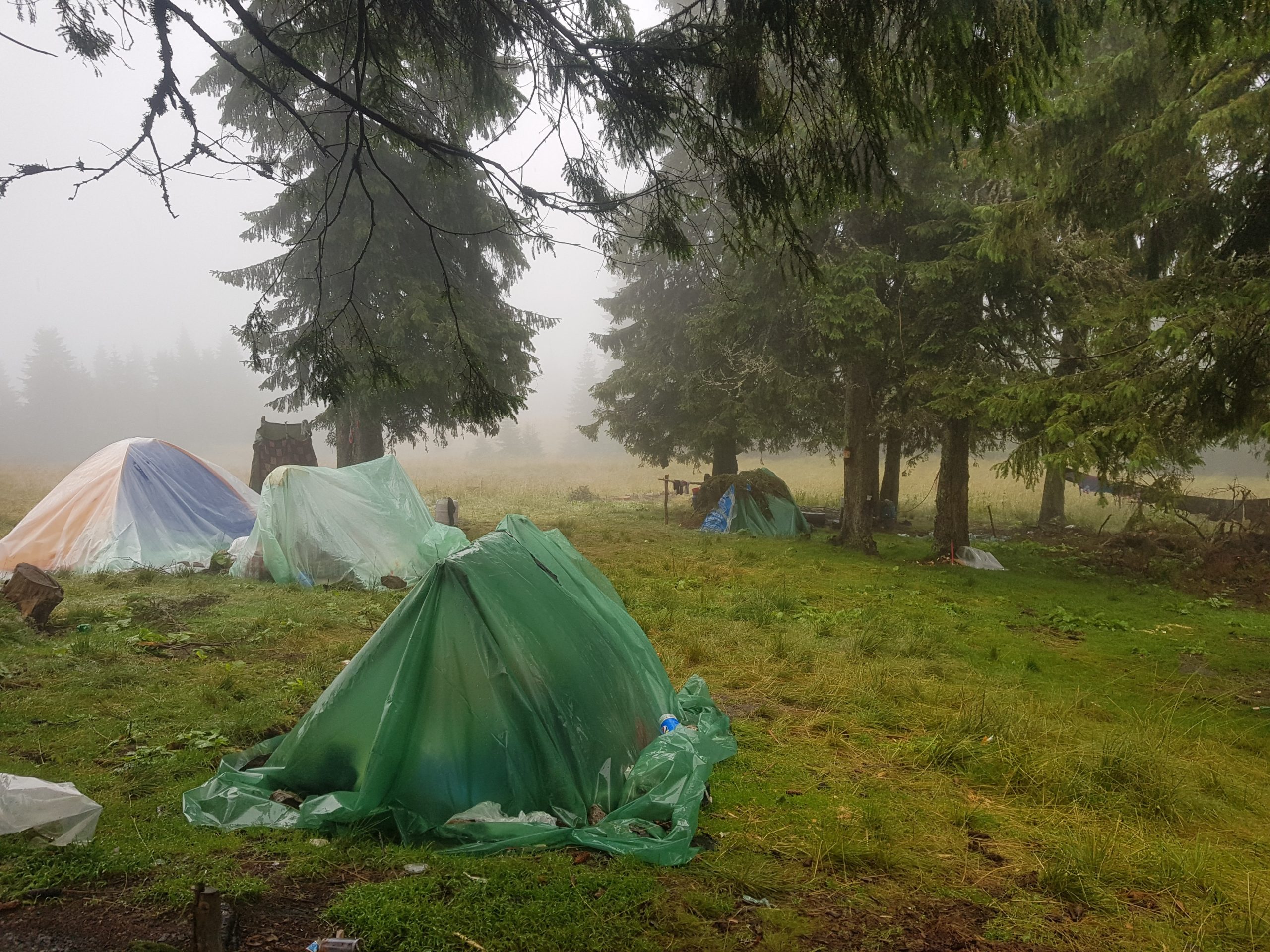
It was pretty cold and drizzling when I came to a large camp of blueberry pickers, most of them children huddling in their “tents.” The “tents” were cheap staff not able to withstand rain and that is why reinforced by plastic foil and wood. A lady who was cooking offered me a cup of coffee with sugar and invited me for a dinner. I gratefully accepted the coffee but refused to wait for dinner as I wanted to get much further on that day.
However, when I saw a hunters’ hide half an hour later and heard another thunderstorm in distance, I decided to use it as my overnight shelter. The disadvantage was it was close to a shepherd’s settlements so the dogs sniffed me soon and were barking around the hide. The next day I learned staying in this shelter was a good decision because the rain was very intense at some night hours and there was no other hide like this further in the mountains.
Disappointment in Petroşani
Overnight I prepared a plan for the Friday 16th August: I start as early in the morning as possible and go to the pass between Lotru and Parâng mountain ranges. If I would be there before 5 pm, I could hitch-hike to Petroşani to pick-up support parcel at the post office. My Romanian friend Nadia was so kind to search for the office opening hours so I learned that they are closed on Saturday. If following the original trail, I would be in Petroşani Saturday afternoon and needed to wait till Monday morning. Skipping this short range I had been to twice before also saves me ¾ of a day so I can make it to the Danube in Orşova in the time I have available, I thought.
The range was in the clouds when I started hiking, well before the dogs were ready for their daily work. The trail was marked, but not always visible so I lost direction in the fog and mountain pine cover several times. Fountains of water were pouring from my shoes with every step. It started raining again.
Nevertheless I made it to the highest peak of Lotru range, Șteflești (2242), at about 11 am. From my two previous visits I could remember it was not far away to Parâng so I felt grateful for this fast advancement, but again I was about to see how poor human memory was. It took me another 5 hours walking in these beautiful grassy mountains to reach the mountain pass crossed by a new tourist attraction of Romania – Transalpina road.
The pass I originally planned to hitch-hike from was about 6,5 km away so I decided to hitch-hike from this point but I could not find any convenient place. I lost 45 minutes going further up as I expected a parking place or a picnic spot at the highest point of the road, which is common in Romania, but it was not there. Finally a guy gave me 6 km lift to Obârşia Lotrului, a small camping site as I could remember it from 1990s had been turned into a busy market selling souvenirs and refreshment to both Transalpina tourists and those staying on site.
I walked another mile where the road to Petroşani diverts from Transalpina and it did not took long when a couple gave me a lift. The road leads through the mountains so we made those 25 km to Petroşani in about an hour. They dropped me on another side of the town and I needed to walk another mile to the post office coming 20 minutes before the closing time. The sign on the door read they stayed closed this Thursday and Friday. No reasons were given. Only two years later I learned that it was holiday on Thursday and offices usually keep closed on Friday as well. So instead of camping near a lake in Parâng and having nice walk the other day, since the weather turned beautiful in the afternoon and forecast was great for the next days, I was in a town and my support package gone.
My hunger and need to charge devices prevailed so I bought some alcohol for my stove in a pharmacy and went for a pizza.
While in the Czech Republic and Slovakia, alcohol fuel can be obtained in drugstores, in Ukraine and Romania in pharmacies. Ukrainian alcohol was considerably higher quality than cheap Romanian 70% blue liquid always leaving some unburned leftovers. If possible I would rather avoid the Romanian stuff or use it for diluting higher quality fuel.
After eating and charging my devices I went to a shop to restock for the next stage. It was dark when I packed the new supplies and continued to the west. I went through quite poor neighborhood of Petroşani and was afraid that after crossing the river I might get to a gipsy ghetto, so I rather camped near the river protected by dark and a 4 metres high wall separating the river from the city.
5th Bear Encounter
I got up at dark on Saturday 17th August, quickly packed, climbed the wall towards the road and painfully pulled my backpack up on rope. Walking west I realized there was no ghetto, just few houses and much nicer camping spots as the hills above Petroşani were composed of meadows used for hay and as pastures. I stopped at one of the mowed meadows to eat the breakfast and dry my stuff in the sunshine.
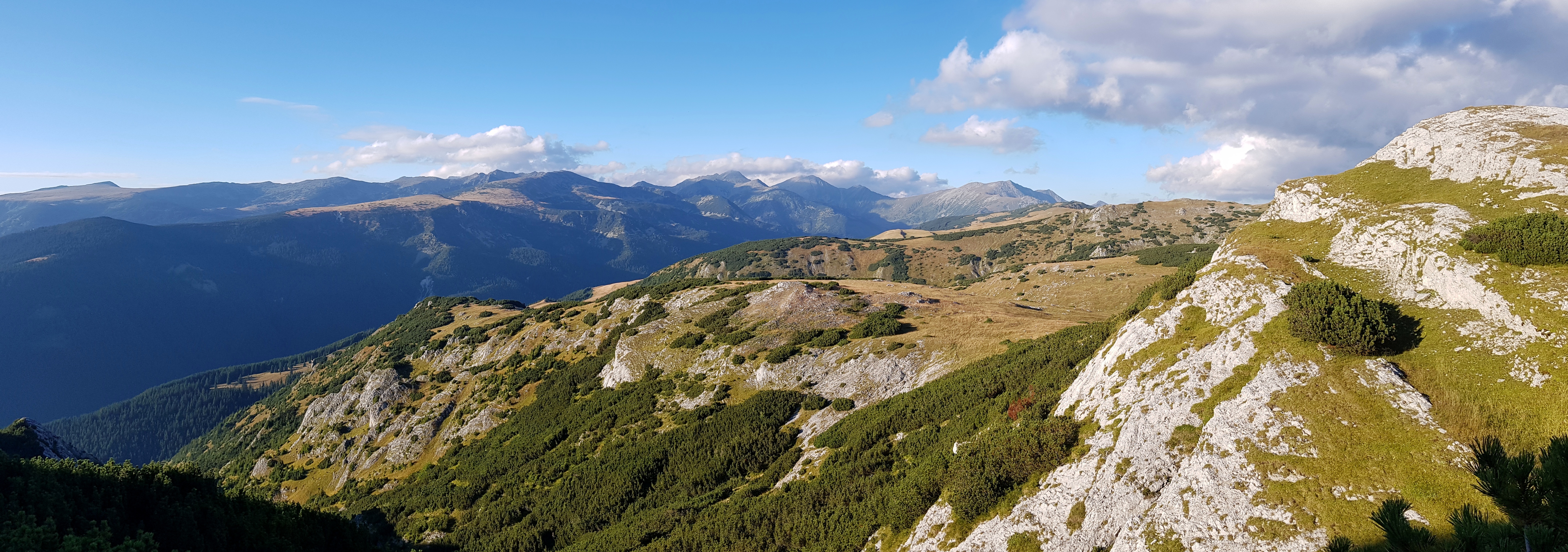
There was a road going on the main ridge through the romantic landscape of meadows, forests and cottages, though I must add that many pieces of land were abandoned and in different stages of takover by forest. It was lot of up and down walk in altitudes around 800 meters but in the afternoon I got close to the Tulişa mountains. I used the only water source I met since the morning to have lunch and laundry socks.
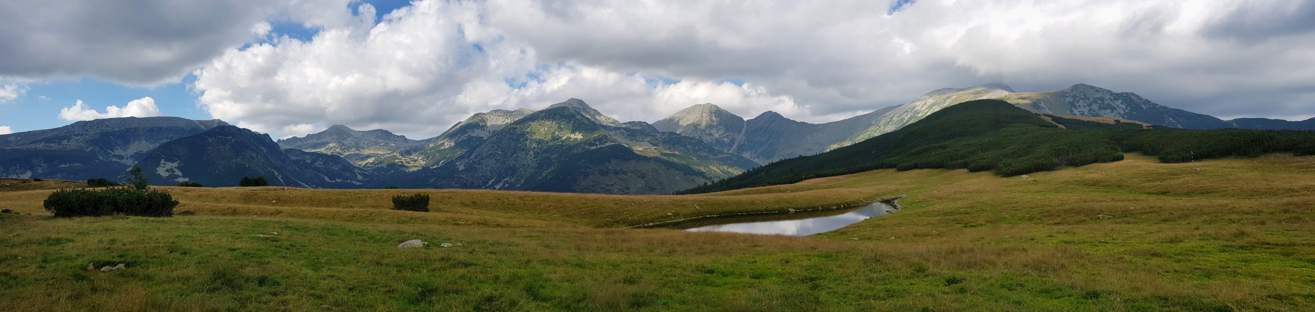
From the peak Piscul Oborocii (1474) I joined a red tourist marking. These mountains were nice surprise to me and I regretted we missed them in the past. Around the Tulişa peak (1792) the range turned into wide flat grazed mountain meadows, that looked beautiful in the evening sun.

Tulişa pass has a special meaning for Romanians for the heavy fighting during WW I and it is also a nice camping spot. Unfortunately, it did not seemed to me water is nearby (though we camped there 10 years before), so I continued to the next water source about 3 km further west. I went fast as it was getting dark and I could clearly see signs of bear activity. Just before reaching my designated camping spot I met a group of semi-wild horses.
I put up a tarp, cooked rice for dinner (first rice on my journey) and was cleaning my teeth when I could hear a noise from the forest below the pass. I quickly scanned the forest with my headlamp and found two eyes belonging to a bear watching me from about 60 metres. I continued cleaning my teeth making noise and talking to the bear. The bear was watching me for about 2 minutes and then silently (!) left. I went to my sleeping bag with both pepper spray cans ready.
At about 11 pm I could hear strange noises near my tarp, like kicking the ground. After the initial stress, I learned that these were the horses grazing nearby. „Great,“ I thought, “bears should not be where horses are.” But I soon realized that the horses pose more imminent danger than a bear. Although it was windy I immediately loosened the anchoring rope to a nearby tree that was about 5 metres away but left the rope on the other side of the tarp as the anchor was just 2 metres long and went over a trekking pole to the ground. It was around full moon and every horseman/woman can tell you how scary horses are even in twilight, not talking about night. Some were grazing just a foot from my head and now and then they jumped scared by a shadow or whatever. The idea of a horse stepping on me in panic was not very calming. One horse put down the other anchoring rope and got scared by jingles that I left on the trekking pole and made noise while falling down. When they left after two hours, I felt much better and could finally fall asleep. Later a horsewoman advised me that instead of fearing of my bones, I could simply scare away the horses.

Small Retezat
Sunday 18th August started with an ascent of 800 meters to the peaks of Retezat. The trail was marked but led through fields of boulders so it was necessary to mind every step.
Approaching the peak of Custura (2457) I met five day-hikers. The peak is actually a crossroad so a hiker can continue to the north towards the Great Retezat with its highest peaks of Peleaga (2509) and Papusa (2508) or to the west to Small Retezat and Godeanu. This was my planned choice and since I had been there three times before I knew I want to camp below the beautiful peak of Piatra Iorgovanului (2014).
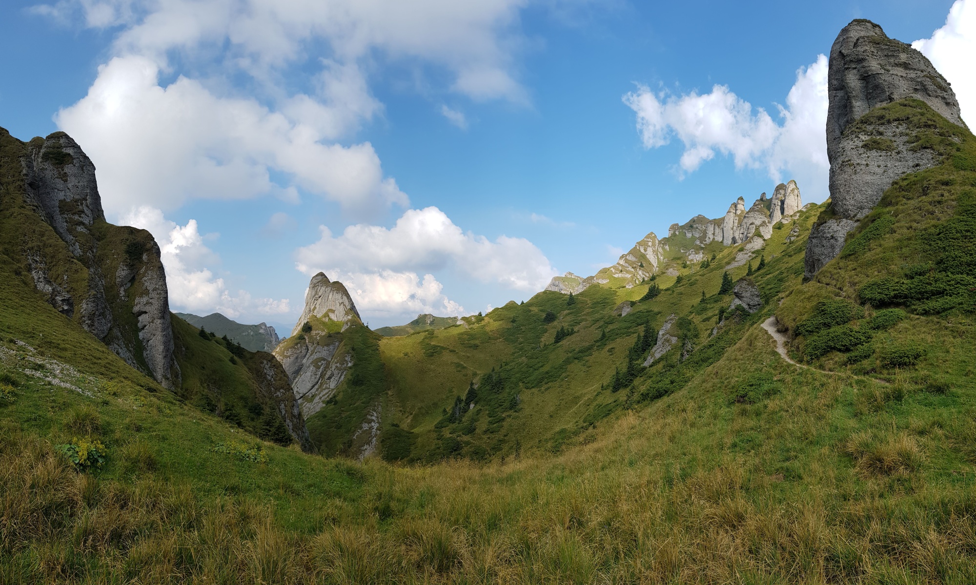
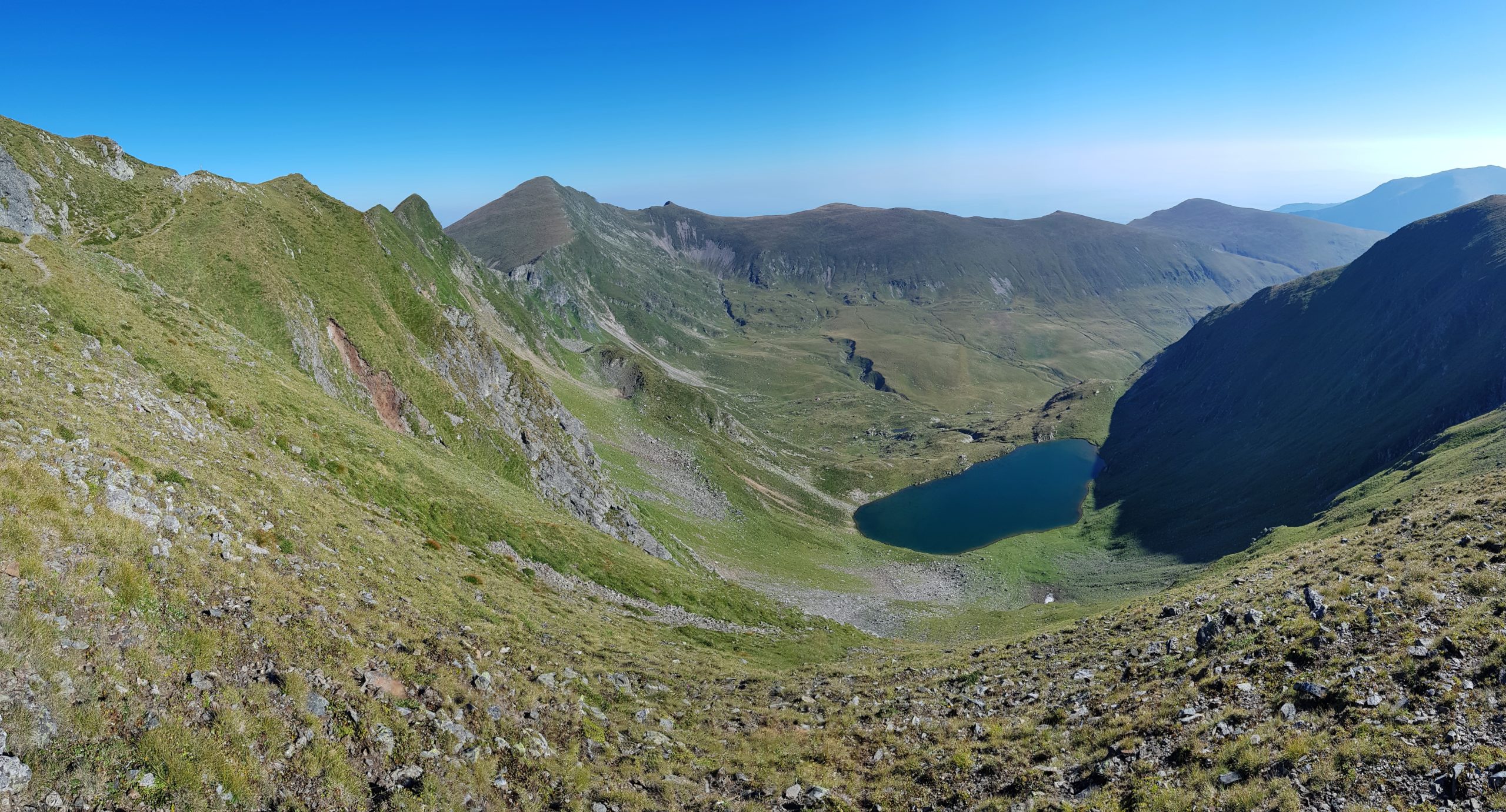
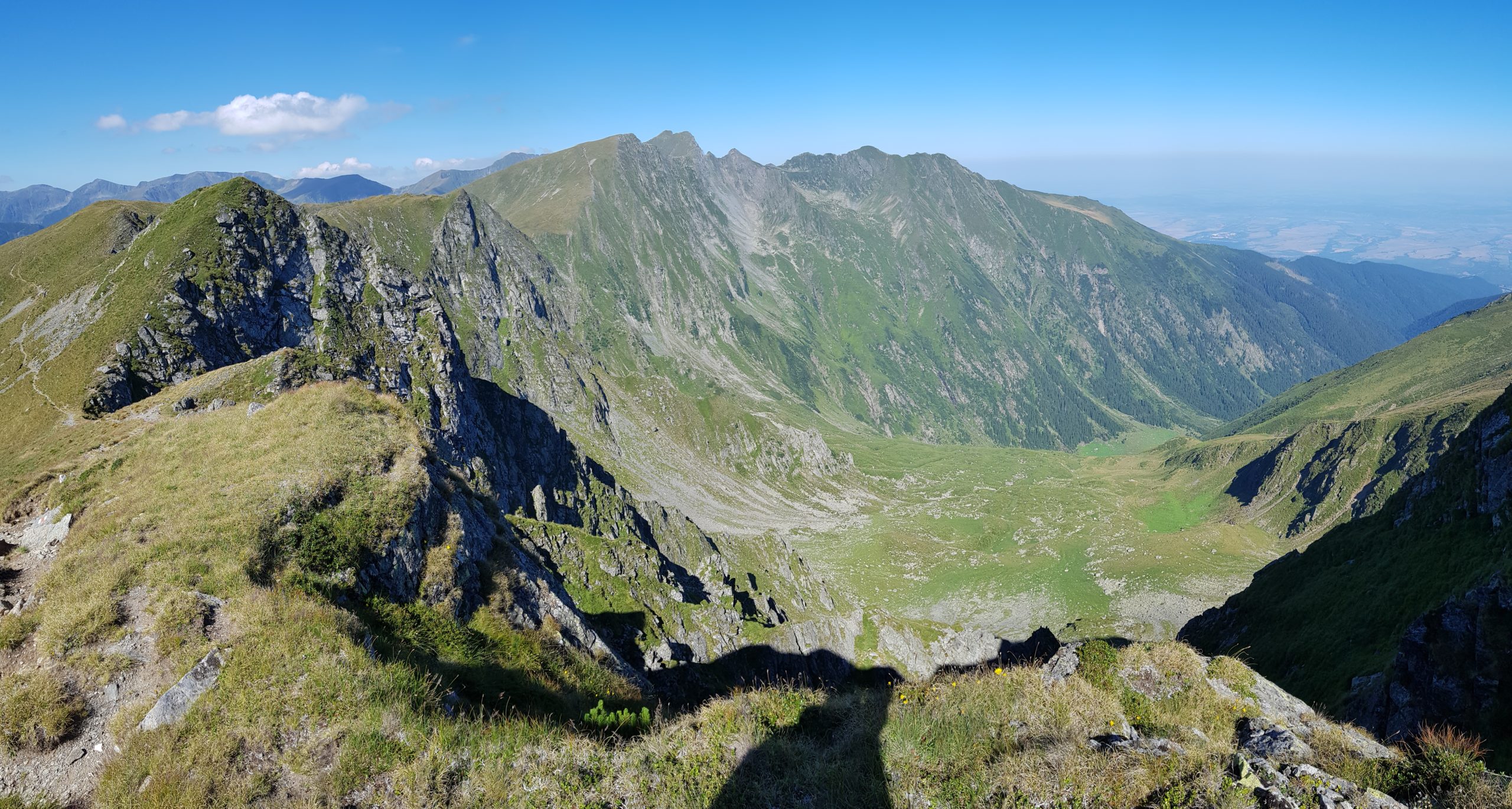
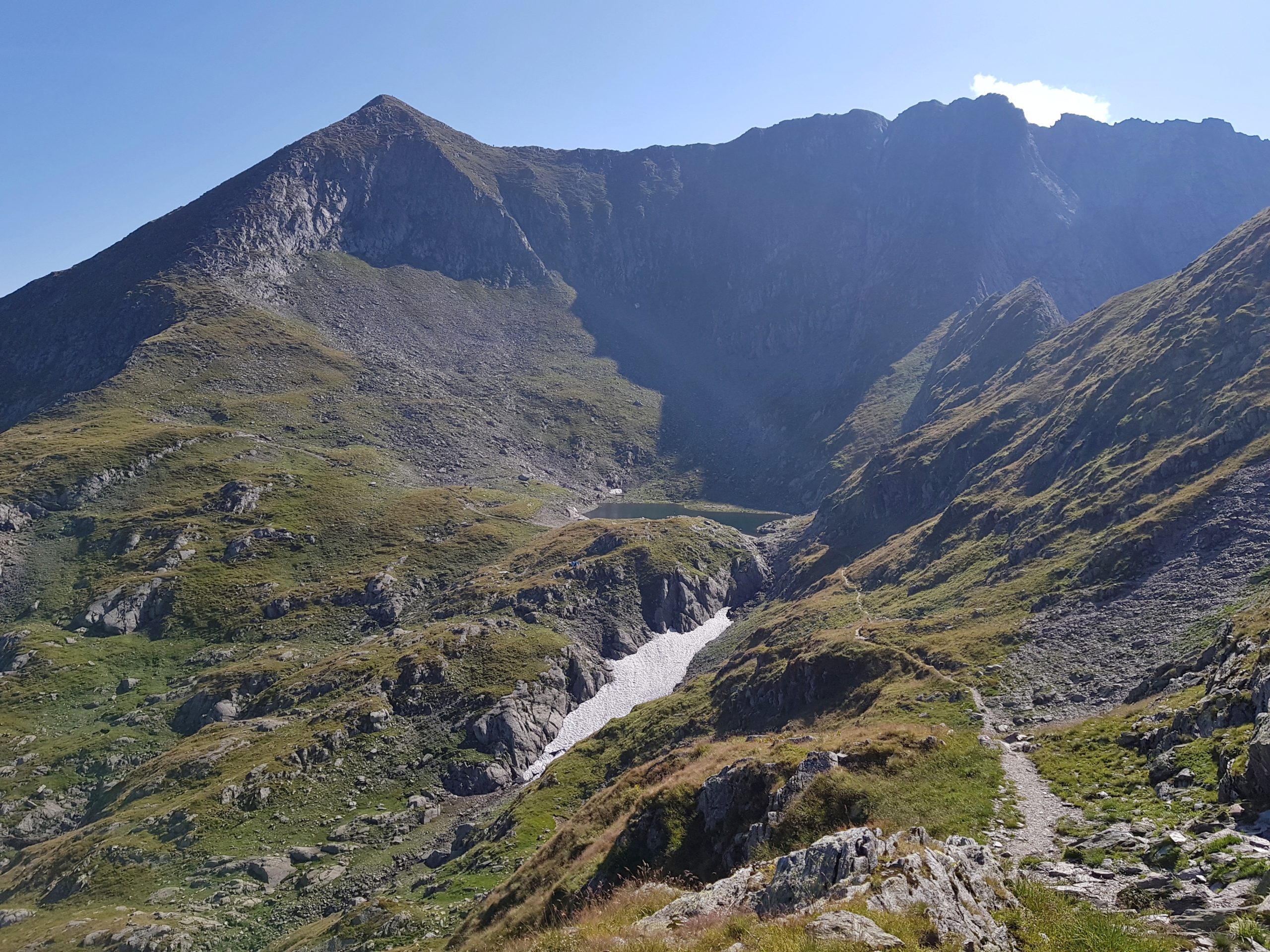
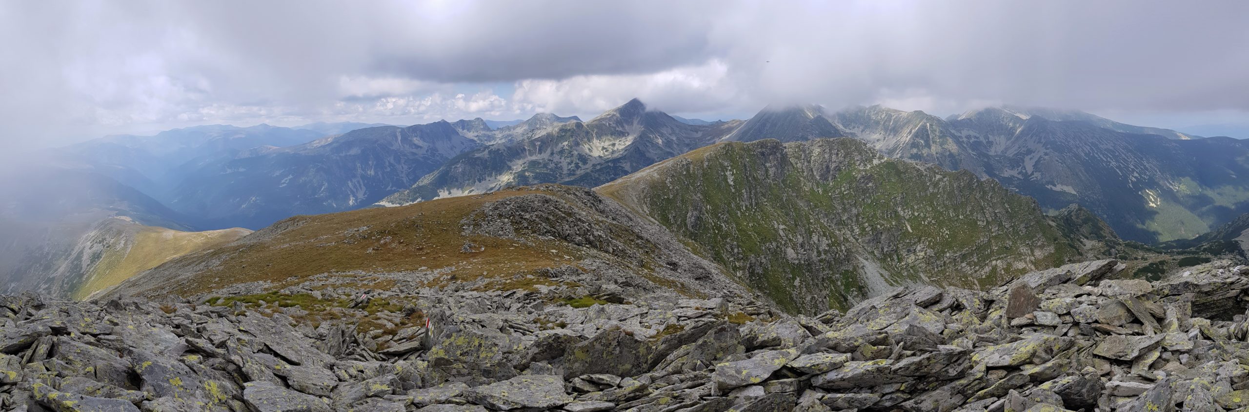
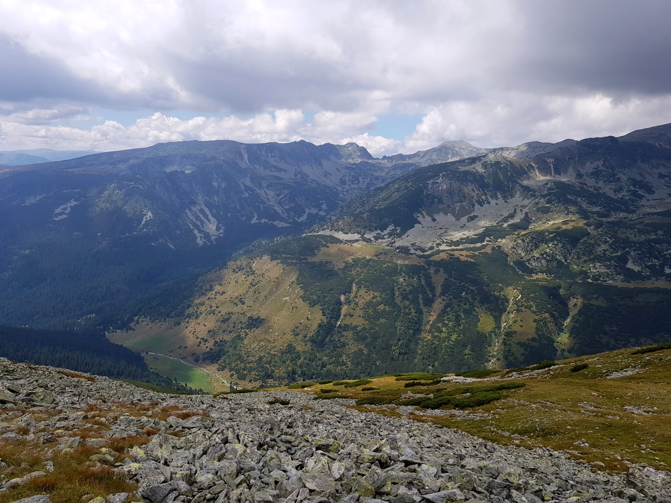
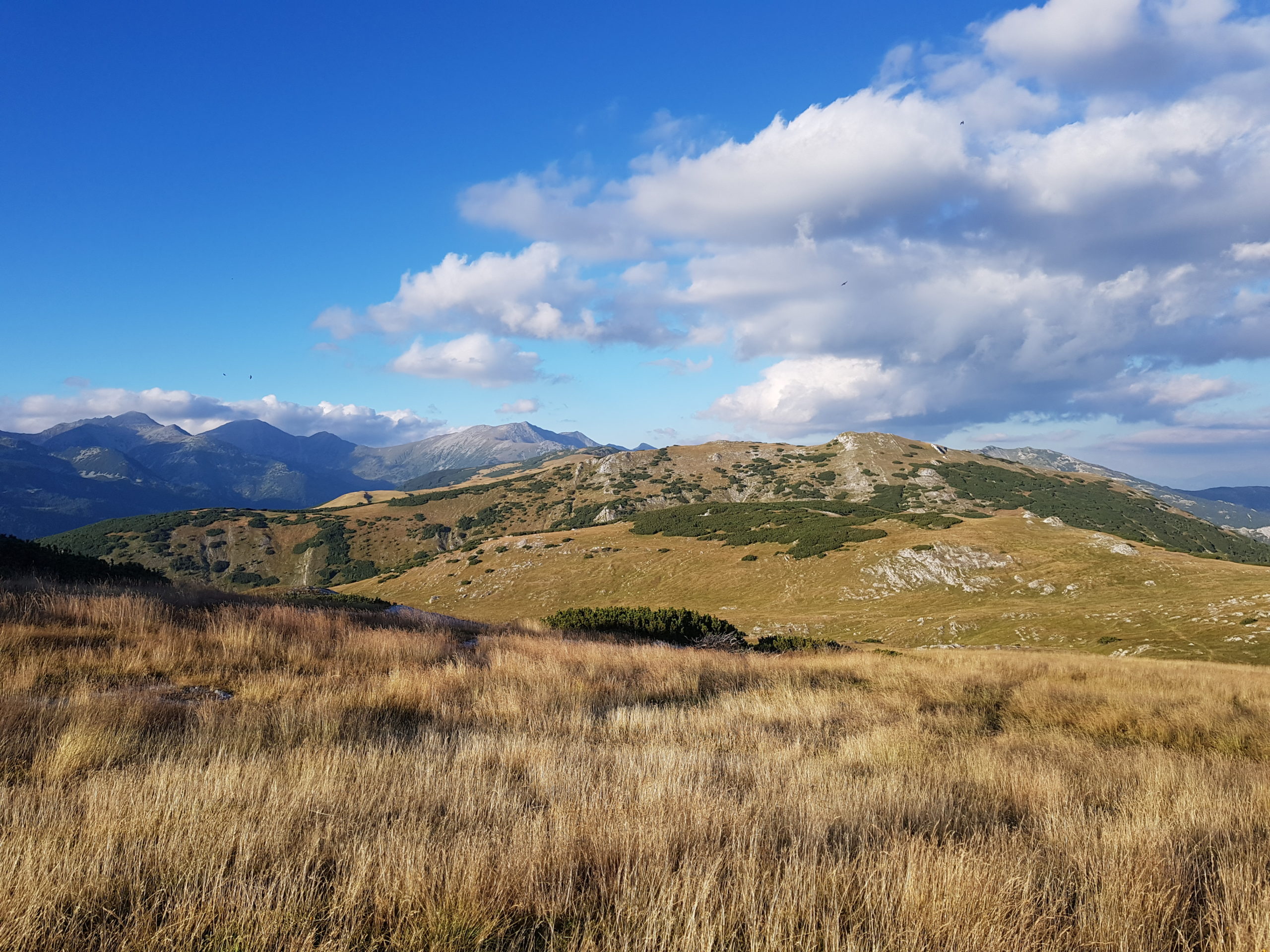
The weather was beautiful so I could not resist to capture something from the beauties of these ranges.
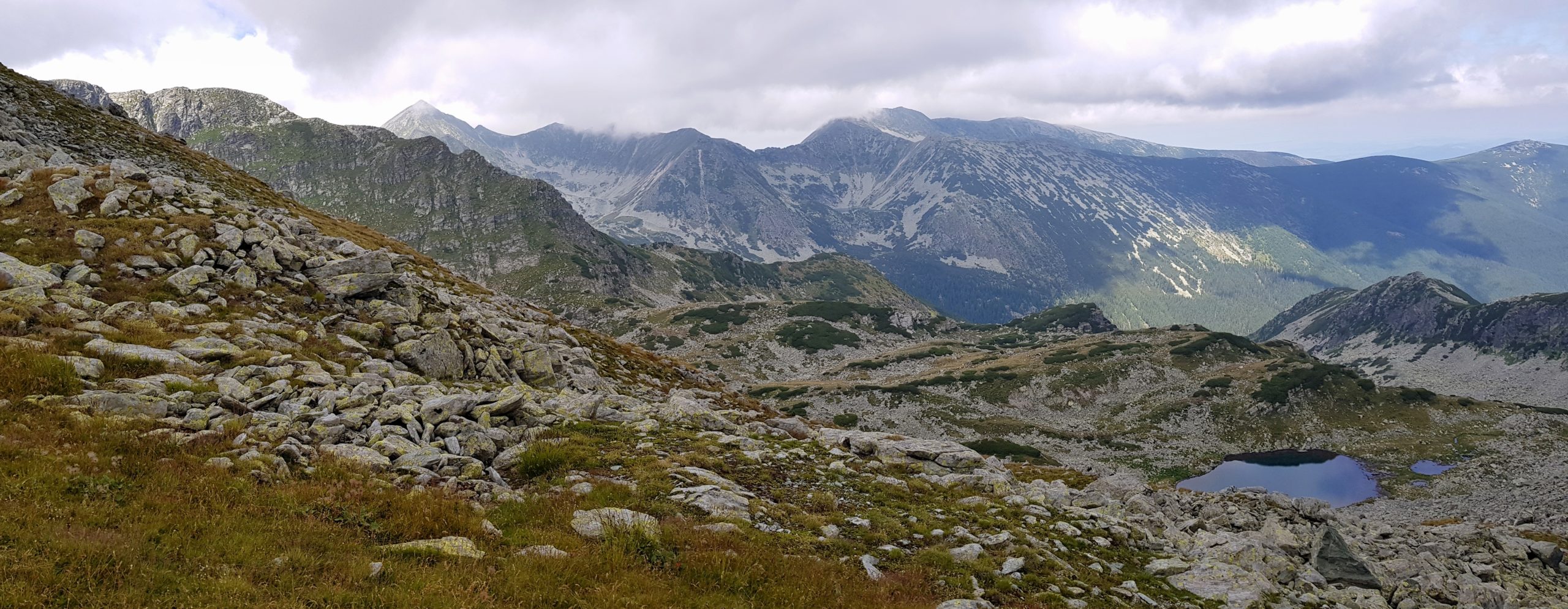
Because Small Retezat is a limestone/conglomerate area, the water is scarce so I needed to fill all my tanks (=3,8 litres) and walk with the weight for about an hour. In exchange I got one of the most beautiful camping spots of the whole journey below the above mentioned peak.
In small Retezat I met 3 Romanian hikers and two groups of Czechs (3 and 4 hikers). First hikers since I left Făgăraş and last for the next 5 days.
One Reply to “Through the Southern Mountains”
Comments are closed.