Michal Medek created these pages to inspire others to hike the Carpathian arɔ, just as others have done before him and many more will follow in the years to come. Since 1990, he has hiked through over 100 Carpathian mountain ranges. This site covers only long-distance hikes; however, it may also provide inspiration for shorter treks.
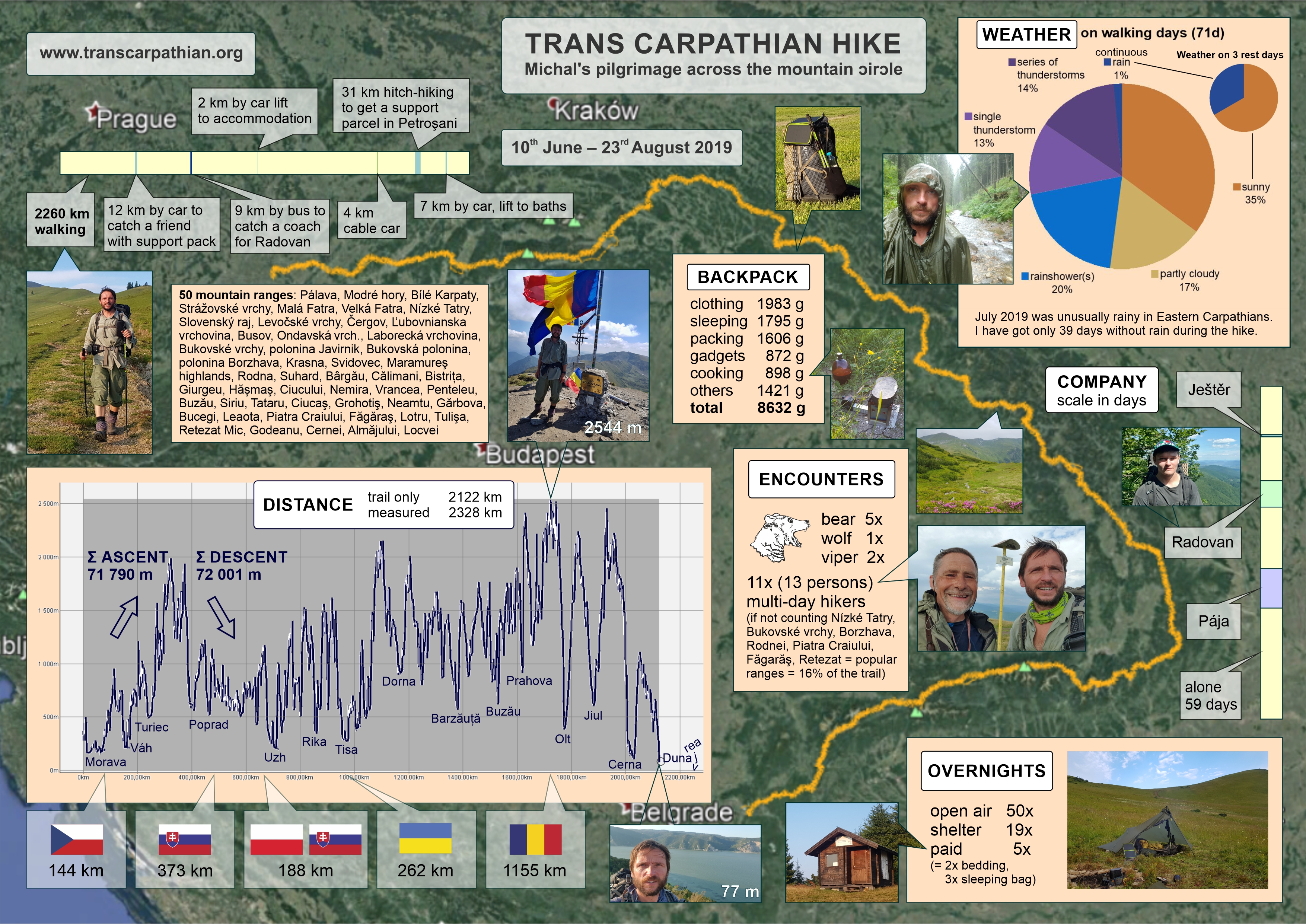
A few years ago, Michal walked across 50 Carpathian mountain ranges in 74 days. He walked 2200 km across the Czech Republic, Slovakia, Poland, Ukraine, and Romania. The blog covers only this longest hike, as we see no reason adding to the myriad of the hike accounts already available online.
The northern and southern trail (Bratislava – Góry Leluchowskie) was published in 2022. The Munții Vlădeasa – Orşova trail was added in 2023, and the Călimani – Harghita – Poiana Marului alternative section in 2024. Every year, more points of interest are being added with the help of other keen Carpathian hikers who gather coordinates for shelters and water sources available for download.
There is no single trail across the Carpathians; in some parts, the main ridge is obvious (Făgăraș), while in other sections, hikers can choose from several different mountain ranges.
Some have already tried to chart the Via Carpatica or The Carpathian Divide Trail, but these plans are materializing slowly and remain incomplete. Meanwhile, a handful of people walk across the entire range every year. Based on my conversations with them, most would love to keep Carpathian thru-hiking as it is – without an official trail in place. The reasons are simple: 1) Charting an “official route” invites competitive hikers who feel the need to compete, often prioritizing their achievement over respect for the fragile nature and relationships with locals. 2) While charting a route means taking responsibility towards nature, local communities, and hikers, it also relieves hikers of their own responsibility, thus attracting less experienced individuals. 3) An official route enables comparison but takes away from the uniqueness of the individual experience. 4) Official routes are often someone’s business projects; the less commerce we see at the expense of the mountains and the locals, the better.
When planning my routes in the Carpathians, I try to avoid civilization as much as possible and stick to the mountain ranges. These trails are physically scouted, not just planned on a screen, which is why the GPS datasets are slightly larger than the computer-generated ones.
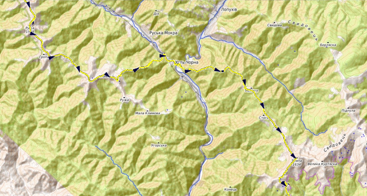
The 2019 thru-hike started at Pálava – the westernmost point of the range, where the Carpathians collide with the much older Hercynian platform. Through Slovakia, I followed in the footsteps of Svetozár Krno, Ľuboš Calpaš and Pavel Mach, who traversed the arc in 1984. Unlike most other hikers, I did not finish in Orșova but reached the Danube in Coronini, walking an additional 100 km to the west. Since there are Czech settlements in that area, I experienced the magic of hearing my mother tongue at both ends of my Carpathian journey.
Map of the thru-hikes
Click the upper-right corner to enlarge the map, click upper left corner to choose points of interest (water, shelters, shopping options, …).
To download:
the 2019 trail in gpx format based on my smartwatch treklog, most of the detours, searches for water etc. are erased
Download instructions: based on several feedbacks the download does not work by clicking the link in some browsers (Chrome, Safari). In this case, right-click the link and choose the save-as or download option. Based on your online safety settings you might receive a warning that the file is not secure. The reason is the browser/antivirus cannot see inside the zip files containing gpx. Here is an alternative link to a Google Drive folder.
I welcome any updates to the points of interest. Feel free to send them to michal@skaut.cz so I can add the POIs to the datasets. And of course, you can buy me a coffee if you find this work helpful.
Other hikers
Pages of (reference to) other hikers who walked across the whole Carpathian mountain range:
I should note that “walking across the Carpathians” can mean different things depending on the trail and the philosophy you choose, so I would be very cautious when making any comparisons. Weather plays a significant role during the hike. Starting and ending points vary. Some walk only the highest peaks, while others also cross valleys or lower ridges. Some avoid civilization, while others pay for accommodation in mountain chalets and villages or take detours to cities. Some have support teams, others depend on local resources. Some walk fast, others slowly. Some raise thousands of Euros for their journey, while others set their survival limit at 1€ a day. Some sell their experience, others keep it for themselves; I created these webpages to inspire others to fall in love with the Carpathians.
If I were asked to define what a “Carpathian thru-hike” means, I would suggest: 1) walking at least 2000 km and passing through most of the Carpathian countries in a single trek, 2) walking the highest ridges or the lower ones connecting them, 3) spending at least two-thirds of the nights away from civilization, 4) having no support team accompanying the hike.
Thanks
I am grateful to my friend Horaţiu Popa – a keen tourist from Cluj for tips regarding Northern Romania, updates on snow conditions in Făgăraș and help with the support parcel during the 2019 thru-hike. Joachim Bungert for his superb Quo Vadis software I used for planning and processing maps, POIs and the final version of the trail. Jiří Chemlon Glonek added extra POIs he gathered along his 2021 thru-hike.
10. 6. – 17. 6. 2019 The hot first week Pálava, Modré hory, Bílé Karpaty, Strážovské vrchy, Malá Fatra 18.6. – 25. 6. 2019 In the high mountains Velká Fatra, Nízké Tatry, Slovenský raj 24. 6. – 30. 6. 2019 Landscapes touched by warfares Levočské vrchy, Čergov, Ľubovnianska vrchovina / Góry Leluchowskie, Busov, Ondavská vrchovina …
Though my original idea was to start on 1st, 3rd and later 4th of June, I am actually setting out Monday 10th June 2019 but with clear mind I finished almost all my commitments. I also needed to manufacture some parts of my gear, which took couple of days and support of my wife and …
Not the start I imagined At first I wanted to start from Romania but my friend, a mountaineer from Cluj, warned me there was too much snow in winter and there were some unfortunate deaths in Făgăraş. I need not think for long about the starting point on the other end of the Carpathian arc. …
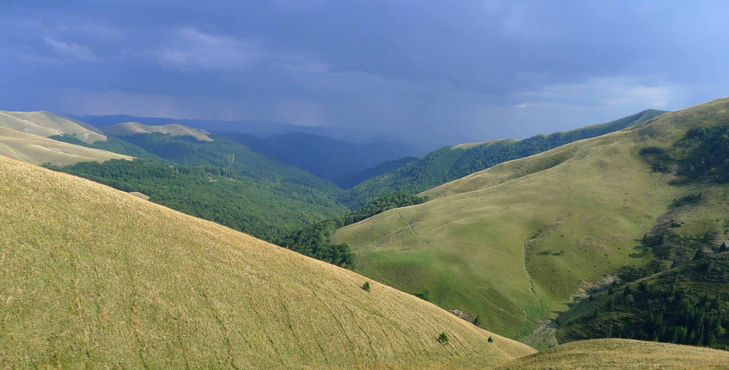
Unlike many other long-distance hikes, in the Carpathians you will find only a few ranges where you encounter scores of tourists – the Tatras, Východní Beskydy, Munții Rodnei, Piatra Craiului, Făgăraş, and Retezat – which account for about 16% of the thru-hike. For the most part, you walk along trails, ridges, and forest roads where you might be the only hiker for a day, or even a week. In some places, there is no visible trail at all, and you need to forge your own path.
To illustrate the point, in Slovakia I met only 1 multi-day hiker over the 200 km stretch between Slovenský raj and the Dukla pass. Apart from Polonina Borzhava I met only 2 hikers in Ukraine, though I saw 3 tents at Polonina Svidovec. The number of hikers I encountered between Rodnei and Piatra Craiului was 2 (two!) over a distance of 550 km. So apart from a few popular ranges I met on average one hiker per 137 km not counting the day-hikers I met at Strážovské vrchy, Haşmaş, Siriu, Ciucaş and Bucegi.
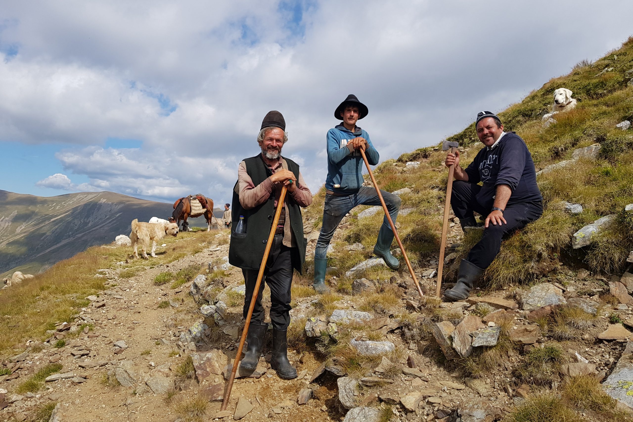
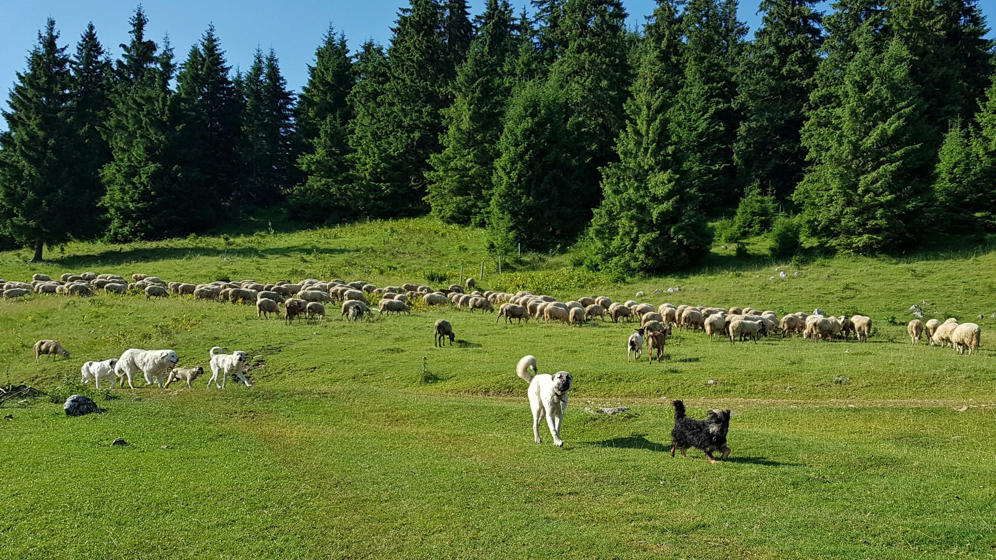
This does not mean the mountains are deserted. A settlement is rarely more than a day’s walk away, and in summer, the mountains are inhabited by shepherds with their herds and dogs.. Hikers arevisitors intheir land and it is better to avoid Romanian Carpathians unless you are willing to accept this fact. Hiking trails often follow paths that shepherds have used for centuries, which is why the sheep-dogs attacks are so frequent there. In many places, a hiker is treated as a being that appeared out of thin air, and the locals simply do not know, how to react in this situation. On the other hand, you can be sure they will help you when you are in real need.
The Carpathians run through several nations, giving hikers the pleasure of using many languages. Do not expect locals to speak international languages. Hungarian is spoken on western slopes of the Eastern part of the Carpathians. Young Romanians, Czechs, Slovaks, and Poles are usually fluent in English. Many Ukrainian men understand Czech, Slovak, Polish and Lithuanian from their experience working abroad. While most Ukrainians are fluent in Russian, many are now unwilling to speak it due to the Russian aggression.
Apart from Slovakian E8, it is very unlikely you will meet any long-distance hikers. In 2019, I almost met with Michał Kulanek who was walking across the Carpathians in the same direction and we connected through Facebook.
The other side of the coin of this solitude is freedom. The freedom to walk, camp, and forage for wild berries and mushrooms – afreedomone hardly experiences in other European mountain ranges today. This, of course, does not apply to strictly protected national parks (the Tatras, Poloniny, Rodnei, Ciucaș, Bucegi, Piatra Craiului, Retezat), where hikers must stick to the designated paths and camping areas.
…
Timing
If you want to hike all the highest mountain ranges in the Carpathians without special equipment for snow, both timing and direction matter. The Romanian section of the thru-hike is significantly more demanding than the Slovak and/or Polish parts. For this reason, many hikers choose to start from the Danube in Romania. In this case, you need to bear in mind that in early June, there are still snow patches in the Godeanu and Retezat mountains, and you might not be able to cross Făgăraş until the end of June. A safe date to start from this direction is mid-June. Another advantage of this direction is that you will encounter almost no mosquitoes as you reach lower altitudes in late summer.
If starting from theDanube in Slovakia (or, as in my case the westernmost Pálava hills), the timing depends on the route: 1) If walking north from Vysoké Tatry through Poland, startimg is possible as early as April. 2) The Nízké Tatry are passable from early June, so a mid-May start is feasible for this route. 3) If you want to cross the Vysoké Tatry, the situation is similar to the Făgăraş – mid June can be considered a safe start. However, a significant difference is that camping is not allowed in the Vysoké Tatry, so you are obliged to stay in mountain chalets.
Expect sub-zero temperatures overnight at both ends of the arc in the second half of September. The first snow typically arrives on the highest peaks before the beginning of October, but it should still be passable. The mountains in Romania become deserted once the shepherds descend to the valleys with their herds in September (in one particularly dry year, I experienced deserted shepherd’s houses at the end of August). The same applies to early June before the fresh grass grows. The advantage is you can use shepherds’ huts for overnight shelter.
Your experience will be highly impacted by weather. The very same ranges can be either muddy or dry during the same week in different years. There is no general rule regarding the weather. I suggest expecting thunderstorms, showers, or continuous rain on roughly one-third of your hiking days. I got rain on 40% of days during my 74 days of the 2019 thru-hike, while Svetozár Krno and his team got only 7 or so rainy days out of 92 in 2024.
…
Supplies
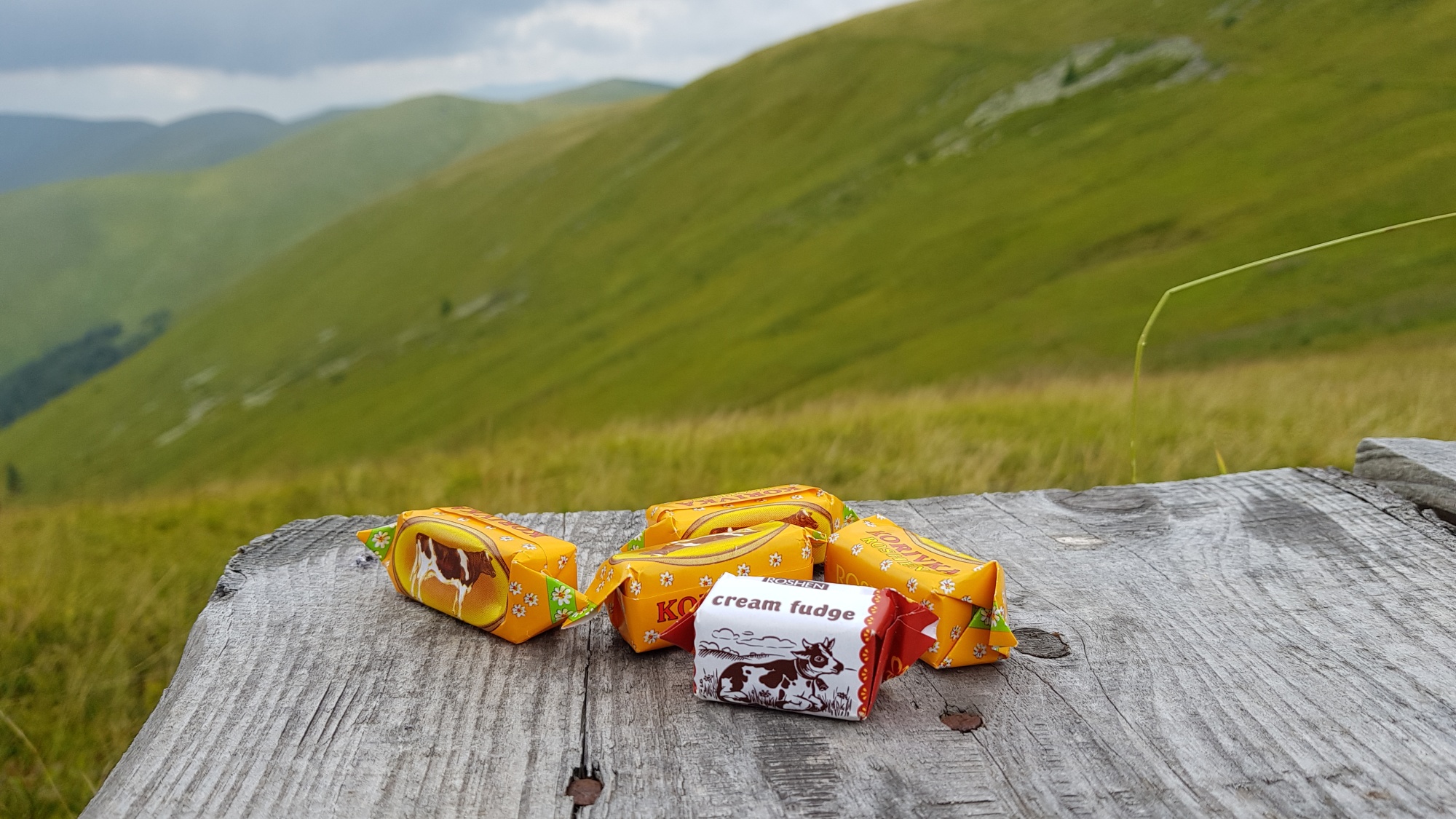
Food supplies for hiking in village shops are more varied in Slovakia, Poland, and the Czech Republic, especially regarding dry instant meals. Expect a more limited offer in Romania and a poor in Ukraine. However, basic staples are easily accessible in all these countries. I mean oil, sugar, rice, buckwheat, cous-cous, chocolate, raisins, instant noodle soups. —specifically oil, sugar, rice, buckwheat, couscous, chocolate, raisins, and instant noodle soups. Sunflower halva, which has a superb price/weight/energy ratio, is widely available in Ukraine and Romania. Fresh cottage cheese (though usually not milk) can often be obtained directly from shepherds. Specialized items like meal replacement nutritional powders, isotonic drinks, or freeze-dried fruits are not available along the trail at all.
Sport/outdoor shops are located in large cities far from the trail. You can find them in Trenčín, Poprad, Sighetul Marmației and Petroşani if following in my footsteps. Some hikers detour to Braşov or Bistrița to get necessary gear. I tailored my own equipment so that I could stay in the mountains for the whole hike.
While in the Czech Republic and Slovakia, alcohol fuel can be obtained in drugstores (Drogerie), in Ukraine and Romania in pharmacies (Аптека, Farmacie). The Ukrainian alcohol was of the finest quality; the cheap Romanian 70% blue liquid always left behind some unburned residue.
I tested poste-restante delivery to post offices in Slovakia and Romania, and it worked well (apart from one case). During my 2019 thru-hike in Romania, I received my first parcel in Borsec, took what I needed, and split the rest into two new packages – one sent to Bușteni and the other to Petroșani. Note that when sending a parcel in Romania, you must provide a local return address where the package will be delivered if it is not picked up. While walking the northern trail, I tried Paczkomat delivery in Poland (self-operated box to box delivery), but it turned out to be too fast—I ended up having to pay a penalty because my package waited in the box longer than the allowed time.
Only once did I take a 10-minute lift from a mountain pass to a nearby village for supplies. I preferred to compensate for the joy of being out of touch with civilization by carrying a heavier backpack (up to 6 kg of food).
Water is generally available throughout the Carpathians, though the Eastern Beskydy and limestone ranges are drier. There is usually no need to filter the water unless it looks dirty or is taken from stagnant pools. You can download the coordinates of water sources here, and also read the description of my daily water management.
Bears, aggressive sheepdogs, ticks and thunderstorms are realities you cannot avoid when walking across the Carpathians.
Out of those, SHEEP DOG ATTACKS are the most exhausting for a solo hiker. Expect them in Romania, everywhere outside the few areas with a heavy tourist presence (such as Rodnei, Bucegi and Făgăraș). I have faced as many as ten attacks a day. Dogs understand well when they have the upper hand and are naturally inclined to attack solitary individuals. Being part of a group is the best defence against severe attacks. The worst attacks happen in the early morning and evening, when shepherds are busy with their sheep. At these times, both the dogs accompanying the herds and those staying at the base unite into a single pack with nothing to do. Every attack is unique, so there is no universal advice; however, I would suggest the following: 1) Track and watch – it is always better to be aware of the dogs before they scent you. Try to avoid an encounter if possible. 2) Always keep three or four stones in your pocket. If you expect an attack, hold both trekking poles in one hand (dogs are regularly beaten by shepherds, so the sight of a long stick scares them). Keep pepper spray handy and stock up on more stones. 3) Look for the shepherd’s help first – Only he/she can calm the dogs down. 4) Ignore the dogs until an attack is imminent and they break your perimeter (about 10 metres). Do not bother with one or two dogs; they either will not attack or can be easily repelled. If the dogs are only trying to scare you off by barking (which is the case most of the time), ignore them. Do not move on to the next point, as that will definitely trigger aggression. 5) If a pack of more than three dogs approaches aggressively (i.e., snarling), do not show fear. Attack the pack leader first—the bigger the stone, the better. If there are no stones around, make throwing motions as if picking them up from the ground, interspersing this with throwing your real reserve stones. If you have a stun gun, do not bother with stones; discharge it towards the pack leader, as the sound scares them off. 6) Try to keep the dogs at a distance and separated from each other. Split the attackers—if two or three hesitant dogs leave the pack after being hit, the others usually stop attacking. 7) Constantly look out for the shepherd’s help. 8) If they manage to get very close and try to bite, face them while moving towards the shepherd or continuing in your intended direction (do not turn your back or run away!) and begin an active defence depending on your weapons: 8.a) Stones: Continue throwing stones without mercy. Do not rely on trekking poles—they are too short, occupy your hands and make the dogs even more furious. 8.b) Stun gun: This has proved to be an excellent defence tool. Dogs are shocked by the sound of the discharge and will pause the attack temporarily. If used too much without direct contact, they likely start attacking again, but it buys you valuable time. Naturally, you can also use it in case of close contact. 8.c) Firecrackers: A Romanian ranger told me these work brilliantly, though I have no personal experience with them. 8.d) Nothing: Shouting loudly as if giving commands sometimes helps stop the attack. 8.e) Other tools: A whip should work very well, as shepherds use them. I tried using a slingshot on a few Romanian treks, but it wasn’t effective because the dogs are unfamiliar with it. I keep pepper spray ready in case of a bite, but I have never had to use it against dogs. 9) Respect that the dogs are just doing their job and be polite to the shepherd. There is an ongoing conflict between shepherds, hunters and tourists in Romania, even at a legal level. Showing respect for a representative of this centuries-old craft is highly appreciated. Smile, shake hands with the shepherd, exchange a few words and apologise for the intrusion. Foster a sense of mountain brotherhood; do not feed animosity. Here is a nice video on sheepdog encounters made by Via Transylvanica.
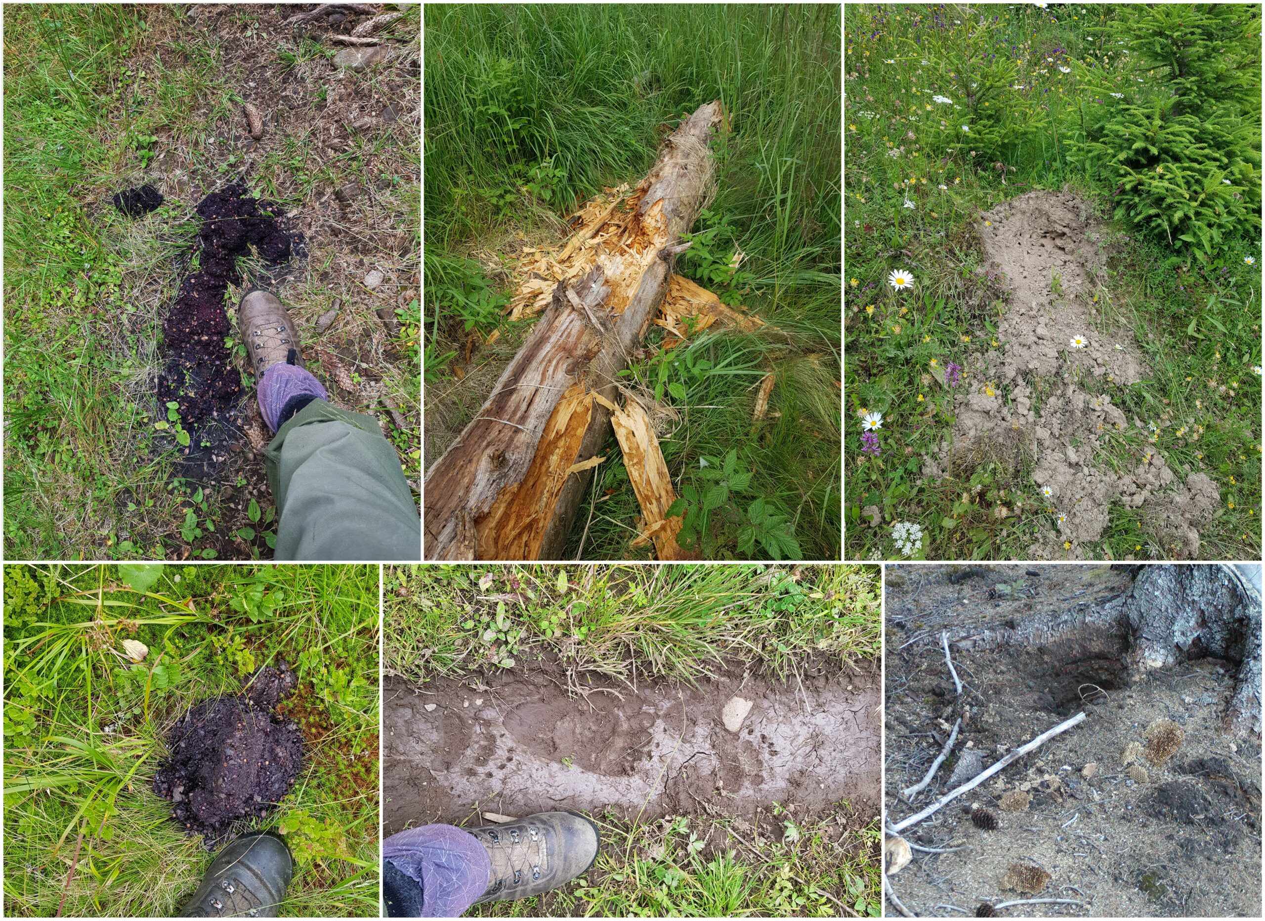
I had five BEAR ENCOUNTERS during my Carpathian solo thru-hike. It is hard to say how many times a bear got out of my way without me noticing, but my guess is at least a dozen times. On the other hand, I hadn’t encountered a single bear on dozens of my previous Carpathian hikes. I attribute this to the following reasons: a) bears usually avoid popular higher ridges with tourist footpaths, b) when walking in a pair or a group, we make more noise and pay less attention to our surroundings, c) the bear population was smaller in the past. In the Carpathians, there are ranges with a high bear density (such as Veľká Fatra, Călimani and Vrancea) and specific spots or times of day where meeting a bear is highly likely. I will not focus on the bears habituated to humans that beg along roads in Romania or regularly approach tourists on the footpath between Bușteni and Cabana Caraiman. They are the most unpredictable, and the only advice is to avoid them entirely. Unless they are curious (which happened to me once), wild brown bears have an overriding desire to avoid human contact. We should help them achieve this by following a few simple steps: – Do not walk at dusk or at night (this is the number one piece of advice). – Keep pepper spray easily accessible (I keep it in my hip-belt pocket and move it to my trousers when signs of bear presence appear.), backpack pockets are too far away. – When in terrain with visibility under 150 metres, make noise. I use bear bells; research shows that a third of bear attacks in Europe happen because the animal was caught by surprise. – Keep your food in a sealed dry sack close to you overnight. Avoid any enticing scents around your campsite (e.g. food leftovers, grilled meat). If cold-soaking food in a pot, seal it and keep it either close to you or well away from your campsite. Hanging food around your campsite will only serve to attract bears to humans. The Carpathians are not the Rocky Mountains, so please help keep them that way: do not hang your food. – Mark your territory. Pee on the path a bear might use, about 30–50 metres away from your camping spot. – When you see signs of bear presence, be extra vigilant and make more noise (e.g. combine bear bells with singing). These signs include: bear tracks, torn-apart rotting trees, upturned stones (bears search for insects beneath them), rummaged anthills and wasps’ nests, scratched tree trunks and, of course, bear droppings. In summer, bear droppings are easily identified by their purple colour, and it is quite easy to judge how fresh they are.
Signs of bear activity (a mother with a cub was just 100 meters away from her tracks as I learned after taking the photo)
In the event of a bear encounter:
Assess the situation: If the bear is far from your trail and your presence cannot be interpreted as a threat, continue on your way, paying no attention to the animal.
If the bear has noticed you: Identify yourself as a human by speaking softly while retreating. I once delivered a fine monologue lasting several minutes to a bear staring at my campsite from 60 metres away. However, try to avoid making direct eye contact or shining a torch on it during your “conversation”.
If you meet a playful cub: Retreat immediately. There is no time for photos; a frightened mum will be close behind. According to this research, 50% of bear attacks in Europe are associated with female bears with cubs.
If the bear charges: It could well be a bluff charge, meaning the bear will stop before reaching you. I have never been in this situation myself; however, there are two options depending on your equipment:
You have your pepper spray ready: Discharge it from about 5 metres towards the bear’s face.
You do not have pepper spray: The best advice is to stand still or slowly lie on the ground face down. Once on the ground, clasp your hands behind your neck to protect your head and face. Remain passive and as quiet as possible until the attack ends.
I remember an account by a Slovak surgeon who treated many forest workers injured by bears over the course of his career. He was surprised that such a mighty animal inflicts relatively minor injuries on humans.
In 2023, a bear attacked a runner in Slovakia during a surprise encounter early in the morning. The man slipped while trying to escape, and the bear attacked him while he was lying on his back. Even though the runner was totally defenceless, he survived with only a few bites and scratches. It is obvious that European bears do not view humans as food, considering they are easily capable of tearing a horse to pieces. It is also worth mentioning that there has been, on average, only one fatal bear encounter per year in the Carpathians over the last 20 years.
What NOT to do: Do not immediately lie down on the ground – This could simply make the bear curious. Do not scream or make sudden movements. Do not try to scare the bear away – This might work a few times, but it could just as easily end in disaster. Do not run away. I once saw a bear running near the Oituz Pass, and believe me, they are incredibly fast. Do not leave food leftovers near your campsite and/or store your food away from your camp.
OTHER WILDLIFE I have only encountered a wolf twice, though I have heard howling and found their tracks quite frequently in various parts of the Carpathians. They pose no danger to humans. A friend of mine even encountered a wolf pack in winter while camping on a remote ridge; the wolves simply passed by the tent, leaving two very frightened humans inside.
Seeing a lynx is a once-in-a-lifetime experience. I have only seen one once, from a distance, in Eastern Poland. They pose absolutely no danger whatsoever.
Some people (UK hikers in particular) are afraid of wild boars. While there are documented cases of them attacking people in Central Europe, I have had several close encounters without any trouble. One night, we even ended up in the middle of a wild boar herd crossing the footpath. I could feel them brushing against my legs, but they were just going about their business. On another occasion, we stumbled upon a den with three piglets and saw their mother running away. In such a situation, however, it is highly advisable to leave the area immediately. Wild boars are more common in the western Carpathian ranges and less frequent in Romania and Ukraine.
TICKS are very common all across the Carpathians at altitudes below 900 metres. They transmit two diseases: Tick-borne encephalitis (TBE) and Lyme disease (Lyme borreliosis).
Vaccination is the best protection against the TBE virus. Ever since a friend of mine ended up bedridden and totally paralysed by it, I strongly advise everyone to get vaccinated. Lyme disease is a bacterial infection; while a vaccine is available in North America, the European version is still undergoing clinical testing. However, it can be easily cured with antibiotics if caught in the early stages.
The first step in preventing the disease is removing the tick from your body as soon as possible and disinfecting the area immediately. Normally, the bite will itch for a few days and a small red circle (about 3–5 cm wide) may appear around the spot. However, if the red mark expands over time to several centimetres or even becomes palm-sized, the bacteria have likely entered your body. In this case, you will need a course of antibiotics (such as amoxicillin). Keep in mind that ticks often leave your body unnoticed.
To reassure anyone from areas without ticks: I personally have picked up well over 1,000 ticks in my life and am still alive and kicking—with no TBE and (hopefully) no Lyme disease.
There are basically two types of THUNDERSTORMS in the Carpathians:
1) Convective thunderstorms (originating from local evaporation) These thunderstorms typically occur later in the day. They are associated with cumulonimbus clouds and are therefore localised to an area of just a few square kilometres. One year, we experienced this type of weather for five days in the Grohotiș and Ciucaș Mountains – every afternoon brought a thunderstorm. Because these storms are clearly visible from a distance in the high mountains, their movement can be predicted, giving hikers plenty of time to get ready. When caught in this type of thunderstorm high up, I sit down, insulated from the ground by my backpack with only one foot touching the ground, my poncho covering both me and the pack, while I enjoy the sting of the raindrops. This type of thunderstorm moves quickly and usually clears the area within 30 minutes.
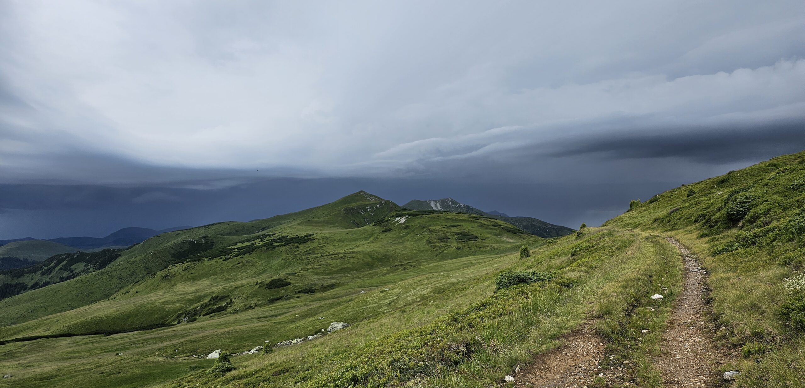
2) Frontal thunderstorms (during cold front crossings) These storms occur over widespread areas, can arrive at any time of day, last much longer (especially when the leading edge of the front stalls over the mountain range) and are usually followed by hours of rain. Lightning during these storms can turn night into day with constant flashes and the relentless drumming of thunder. As weather forecasts are easily accessible nowadays, I suggest that hikers check them and find shelter away from the high ridges for the duration of a cold-front crossing.
..
Orientation
My first trips to the Carpathians relied on 1:100,000 Czechoslovakian maps of Slovakia and sketches published in 1986 Guide to the Romanian mountains. For the past 15 years, however, I have relied on digital maps. For the thru-hike, I backed up smartphone by having the trail loaded on my smartwatch. Today, my smartwatch is my primary orientation tool and I consult my smartphone only when necessary.
MOBILE APPS (Android): Mapy.com – free of charge in online mode, 19€/year with offline maps. The app has excellent offline maps, and a good online planning tool. Although it is #1 choice for most hikers in the Carpathians, I am personally not fond of this app because of poor customization and battery drain issues I got with it. I use it only as a secondary source, double-checking that the app is fully closed afterward. PathAway – was my app of choice for almost two decades. It offers high customization, a solid trekking function, and “on-the-go” map downloads (Open Topo) for offline use. Unfortunately, the UI is still stuck in the Windows Mobile era, and its slow responsiveness during my thru-hike was maddening. Also, the position-sharing tool did not work for me. Locus Map(formerly LocusPro) – my current favorite. While the default offline maps are slightly less detailed than Mapy.com, you can easily switch between various free and paid map sources within the app. It has a well-organized UI, smooth operation, and a wide range of useful plugins. (Tip: Disable automatic app updates while on a hike; otherwise, you might have to re-download all your offline maps.) Soviet Military Maps – though the map data is 50 years old, it provides a nice overview and servers as an alternative source of information. Munţii Noştri – a Romanian-developed app aspiring to cover this part of the Carpathians AvenzaMaps – features the largest collection of digital versions of printed maps (though in my experience, the calibration/georeferencing is not always perfectly precise).
PLANNING I use Locus Map or Mapy.com for rough planning, export the gpx and then fine-tune the trail in the Quo Vadis software. I also use this software to process and archive the data collected during hikes.
..
My gear
Unlike in the Alps, outdoor shops are far from the mountains. You can easily tear your gear while pushing through thickets or new growth where a path might once have been. The “land management” in Romania and Ukraine changed significantly since the 1990s. Following clearcuts and heavy storms, paths are sometimes blocked by logs and overgrown with tall grass and bushes. Old trails sometimes vanish into the undergrowth as they are no longer used. This requires a great deal of improvisation and preparedness.
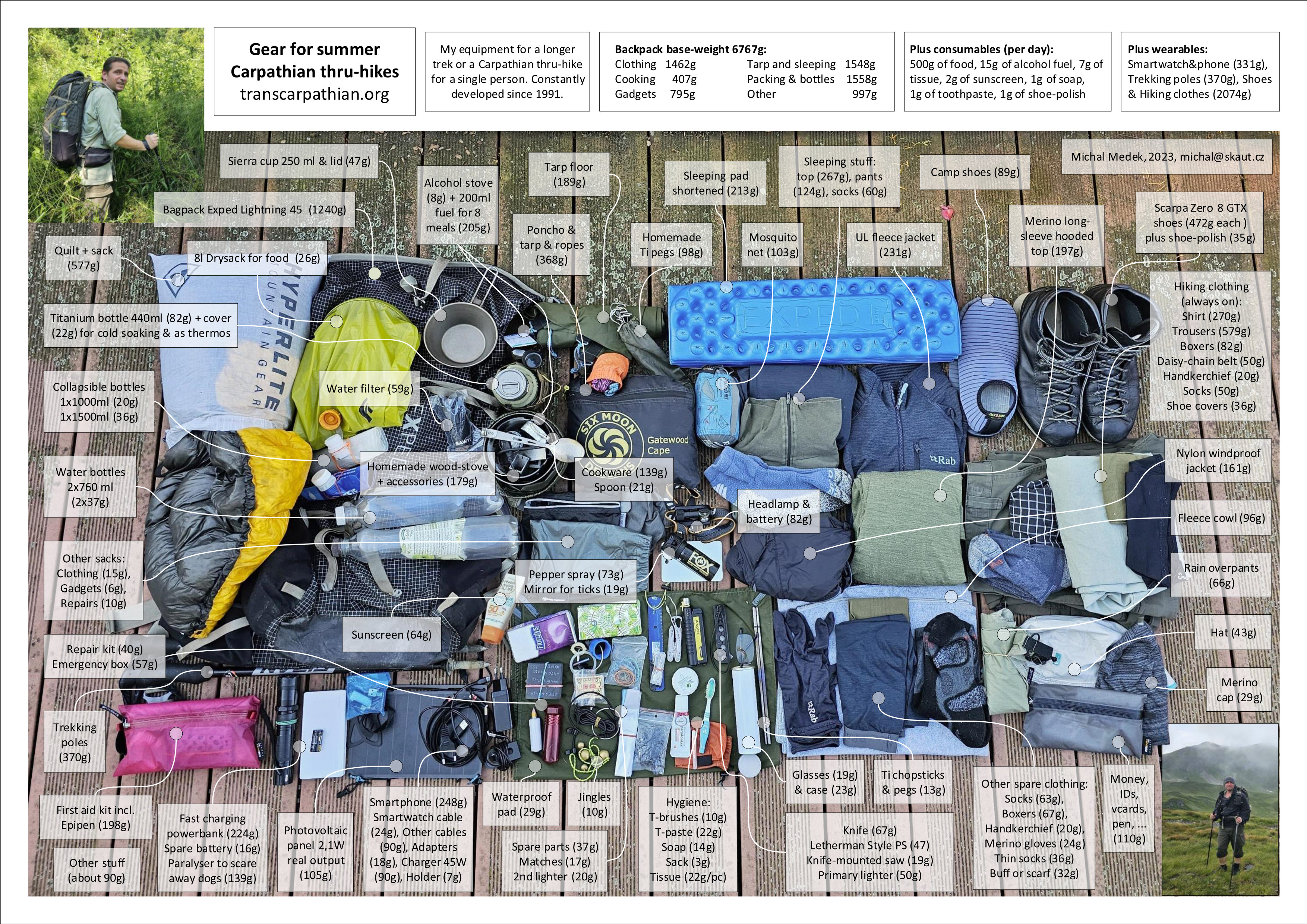
My backpack for Carpathian hikes is not the lightest; I know I might not encounter another person for days, and I want to be prepared for any trouble. The base weight is almost 7 kg. Including consumables (food, fuel) and water, I usually carry under 14 kg after resupplying. That is sufficient for a 10-day trek in the Carpathians. Water management throughout the day also plays an important role.
For my 2019 thru-hike, the total pack weight was about 8,600g (7,950g base weight). I should note that I didn’t end up using about 450g of my repair kit, first-aid supplies, and pepper spray. I also carried a keyboard (177g) and a scout scarf, and my first-aid kit included two EpiPens (55g each). In retrospect, my cooking setup was too powerful for one person, and my sleeping bag was too warm.
In general, my advice regarding the gear for a Carpathian thru-hike is: 1) Don’t just copy-paste experience from popular US trails. Keep in mind that many influencers making videos about ultralight backpacking earn their money from your clicks, which doesn’t always translate to the reality of the Carpathians. 2) Fast charging is a must. Unless you stay overnight in civilization, there is no way to charge a power bank that requires 6 hours of charging time. In 2019, I only had the opportunity for an overnight charge 5 times in 74 days, though other hikers may use different strategies and stay closer to civilization. 3) Long pants are a necessity as you often need to bushwhack your own path. 4) Expect rain. In 2019, it rained on 40% of my hiking days. Good rain gear and waterproofing your backpack’s contents will save you a lot of trouble. I keep a waterproof pad in my pocket to put my backpack on or to sit on wet surfaces. 5) A fan-powered woodstove is my choice. It provides the magic of a fire, allows for fast cooking (even for food requiring long boiling times like rice), and provides warm water for hygiene and laundry. I don’t have to worry about carrying fuel, and unlike a traditional campfire, it follows Leave No Trace principles. In sensitive areas, I use an efficient liquid alcohol stove (20g of fuel can boil 0.5l of water for 6 minutes). 6) Despite what outdoor shops and commercial hikers claim, hiking is not about the gear, but about having nature near.
..
Philosophy
Although I don’t view my journeys as athletic performances, but rather as pilgrimages, I must admit that my goal to walk the entire Carpathian arc within a set timeframe turned the 2019 hike into something of a contest. Unlike my previous journeys, I felt I lost a large part of my sense of freedom once I started comparing my progress against a pre-planned schedule.
In other respects, however, I stayed true to the philosophy I embraced 25 years ago: local sources + less comfort = less weight = nicer experiences. The philosophy I learned in the book Carpathian Games by Miloslav Nevrlý.
Media
I am not the guy who builds his/her identity upon presenting to public, so I give talk shows only upon request. My talk shows are more about the Carpathians, their changing nature, history and people. Do not expect much of “personal adventures”.
Carpathian Games – the ultimate book about hiking in the Carpathians.
Video in Czech / Slovak from an extraordinary presentation of 4 Carpathian thru-hikers (Svetozár Krno, Martin Davidov, Jiří Glonek, Michal Medek), October 2024.
Become a member of the Carpathian thru-hikers community and join the Facebook Group!
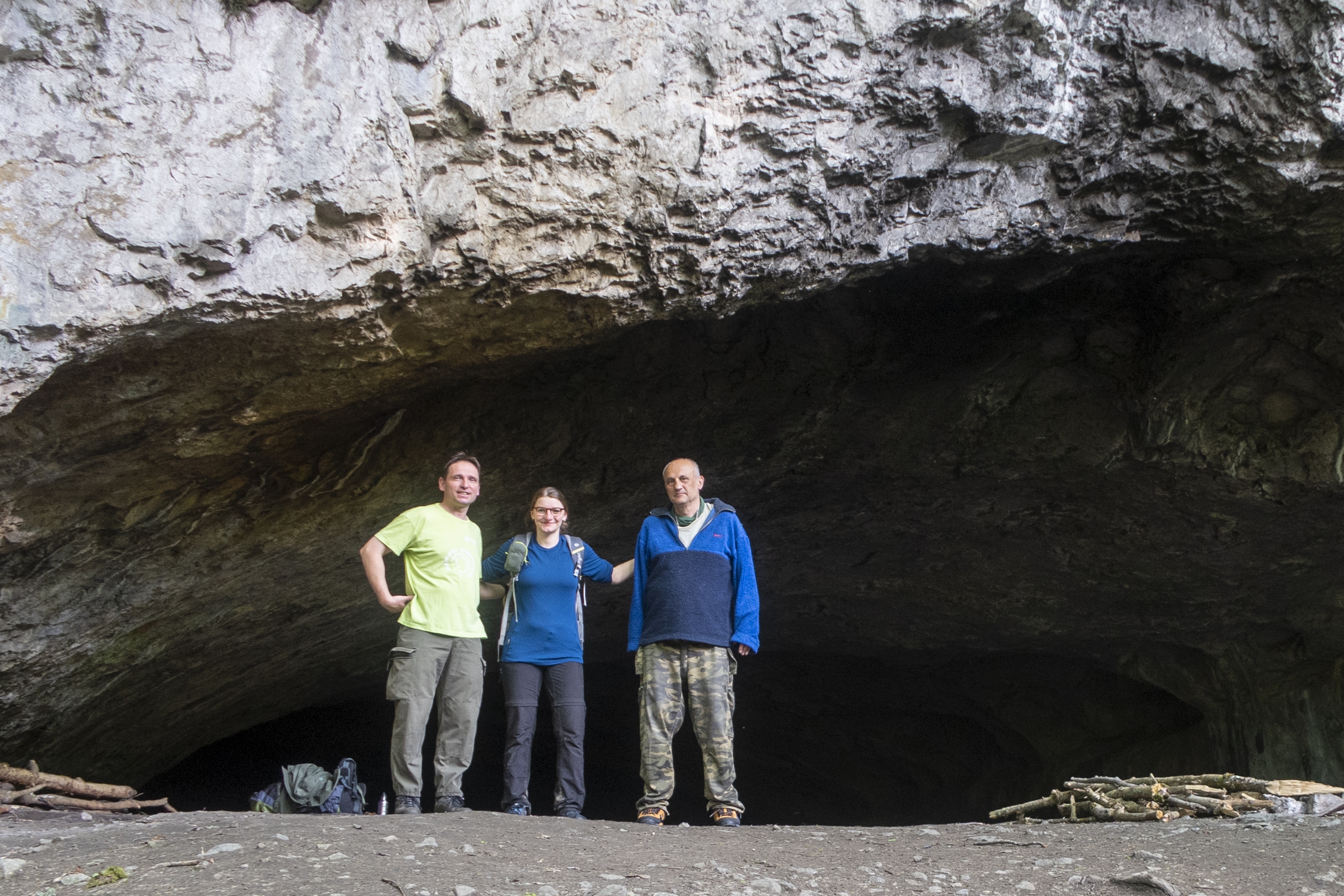
Sitting around a campfire with great people is the best medium. A unique meeting of 3 generations of the Carpathian thru-hikers took place in the Moravian karst (CZ) in June 2021: Michal Medek (2019), Viktorie Hlaváčková (2015, 2021) and Svetozár Krno (1984).
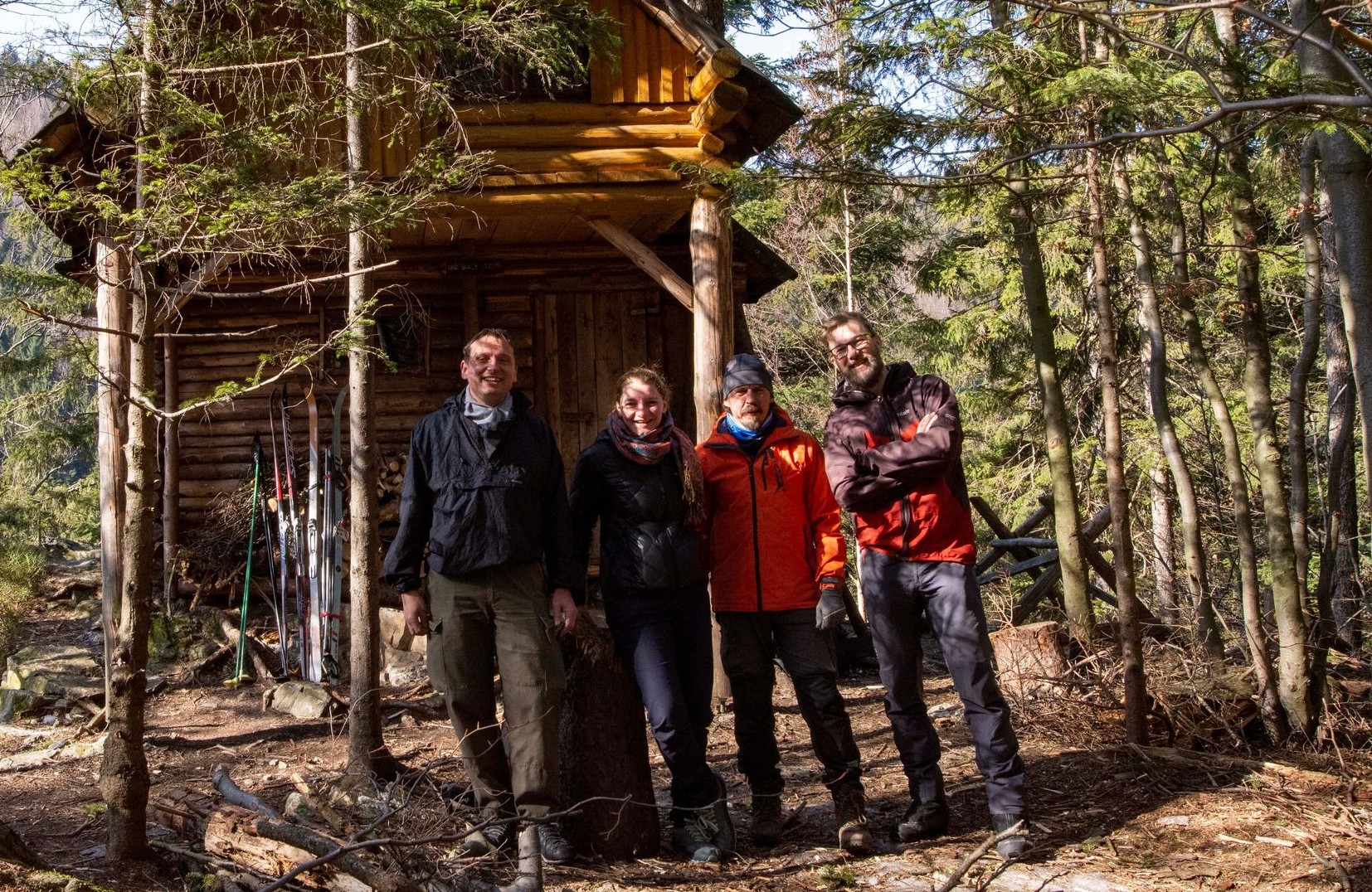
In March 2022 Jiří Chemlon Glonek organized meeting of all the Czech thru-hikers in Rychlebské hory.
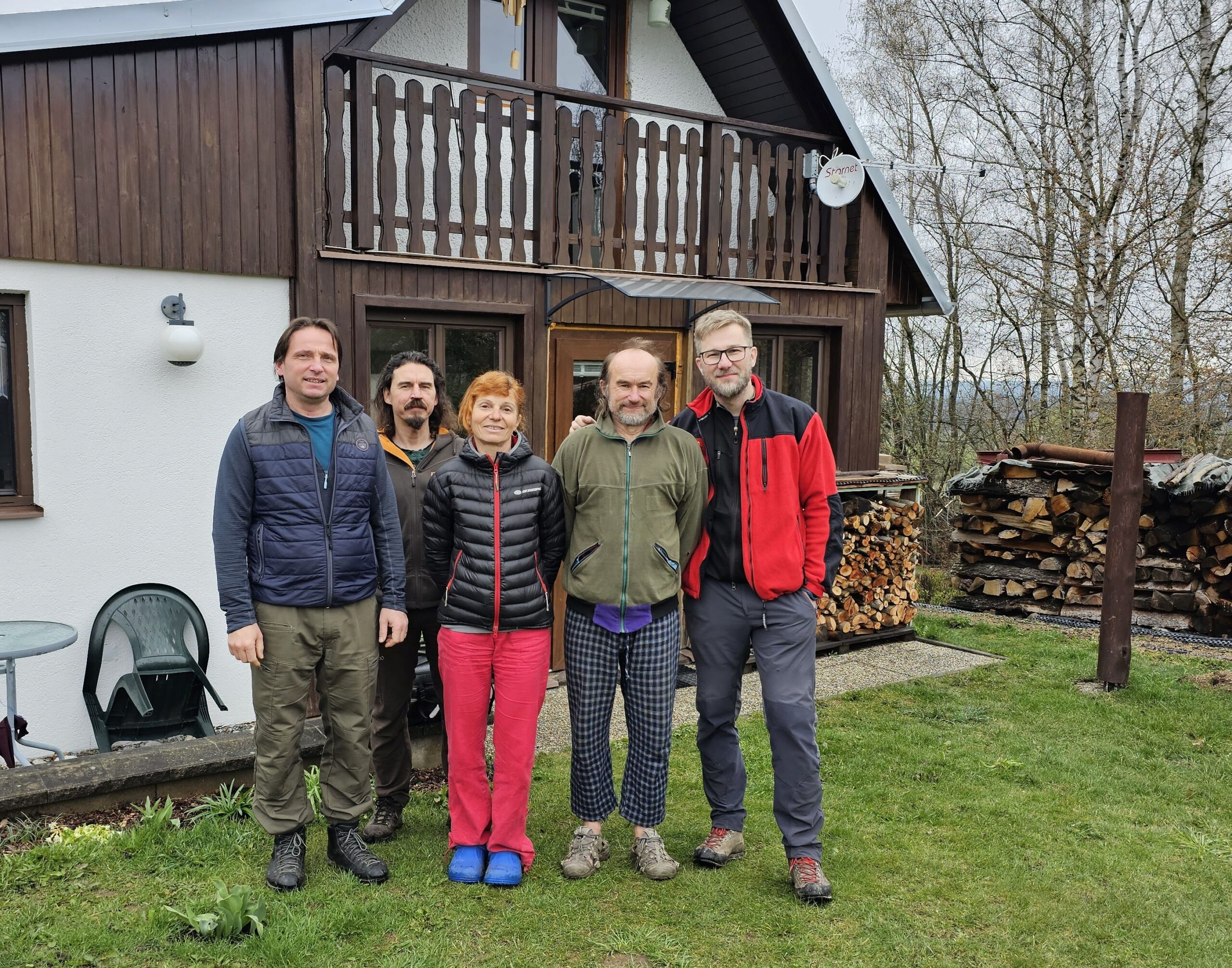
In 2023 we met in Novohradské hory at the place of one of the oldest Carpathian thru-hikers: Jiřina Lípová & Rosťa Gregor.
In 2024 Czech and Slovakian Carpathian thru-hikers met in the Carpathian range of Javorníky next to the border between the two countries (left to right: Martin Davidov – 2021, Peter Jankovič – 2021, Jiří Chemlon Glonek – 2021, Agi – 2021, Svetozár Krno – 1984, Pavel Löbl – 2023, Michal Medek – 2019).