Dying Poloniny
I woke up quite late on Monday 8th July as I got phone call till late night with my wife. The sky was blue and I was next to a stream so I used the opportunity to wash my clothes and dry up my garments, that is why I started walking at about noon. There is always this trade-off on long-distance hikes: keeping clothes clean means spending sunny days making laundry.
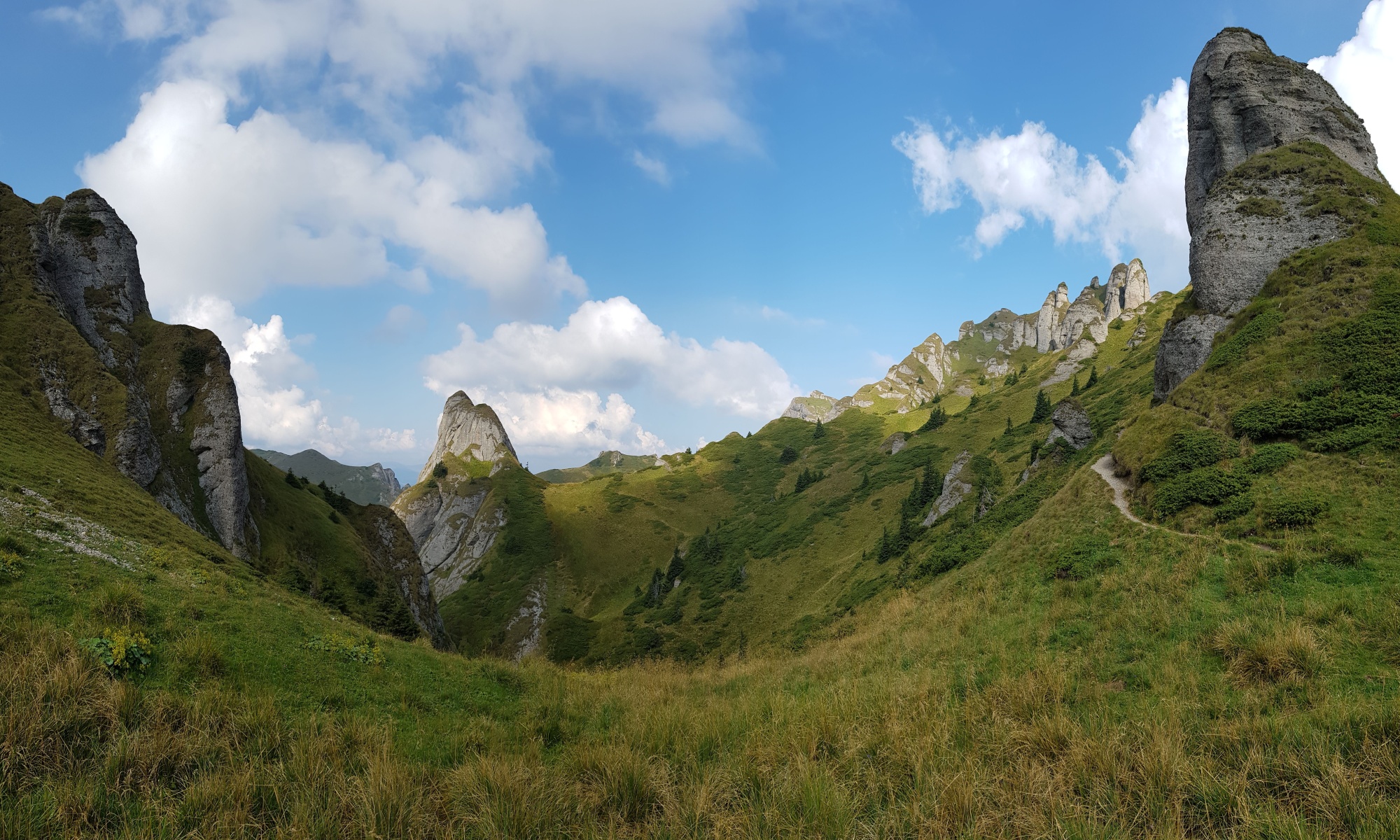
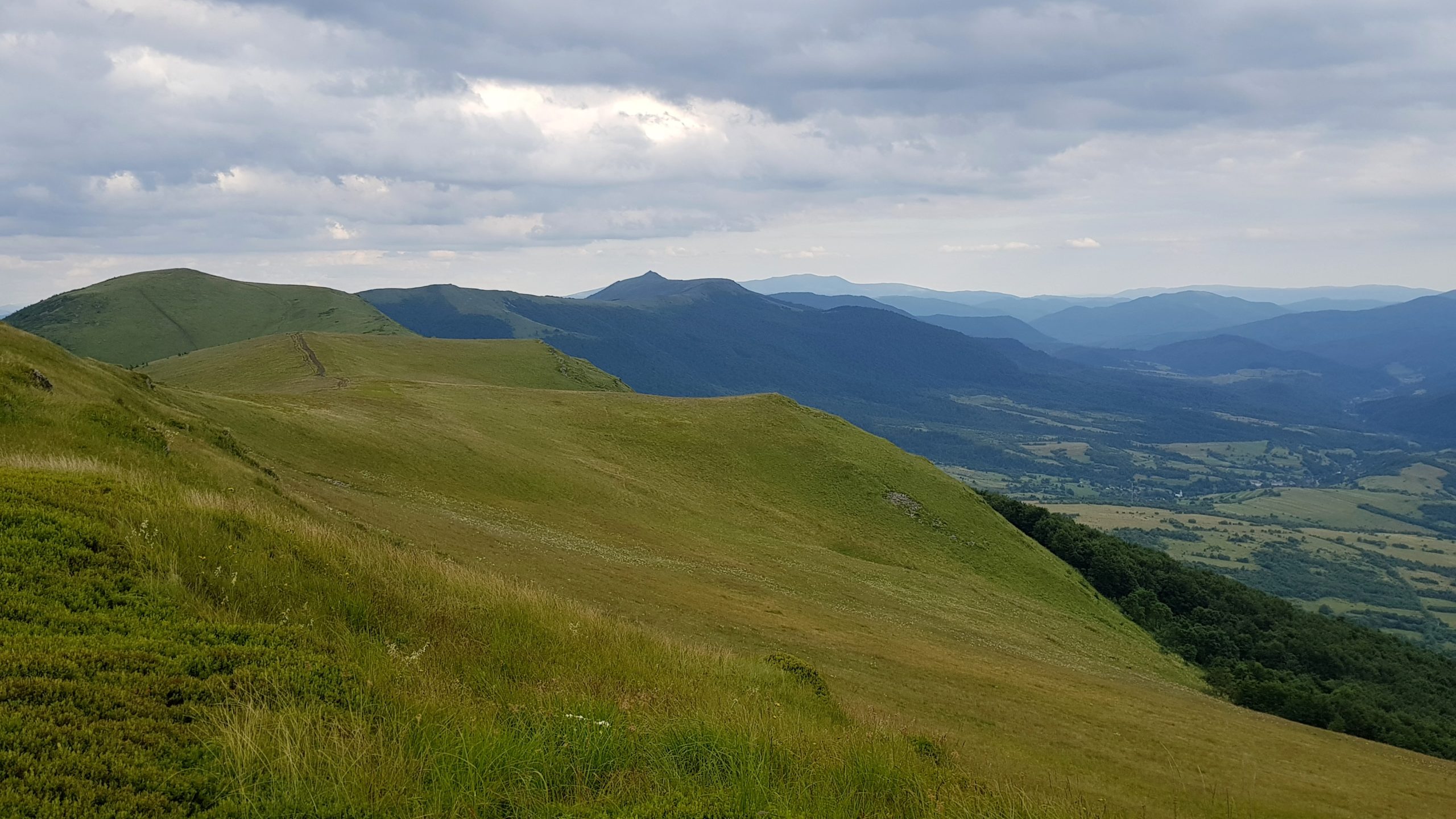
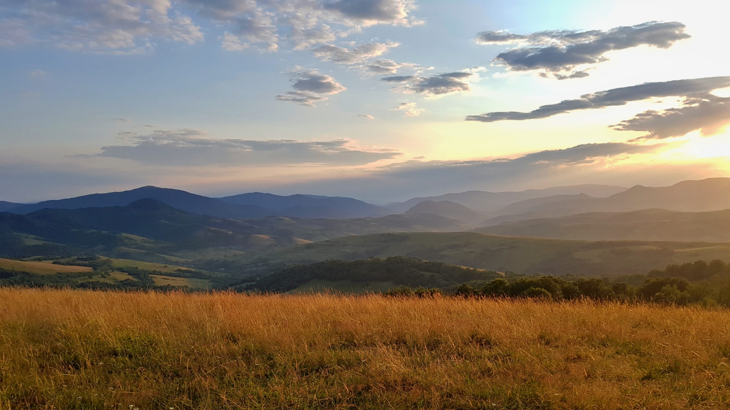
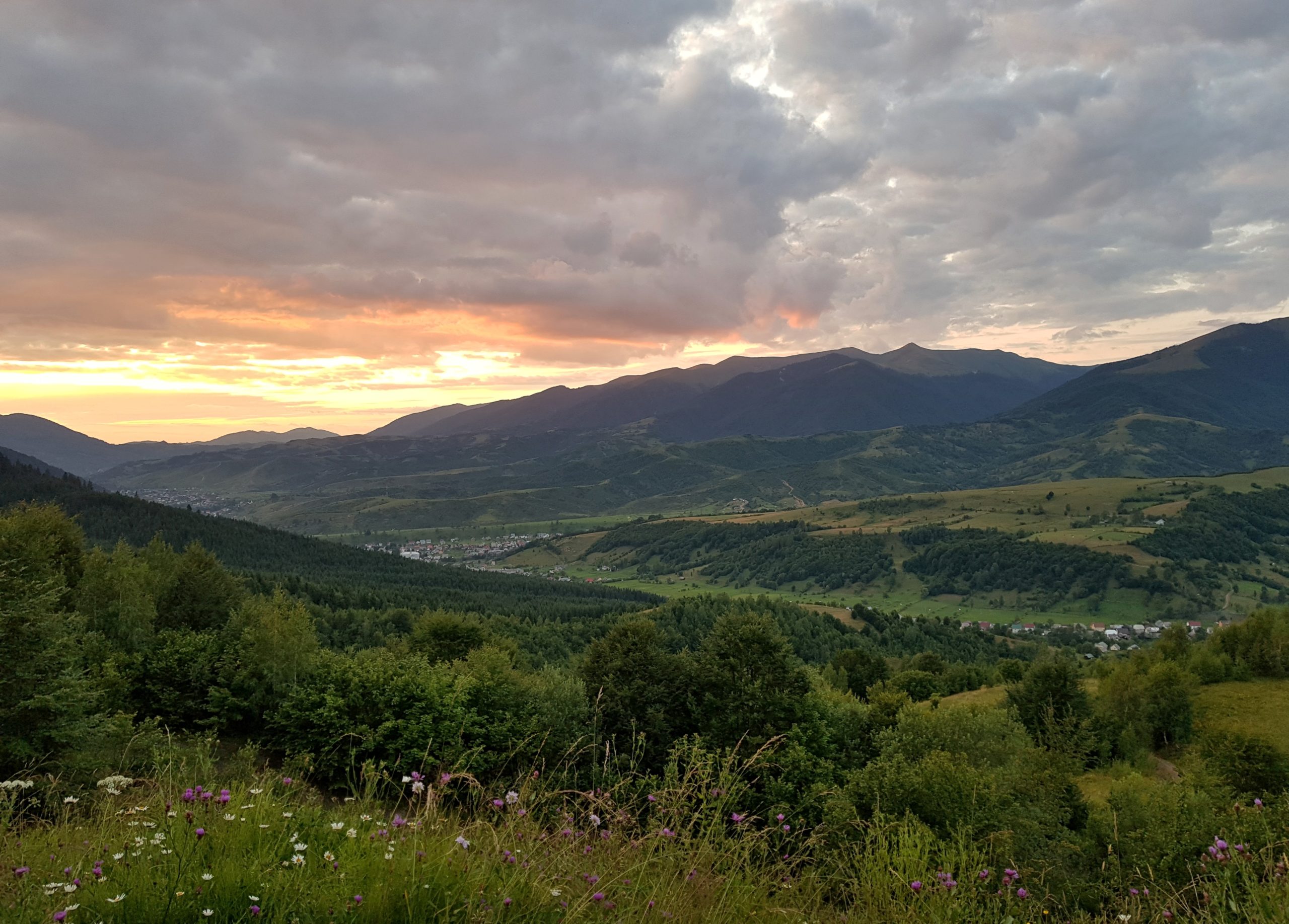
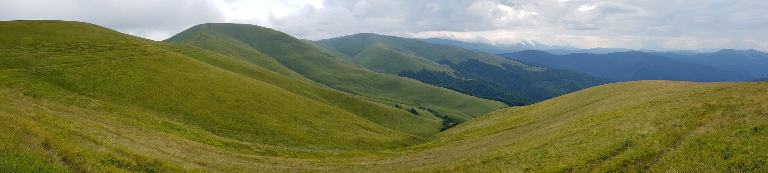
After crossing two small hills and valleys with typical Zakarpatie villages I finally approached poloniny – short-grass meadows in higher altitudes created by sheep grazing. To my surprise there were no shepherds with their herds there any more and I could clearly see the habitat is being slowly taken over by forest again as it has happened years ago in Slovakia and the Czech Republic.
Long march over puddles
I started with dawn on Tuesday 9th July as some rain was forecasted for the day. Behind a landmark peak Pikuj (1405) the ridge went steep down. Although there were no more shepherds, the poloniny were very busy with people picking up blueberries.
On descent I could see marketers who immediately paid blue-berry pickers for their harvest (I wondered how much). It was a long march on a marked trail towards Polonina Borzhava near Volovets.
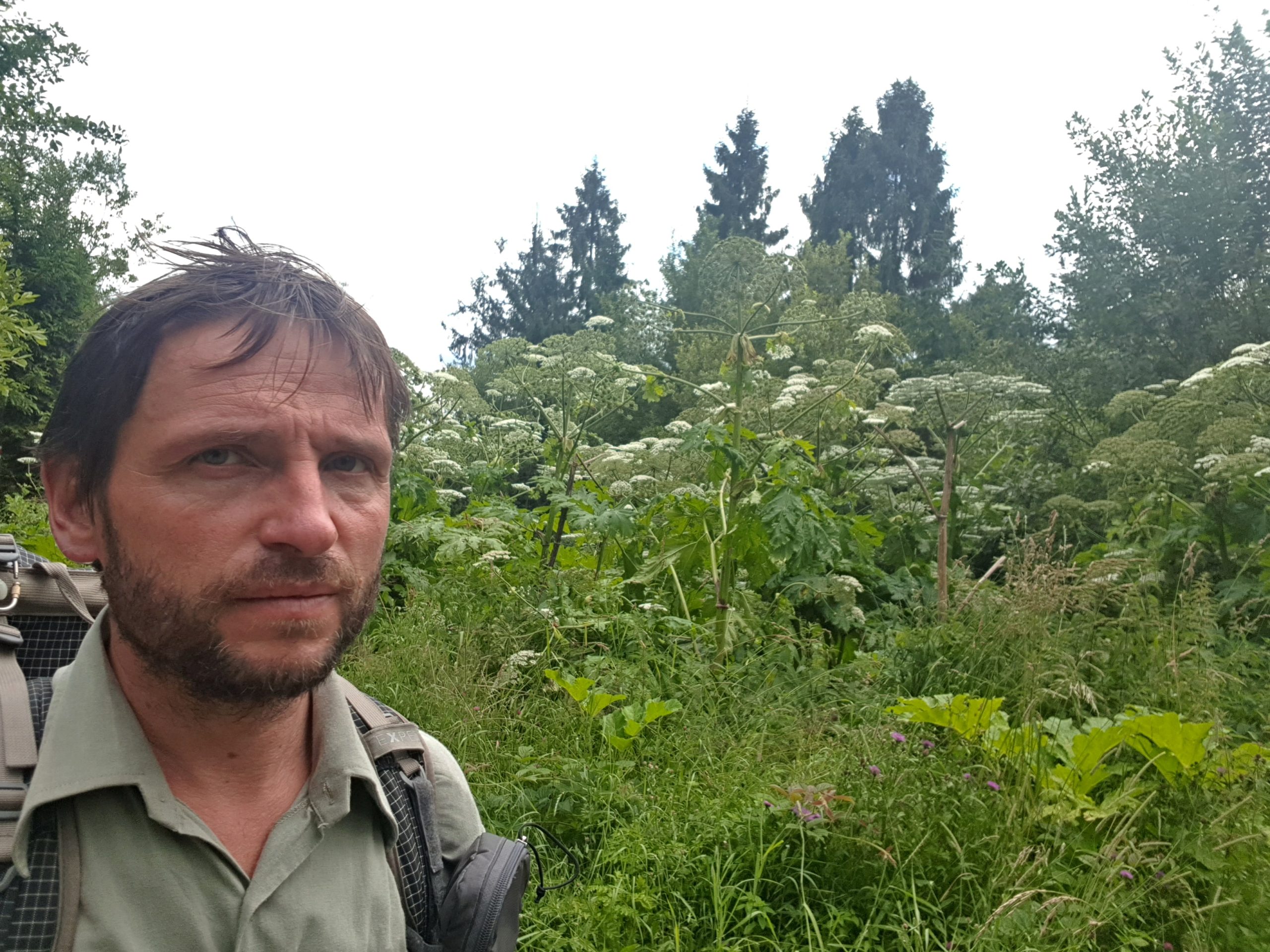
Another rain approached and I needed to walk slowly over many puddles as the soil had been already soaked by water. What really surprised me in this part of Ukraine was giant hogweed (Heracleum mantegazzianum) taking over local ecosystems. It does not seem locals are doing anything against it.
The trail went along the memorial built by Hungarian government to commemorate invasion of Hungarians to the Carpathian lowlands. Few weeks later in Romania I realized this was just one of many attempts of Hungarian government to make claims over what they consider territory of “Greater Hungary.”
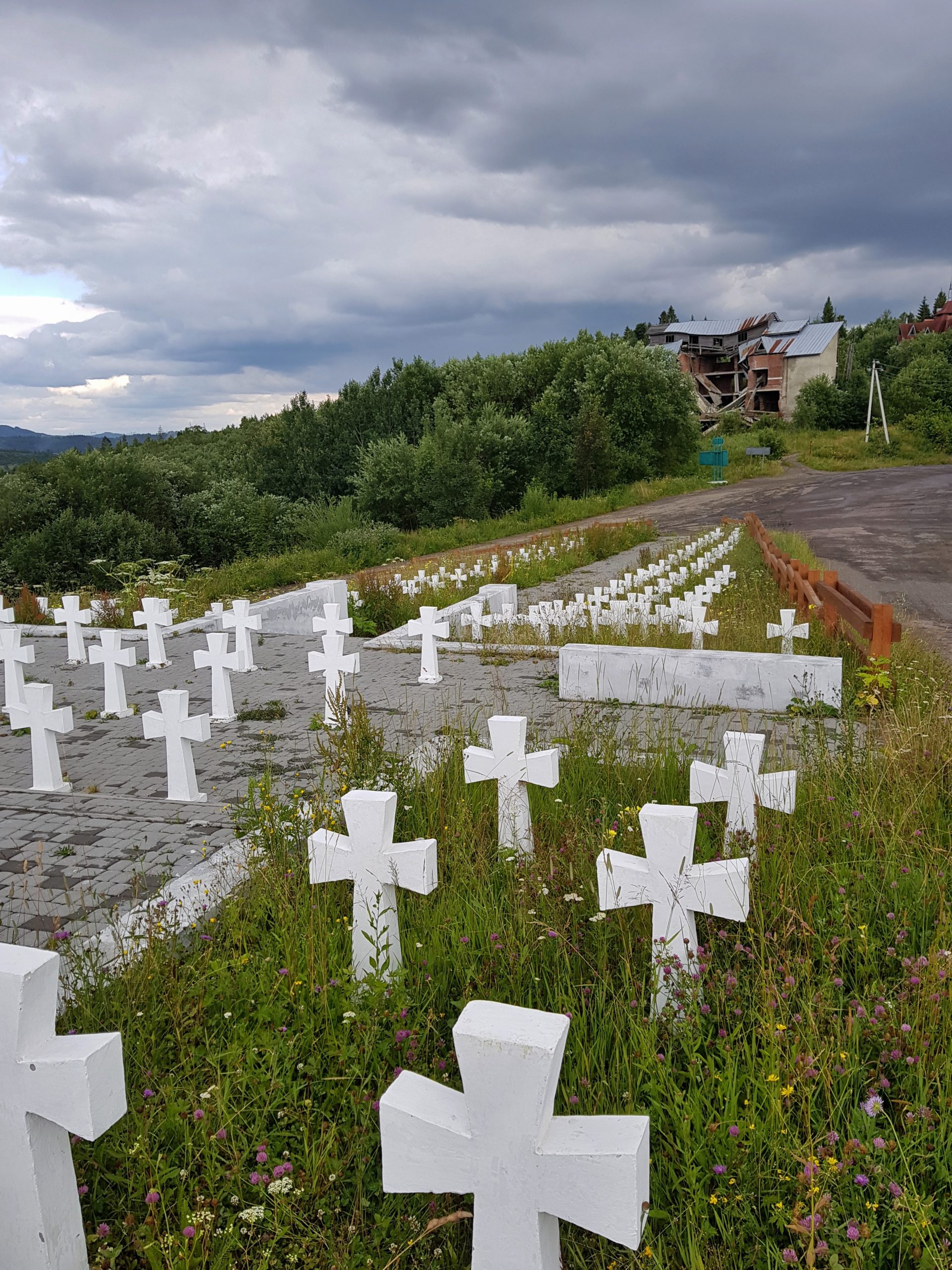
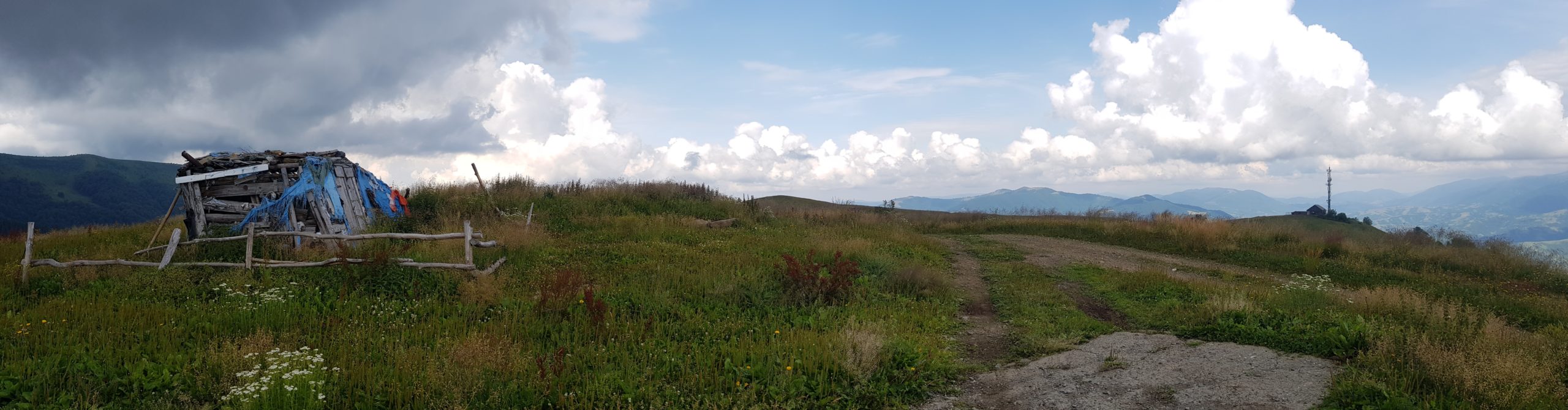
I continued through the Veretsky pass (841) with WW II memorial remembering 600 Ukrainian Sich fighters slaughtered here by Polish border guards to whom they were handed by Hungarians. Hungarian soldiers stormed into Zakarpatie (at that time part of Czechoslovakia) in March 1939 making my wife’s grandma family war refugees. Sich fighters and Czechoslovakian army resisted only for few days meanwhile Slovakia left the republic and Bohemia, Moravia and Silesia were seized by German army. Ruins of hotels witness someone thought this place has some potential for tourism many years ago.
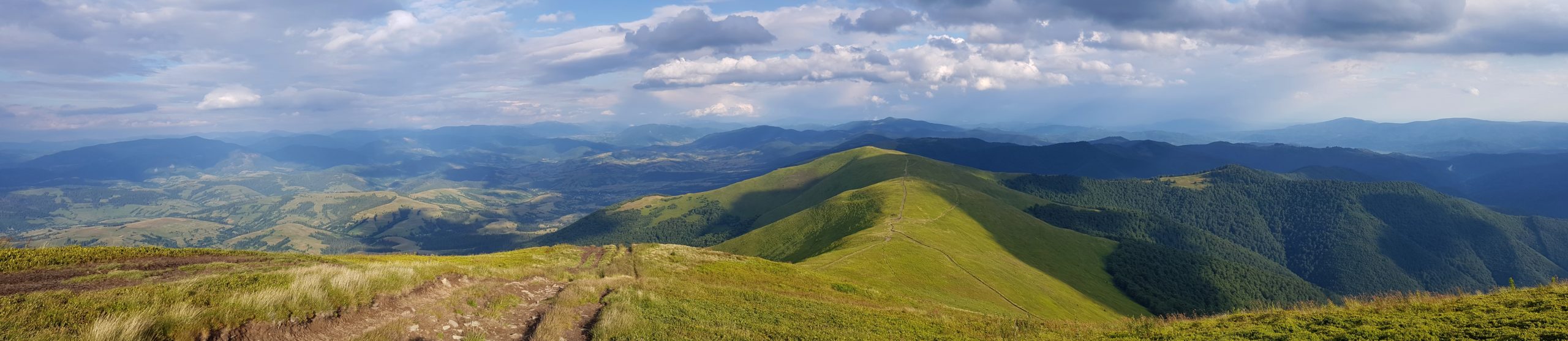
Polonina Borzhava
I tried to pack my tarp quickly on Wednesday 10th July to avoid the rain coming but it was quicker than me. It appeared my overnight camping was near to a gas pipeline station supporting Europe with gas from Russia. Descending to Volovets turned a bit adventurous as I wanted to avoid the main road in fog and drizzling and I was not successful in finding the right way through the private gardens. In Ukraine many shops are accompanied with bars, which is great when you want to eat the things you just bought and recharge the phone. This exactly happened to me in Volovets. That is why I ascended up on the polonina Borzhava later afternoon. As elsewhere in Ukraine, gangs of blueberry pickers were harvesting the slopes taking away the fruits and leaving behind garbage.
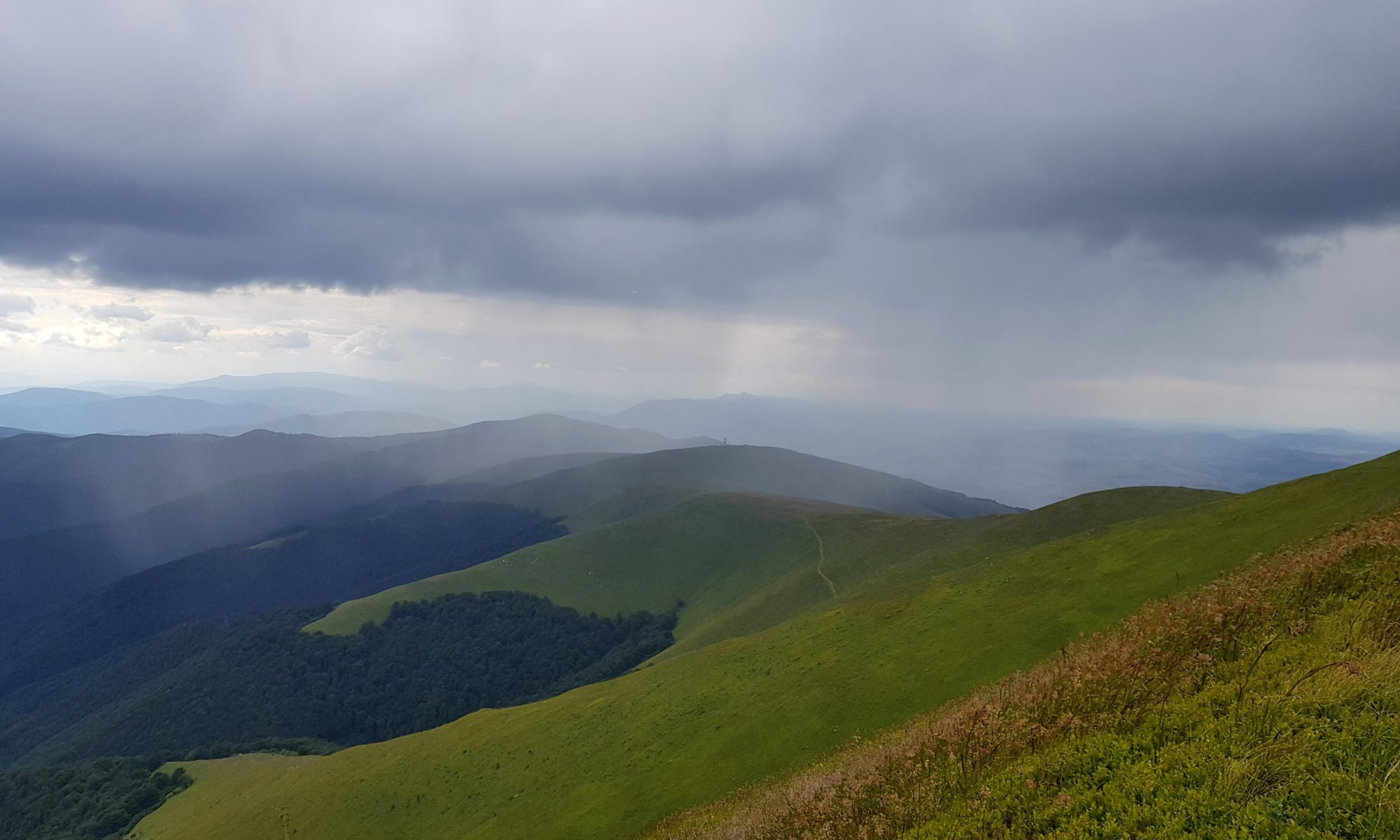
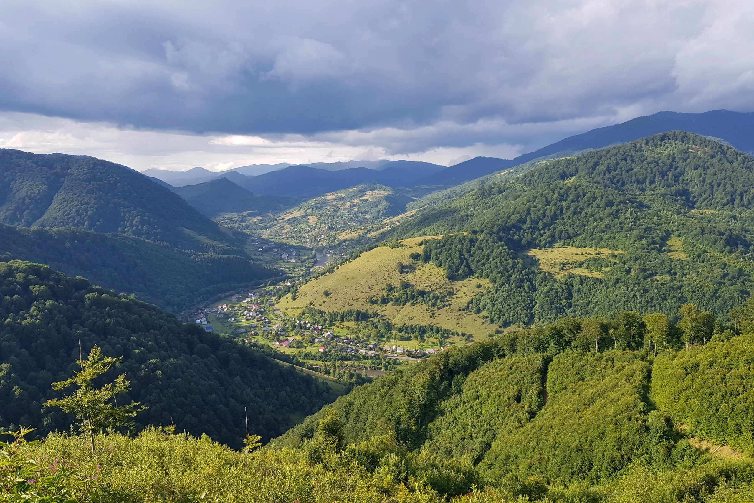
The good thing up in the mountains is one can see rain approaching and then it is only matter of experience to find a place with no wind and put on raingear. In my case it is a poncho and waterproof pants I can put over even without taking my shoes off. I walked till 9 pm to approach a designated camping spot below Kychera mountain (1257). The evening offered beautiful views as the sky was cleared by the rain and the Sun went below horizon late.
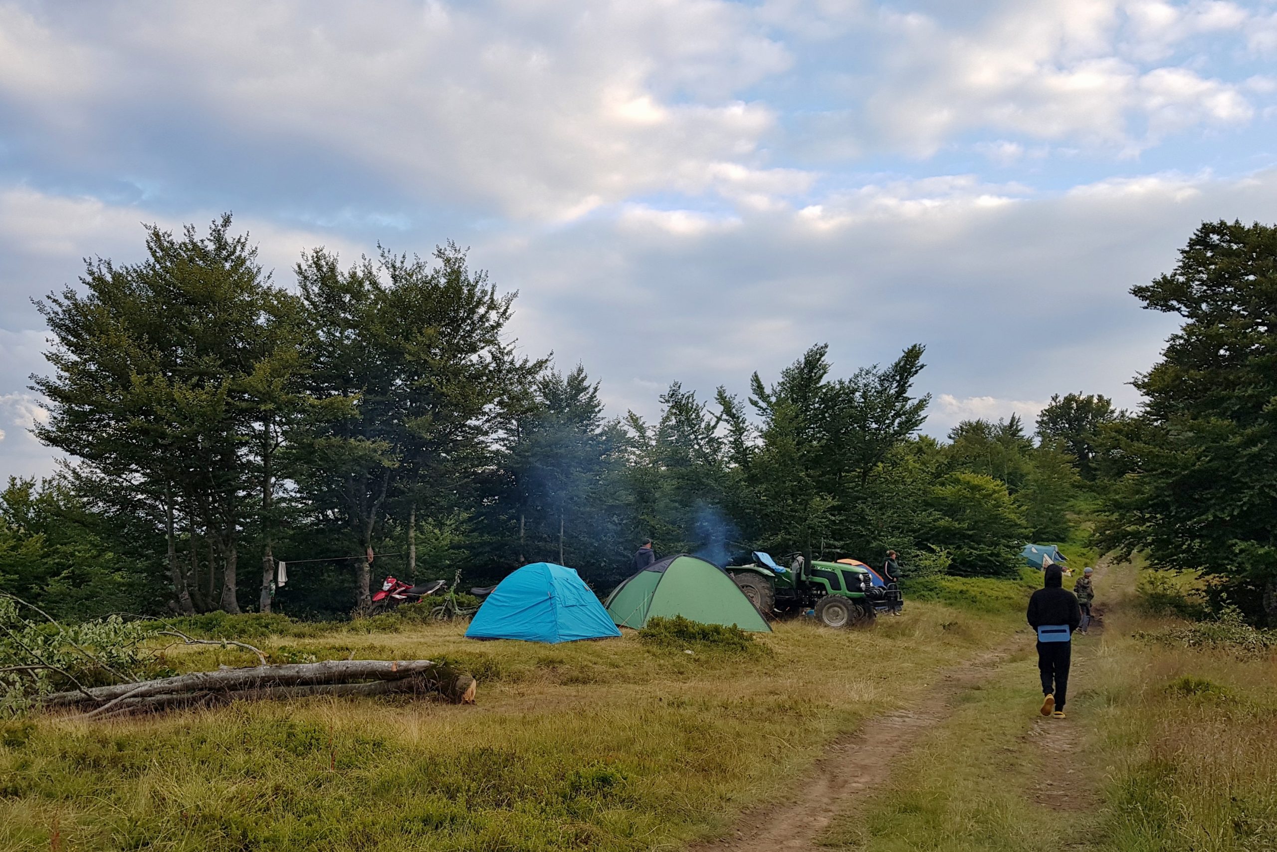
The spot appeared to be occupied by blue-berry pickers and a group of students from Prague (they were in their tents both in the evening and also in the morning when I was leaving) and a group of students from Dnepropetrovsk with their teachers. I was lucky to use two of their many campfires to make some warm food. We talked till late night about life in Ukraine and the Czech Republic. Apart from here I had met only two hikers camping below Pikuj and that has been so far all for the Ukraine.
Being twice the first one
I again started early on Thursday 11th July as rain was forecasted. Unfortunately I got lured by strawberries along the way and the thunderstorm got me right before the peak of Kuk (1361). You may know the feeling when you walk in the rain, high wind and can hear thunders while you are on the highest point around. I tried to get out from the place fast but lost the way in the fog and started descending different ridge. Fortunately, I realized this quite soon thanks to smartwatch out-of-the-track beeping. Anyway, the temperature was around zero, I could barely move my fingers because of cold, boots soaked with water.
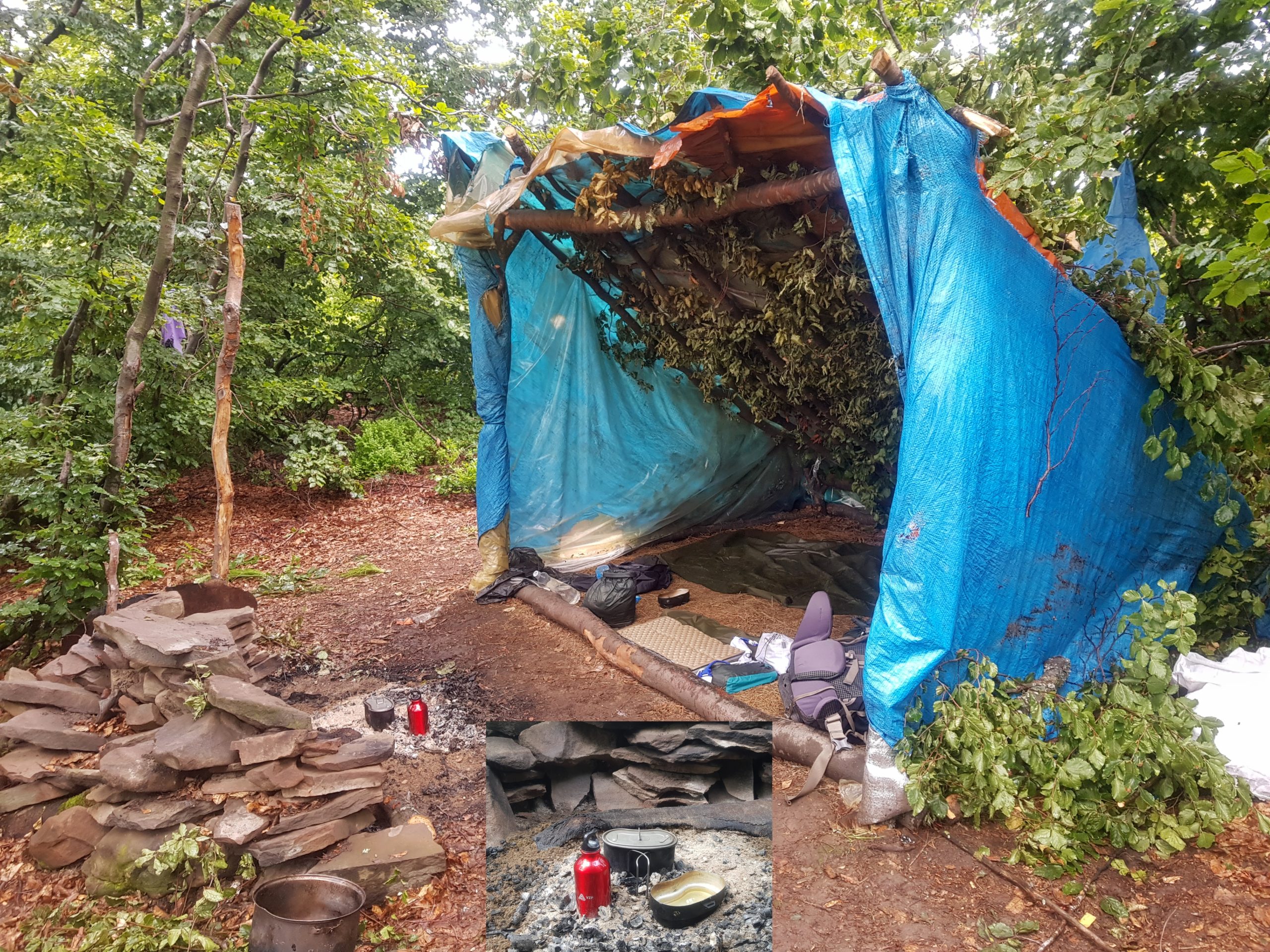
When the rain was over I felt fortunate to find a group of temporary shelters made by blueberry pickers and realized the ashes are still hot near to them. So I used the hot ash to cook something warm and change my wet clothes. As soon as I started walking again I met a group of people.
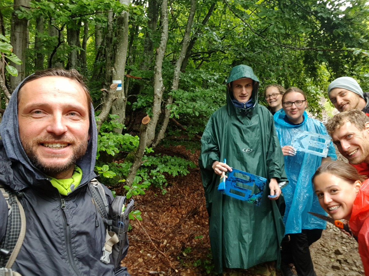
These were Czech volunteers making tourist marking in western Ukraine. So from this point my trail continued on a tourist footpath (blue mark). During our short talk (I was definitely more surprised than they were) they suggested me other way down the ridge than I planned.
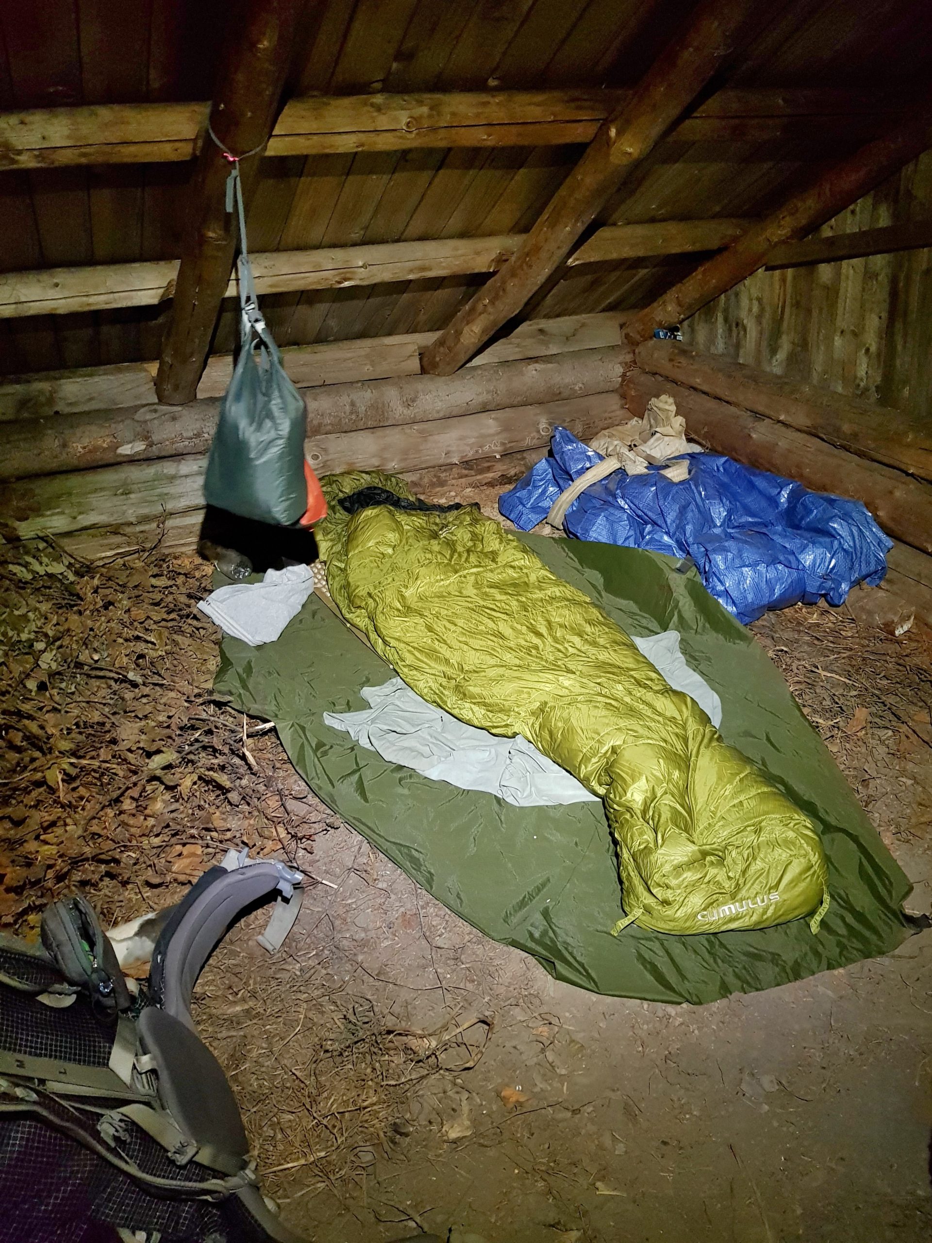
That is why I followed a newly painted green sign and while another rain started I met another group of Czech volunteers that were just painting this green line. This means on this historical day I was twice the first tourist on a newly painted trails! Since the evening was approaching, I was happy to accept their offer to stay overnight at their base in Vuchkove village. To get there took some time because the dirty road was full of puddles.
There were many people we got common friends with in the Brontosaurus movement volunteer camp. I needed to put-up my tent but could have a shower, access to warm water to wash my garments and internet to go through e-mails and finish last week’s blog. That is why I went to bed very late night.
Zakarpatie is changing slowly
Though I was the early bird in the camp, I set up for the hike around noon on Friday 12th July. It took time for the garments to dry, wax my boots and do other necessary things people on shorter hikes need not do.
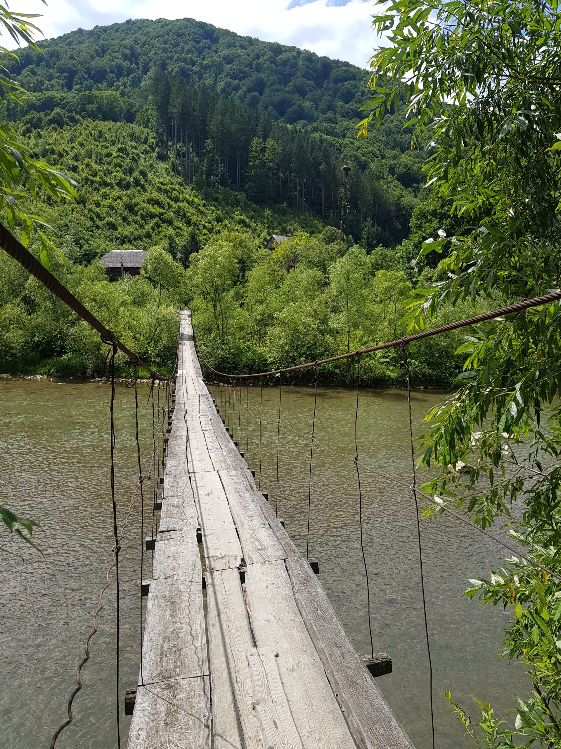
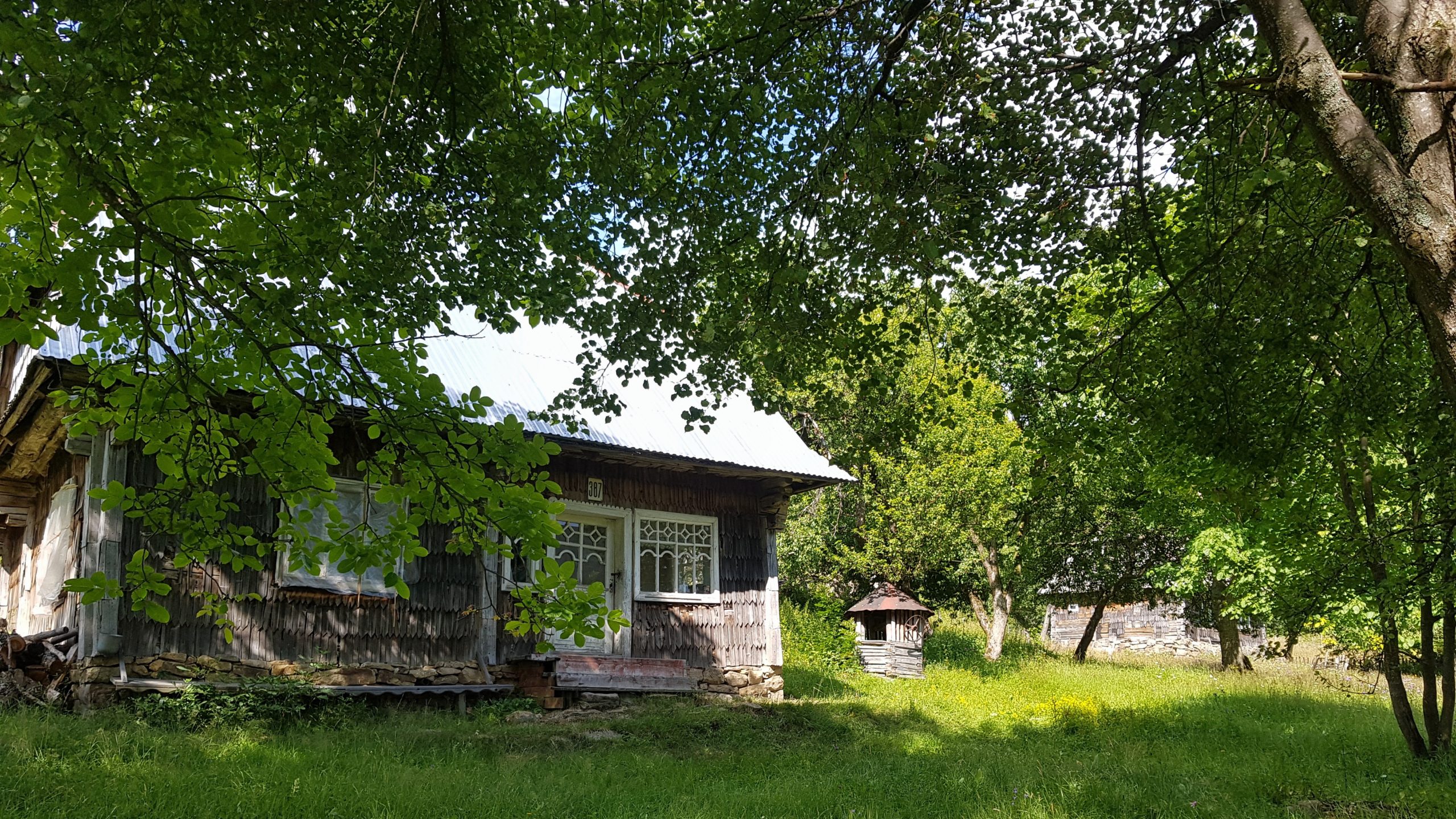
I followed the trail we took in 1993 with Veronika, crossing the Ricka (River) river by the same suspension bridge. I might have crossed the river further upstream in Mizhiria but this would mean either walking to Negorovets peak (1709) or on the gravel road in the valley. So I rather preferred to walk polonina Borzhava as far as possible and not descending before Kuk. On the way to Negorovets I lost the marked trail but did not regret because I found an abandoned village of Kosovo Verkh (750), which was magic.
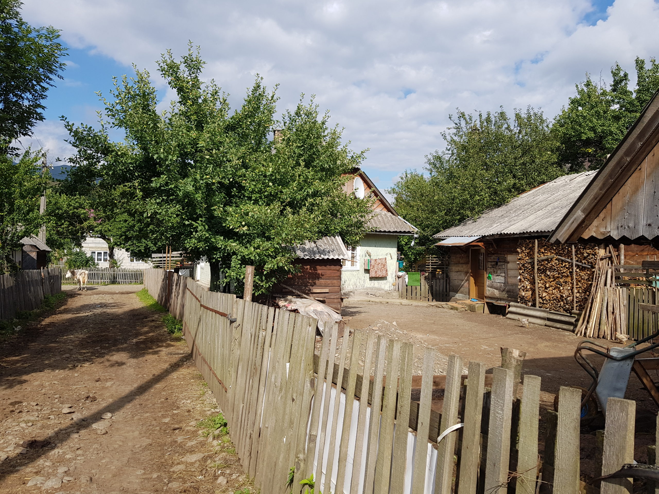
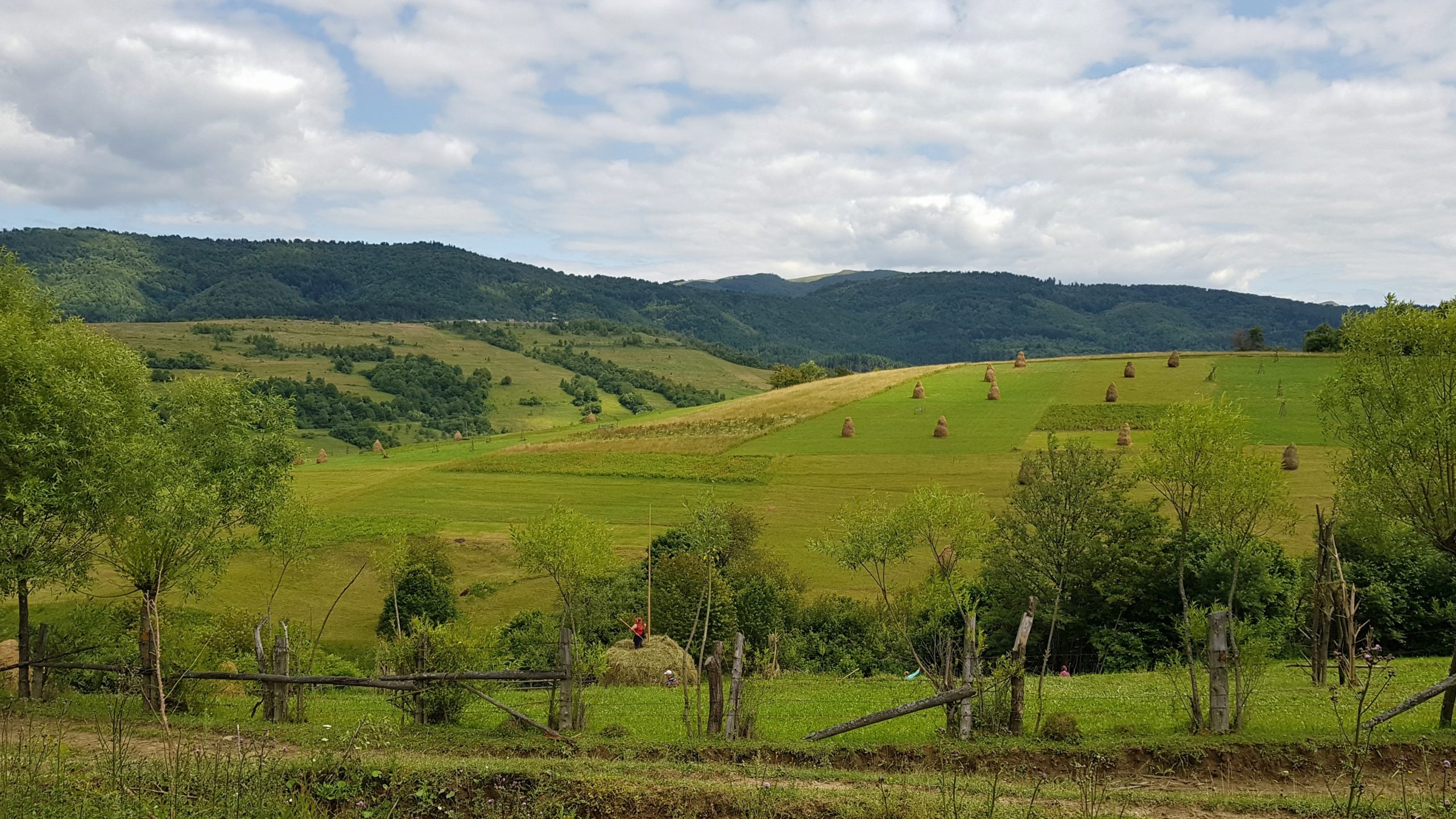
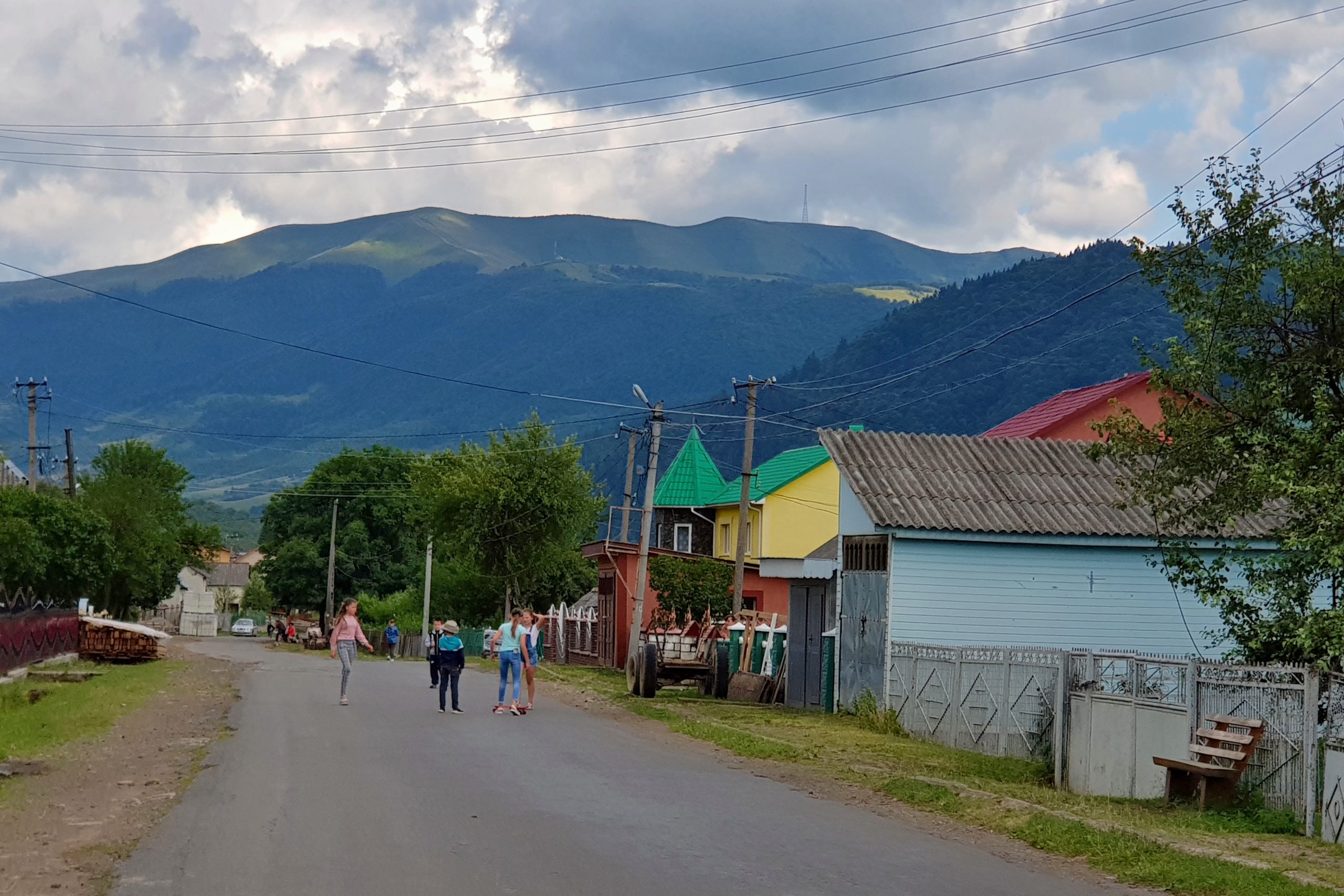
In Negorovets I was surprised how little had changed since 1993. Churches and crosses were repaired but the roads look the same. What you immediately notice while coming to Ukraine is that the life happens on the street. People are meeting, children are out playing. That is huge difference to my country or other western countries (actually expression for “outdoors” in both Russian and Ukrainian literally means “on the street”).
I went for dinner to “Četnická stanice” – a restaurant in Kolochava focused on Czech clients. The village is famous as Ivan Olbracht placed there his novel from a period when this part of Ukraine belonged to Czechoslovakia. I then hiked to the dark as I wanted to reach an old koliba (shepherds’ house) when we stayed overnight in 1993 and survived a horrible thunderstorm, but I did not succeed.
Loss
In the morning I realized that both shepherdd’s houses I can remember from 1993, when they provided us shelter during an after a horrible thunderstorm, are gone today.
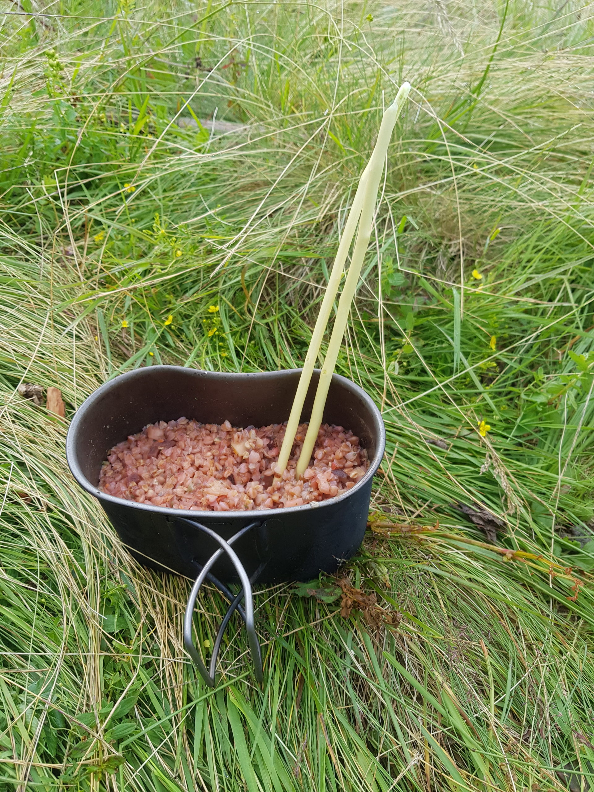
When I wanted to cook my breakfast on Saturday 13th July I realized I was missing my spoon. I must had left it at the camp of the Czech volunteers. So I made wooden chopsticks and started calling my friends in the Czech Republic in order to get contacts to the camp organizers. I tried to call them, text them and contact them on Facebook but with no apparent success. Spoon does not mean much in normal life but if your possession counts dozens of things, it is a considerable lost, especially when the spoon is a titanium one and is adjusted as a mess-kit handle.
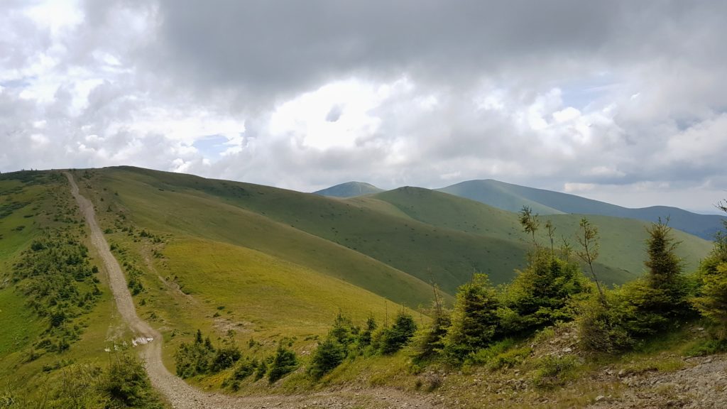
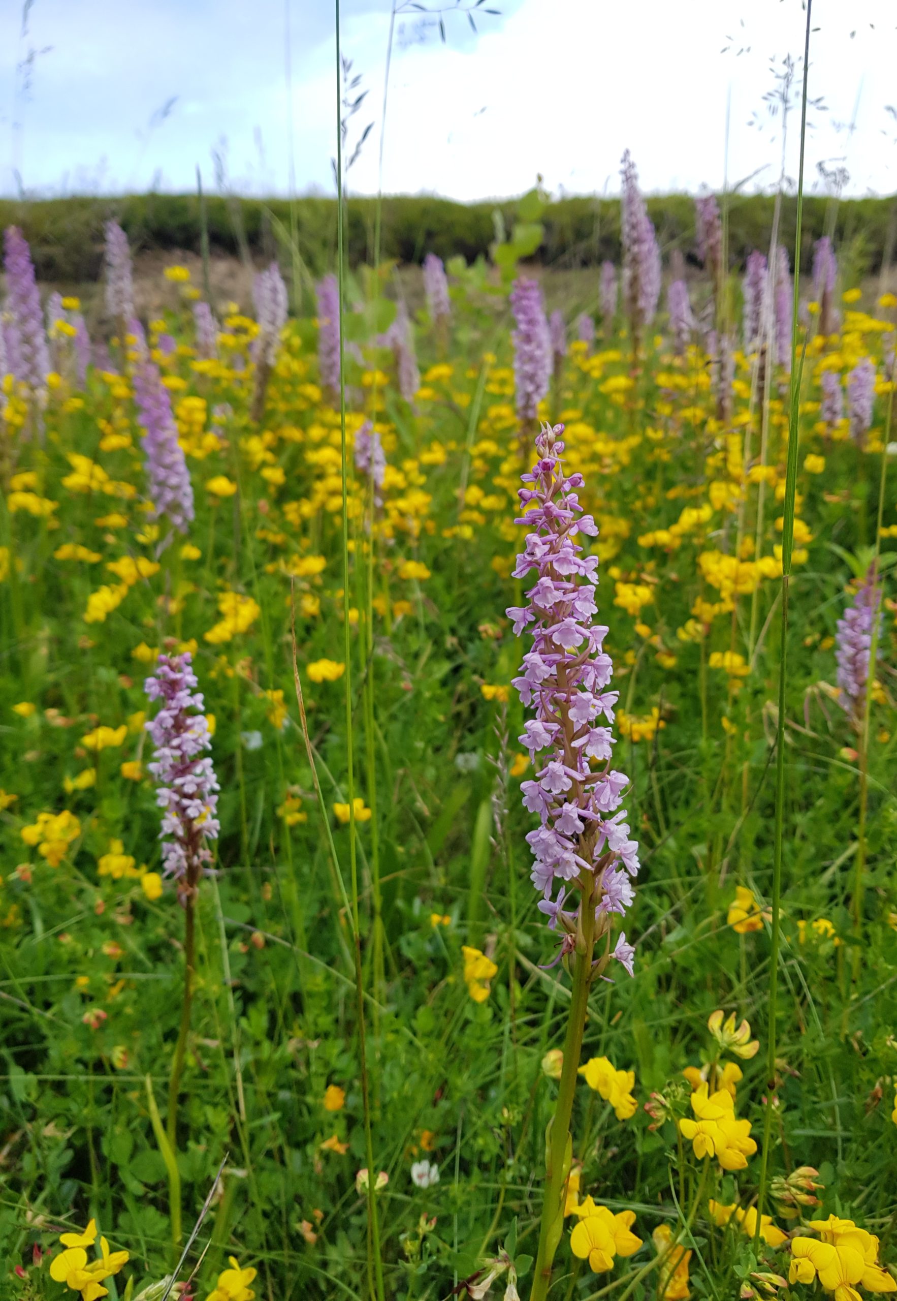
Polonina Krasna is slowly healing from the gas pipeline construction we could see happening here in 1993. Muddy road runs right on the ridge and at one point I could see pipes left over in the mountains. At some places the disturbance made new habitats for rare species like the short-spurred fragrant orchid Gymnadenia odoratissima (left).
I met only one hiker on Polonina Krasna – Tomasz Wilkonski.
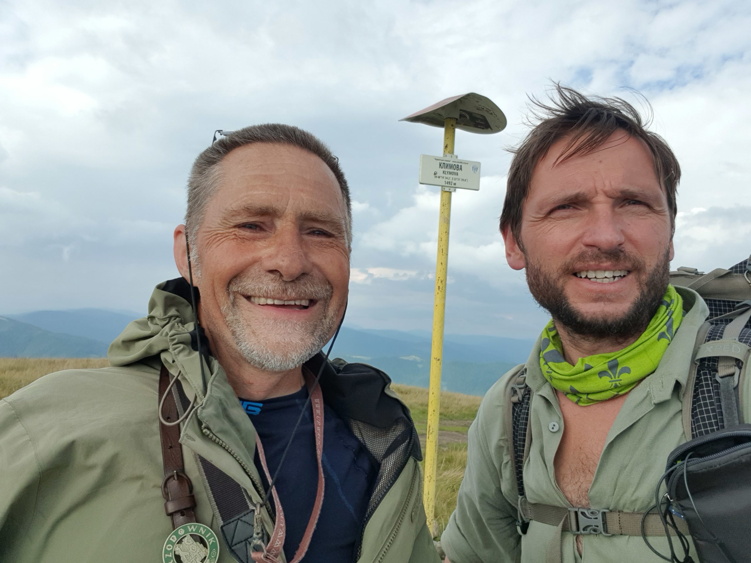
A retired Polish IT specialist, who had been systematically visiting all the ranges and hills in the Zakarpatie region of Ukraine. We felt we are on the same tune so we both regretted we are going opposing directions.
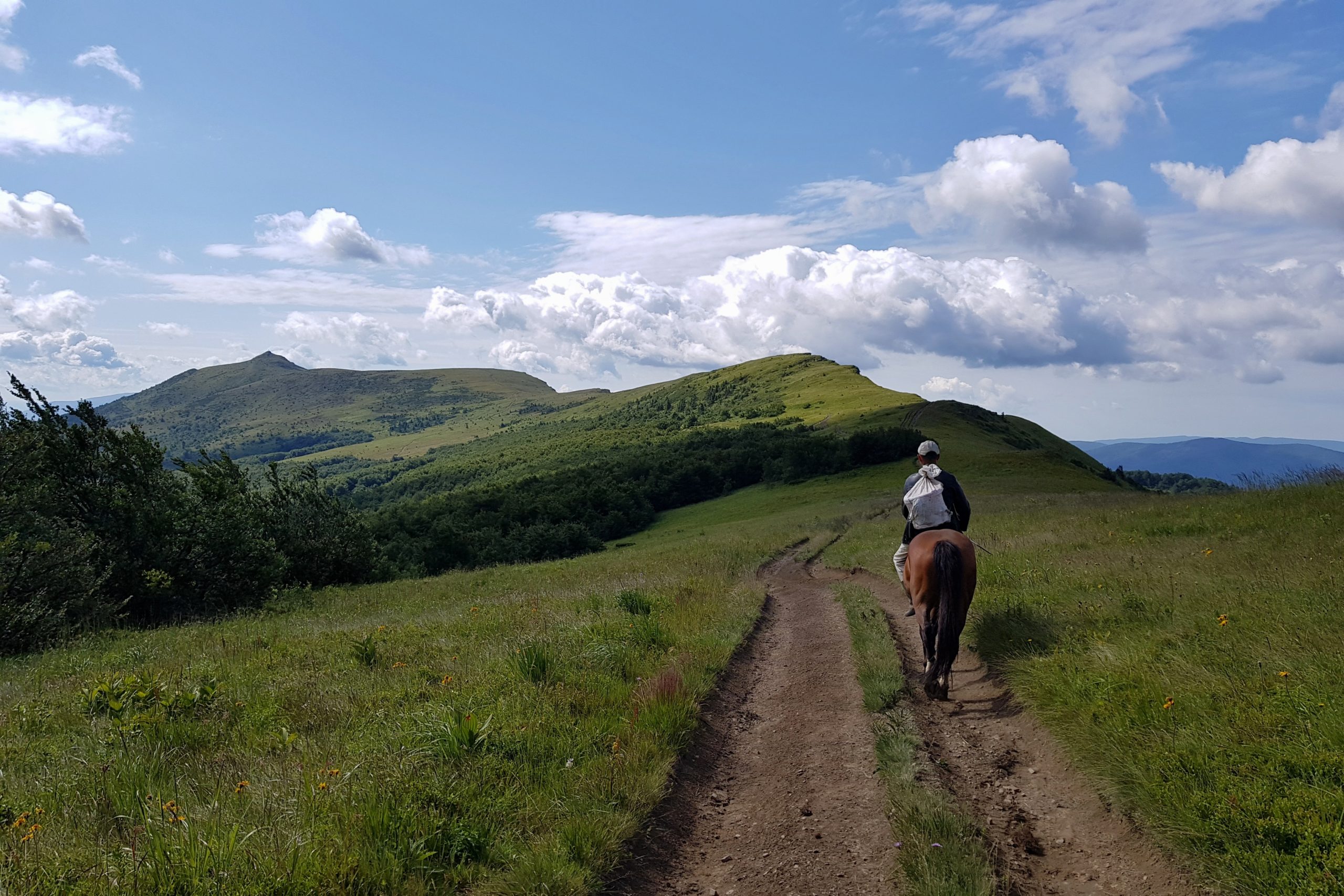
We met at the moment when a group of tourists passed by in AWD vehicles. This is unfortunately the way many Ukrainians enjoy the mountains. And not only them.
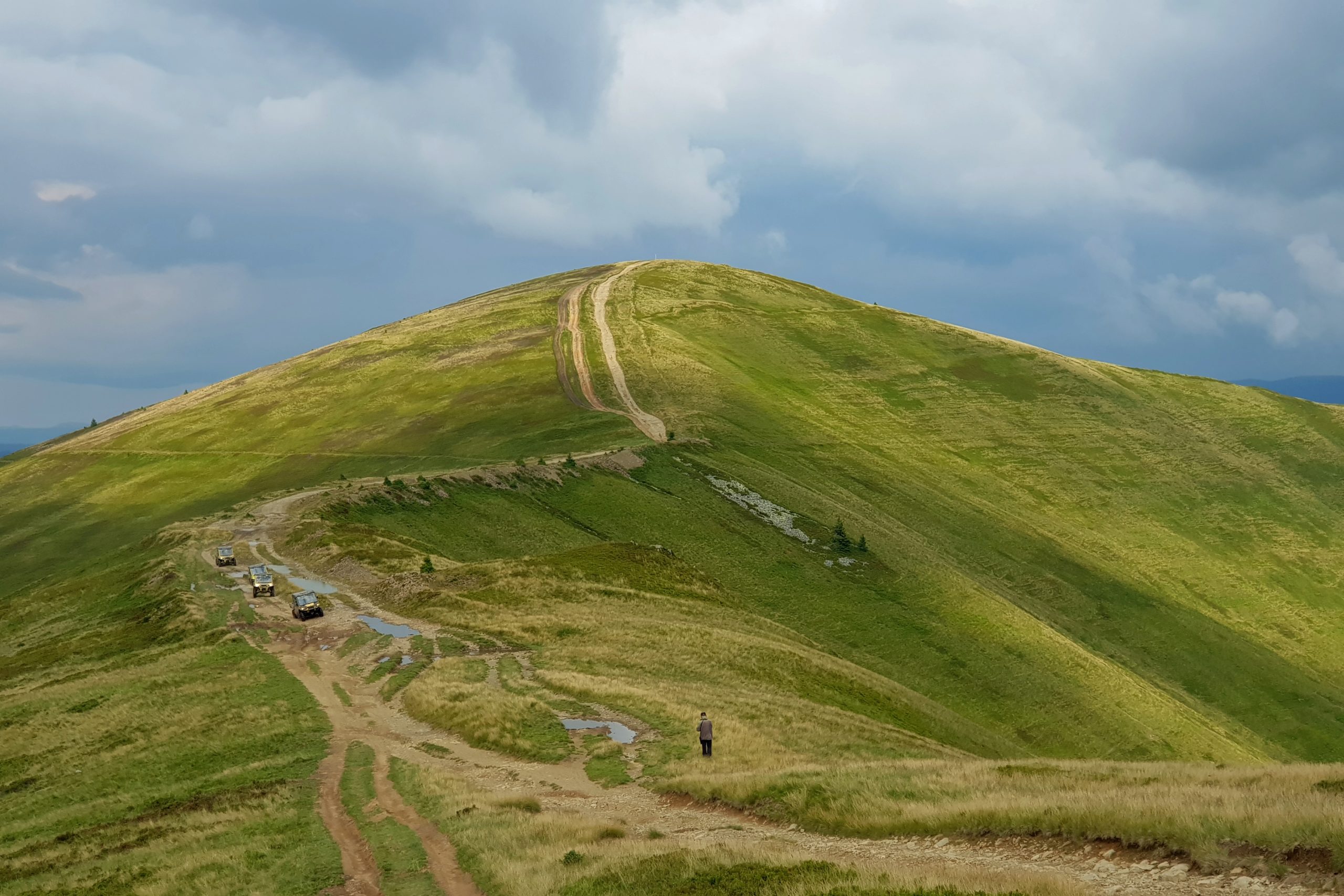
Carpathians in Romania and Ukraine are well known among off-road driving enthusiasts that come here from abroad to enjoy their hobby that is in this form illegal in their own countries. It is illegal here as well but the law enforcement is poor. Just the night before a gang of off-road motorbikers passed twelve meters from my tarp at about midnight.
The descent from Polonina Krasna towards Ust Czorna was steep and thus difficult because the soil was soaked with water due to the rains (of course I went through showers on this day too). The road near the village with former German settlement had not changed over the last 25 years.
Right near the tourist trail there was a new restaurant. As a single guest I ordered pizza and the young owner who just opened the restaurant along with shop was very happy to serve. She even donated me a stainless spoon. It was already dark when I started hiking but I knew the weather forecast and wanted to pass polonina Svidovec before rains come on Sunday. Short before midnight I reached a shelter. Two tents stood nearby but the simple shelter was empty. So I went to bed knowing the rest would take only few hours.
Illness
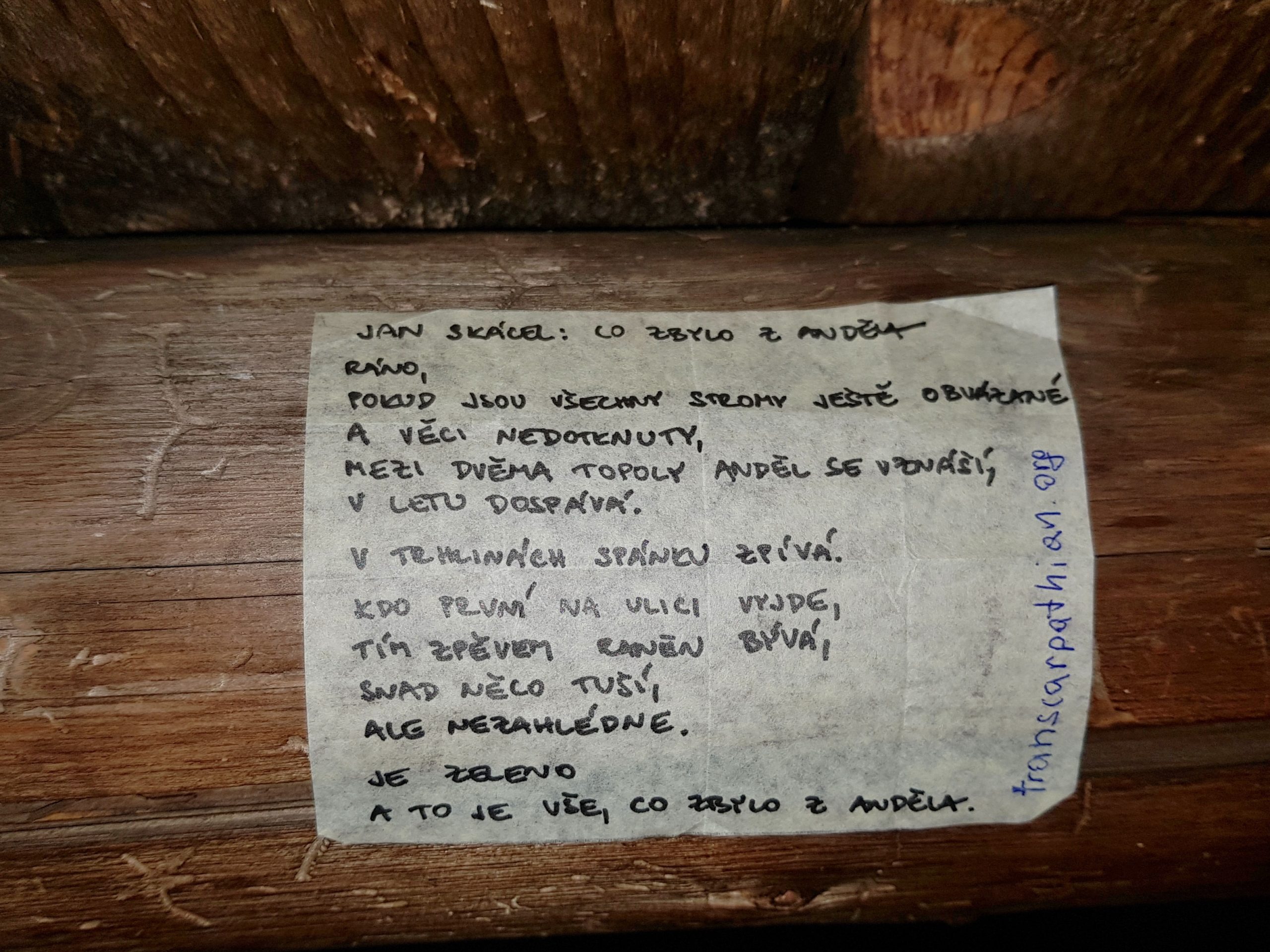
I started at about 5 am on Sunday 14th July so I was not able to meet with the hikers sleeping in the tents nearby. But I left one of Jan Skácel’s poems Pája gave me for the hike in the shelter for them to read (the equipment indicated Czechs or Slovaks).
When I reached the Tempa peak (1634) I realized it is my highest point on the territory of Ukraine. The clouds were still far away but after few kilometers the thunderstorms caught me.
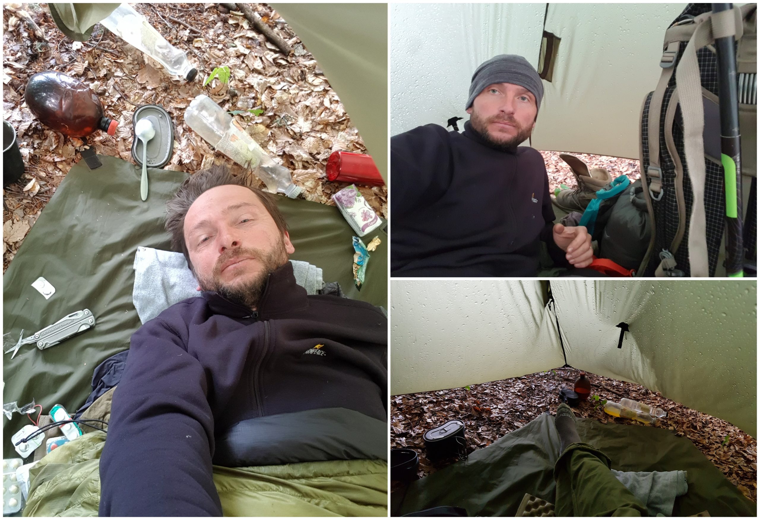
I found a place of a former loggers’ camp and got ready for the thunderstorms. I even finished cooking the lunch just when the first drops started drumming on my tarp. The plan was to eat and sleep a bit but things went wrong. I could not finish the meal and started feeling dizzy. Few minutes later I was in my sleeping bag unable to move my stomach shaking. I soon realized this is similar to an illness that cut our hiking trip with Eco-club Kvíčala 20 years ago. Back than it was a Campylobacteria in a cream sauce we ordered in a restaurant. Wait – they offered me a cream sauce along with the pizza yesterday. And they gave me large portion of it despite I asked for a small one. I spent the rest of the day sweating in fever, vomiting and having diarrhea. Every small movement took me large amounts of energy. Fortunately there was a GSM coverage and my wife Veronica was my GP on a phone helping me with medication. I have got no idea, how can I continue the hike as I could barely turn around in my sleeping bag.
Hi,
I am so impressed with your trek and so grateful for the info on your site.
How did you manage to cross borders, especially the Ukraine border, it being an non-eu border?
Ben, UK
Hi Ben,
the borders of non-Schengen countries need to be crossed only through the official border crossing points.
EU countries have visa-free regime with Ukraine => you just walk through the customs with your passport.
You can freely walk through the CZ-SK and PL-SK border at any point as these are Schengen treaty countries (Romania not).
There are only few border crossings to UA. While hiking Carpathians W=>E, from Slovakia it is Ubla – Velikij Bereznyj, from Romania Sighetul Marmatiei – Solotvino.
Some hikers walk to the border point, then take taxi / public transport to the same point on the other side of the border. I planned my hike integrating the border crossing points.
Contact me if you need any further help.
Michal
thansk so much for getting back to me. we have been investigating the route with the help of google earth and was surprised to find the junction of the Slovak,Polish.Ukraine border does not seem to be anything more than a fence post. We are from the UK and being an island the whole idea of land borders is somewhat alien. we were just discussing the idea that anyone could get lost trekking along the border and inadvertently stroll into Ukraine, are there border patrols or fences of any kind or in theory can you just walk straight in?
There is no border fence, but the border is marked in the landscape and there is clearcut around. Tourists MUST STICK TO THE DESIGNATED TOURIST PATHS, that are marked. All the other routes are forbidden, though you may see them in Google Earth.
The border is super protected. This summer we got an accident with an ankle and needed to stay overnight 0,5 km from the border in the valley on PL side, the police came in 45 minutes, though we were not making noise or light. We met hikers with similar experience. I suppose they use some satellite infrared scanning.
Since there is no border crossing further east from the 3 borders point, I suppose you turn south there and cross through the customs.
Good luck with your journey.
Michal