Sheer beauty of the Carpathians
I wanted to get as close as possible to Baile Herculane on Monday 19th August as the weather was beautiful, trail well-marked and known to me from the previous hikes. The views to Godeanu, Țarcu and Retezat mountains were so beautiful on this sunny day I must have told myself I should not stop so often to make photos. It was nice to walk again these mountains and remember places of watching the 1999 eclipse with my wife Veronika, camping with the eco-club on our 2009 trip and the first miles across Romanian mountains during our 1995 hike with Veronika and my university friends.
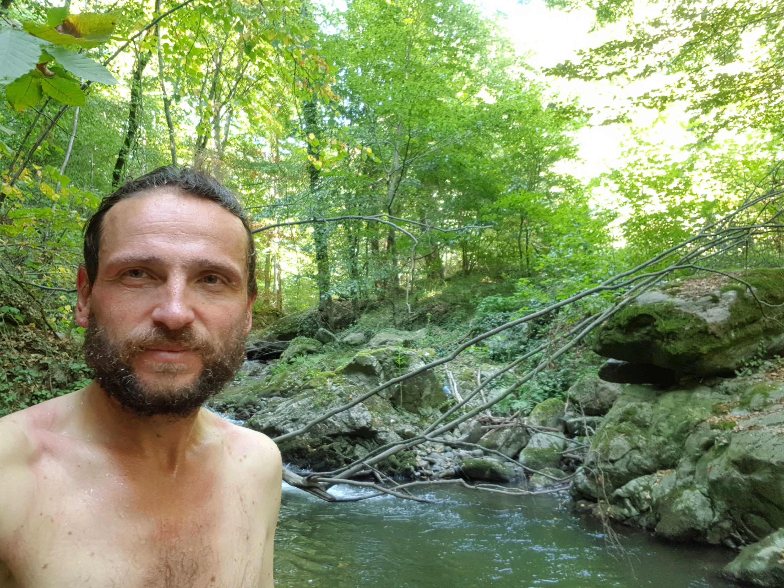
I stopped near Lake Scărișoara for a lunch and laundering of my trousers and socks. Though it was sunny (and this enabled me to keep all the gadgets fully charged), it was quite cold, so I could not laundry too many garments at once, if I wanted to use my body heat to dry them.

The Godeanu was grazed more extensively than it had been before, this means the shepherds, who stay with their herds, take over areas of those who left. Miraculously I escaped couple of encounters with wild dogs on this day.
At about 3 pm I came to a bottleneck below the peak of Godeanu (2229) – I needed to wait for sheep to pass a footpath on a steep slope in front of me. This led to an encounter with 3 generations of shepherds. The youngest one was impressed by my journey, his father with my Romanian and his grandfather made the sign of the cross, pulled a bottle of homemade spirit out of his pocket and offered me when I told him how many kilometers I had been walking to get to this place. I could see that this is a good door and hearts opener as my kilometer count makes me standing out of the crowds of tourists that locals meet in the mountains.

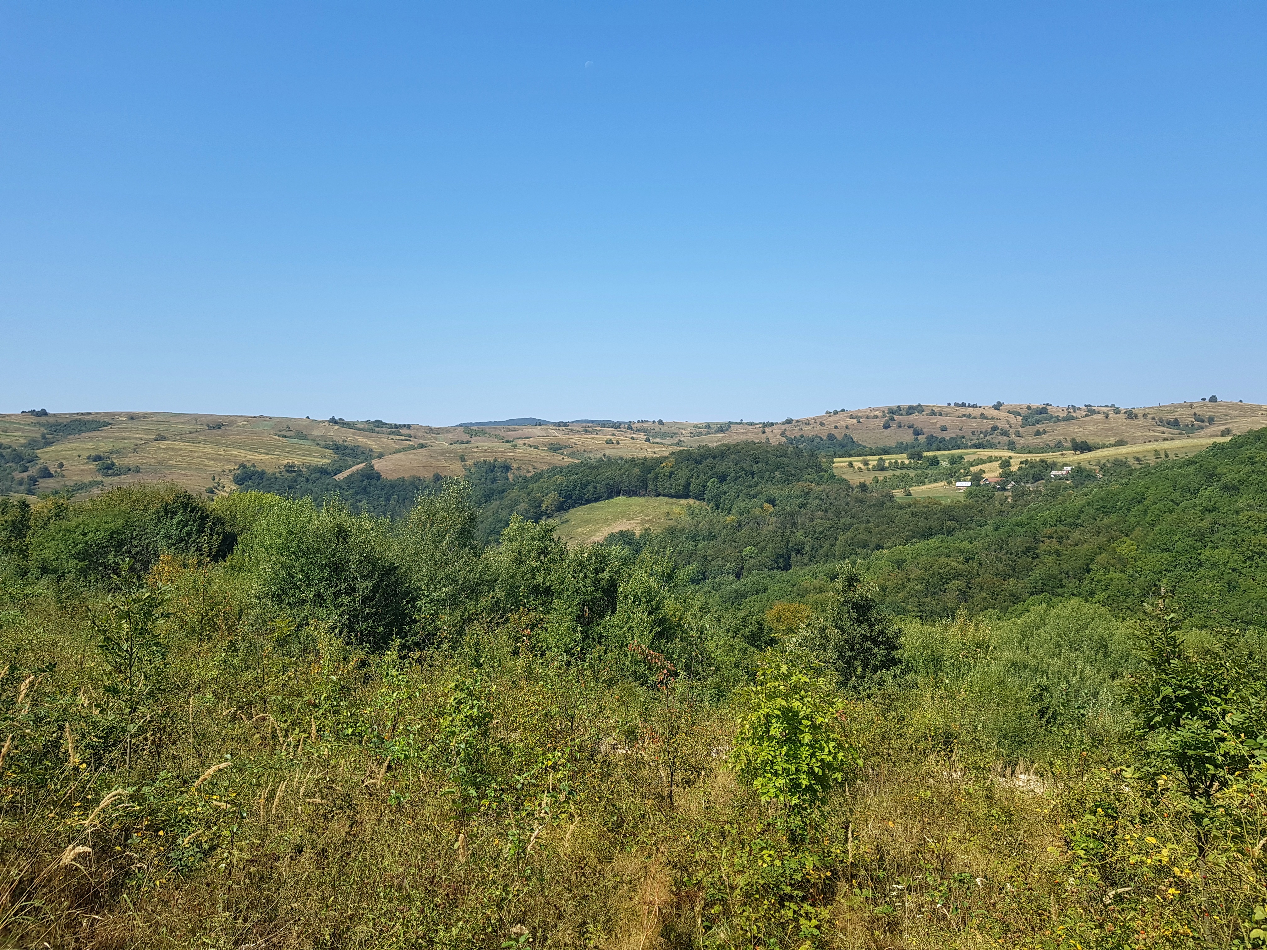
The landscape west of Godeanu looks surreal with large river of Șes running through the grassy mountains. I was enjoying the walk very much with light backpack, knowing I have enough time to make it to the Danube and that these are the last mountains above 2000 meters altitude on my journey.

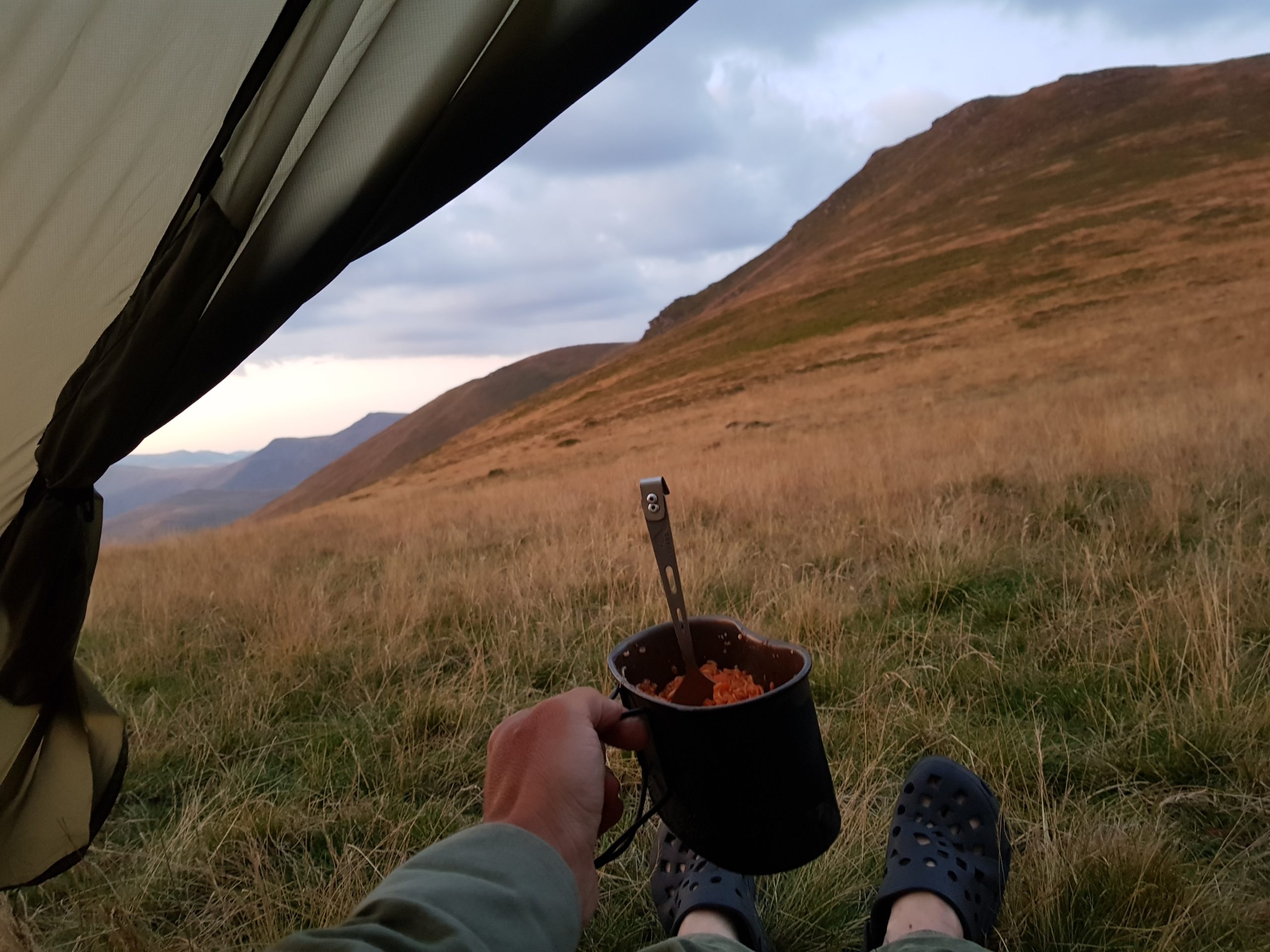
Unlike yesterday, I did not meet a single tourist this day. The shepherds told me that only Czech hikers are visiting the Godeanu range. While camping in the pass under Dobrii peak (1928) I managed to get online and read a message from a Pole Michal saying he had been in the Cernei mountains I just came to. Unfortunately, the message had been sent in the morning but it excited me that I am just one-day walk away from another guy who is making the trans-Carpathian hike (actually we were the only two thru-hikers of 2019). Michal started from Bratislava in April and I first came across him in Rodnei mountains refuge logbook where he was staying on 15th June while I came there on 21st July. His journey was much more extensive than mine covering about 2600 km.
Descent
After a calm night at comfortable altitude I continued to the west through the Cernei mountains on Tuesday 20th August. As many times before, I had mentally prepared for a descent so it was difficult to climb up the peaks again. Since these mountains are not so popular with tourists, the trail is not so good and a hiker walks mostly through grass or narrow sheep trails. I went through two shepherd’s dogs’ attacks but I could see I approached them more lightheartedly knowing I still had two pepper spray cans I could use.
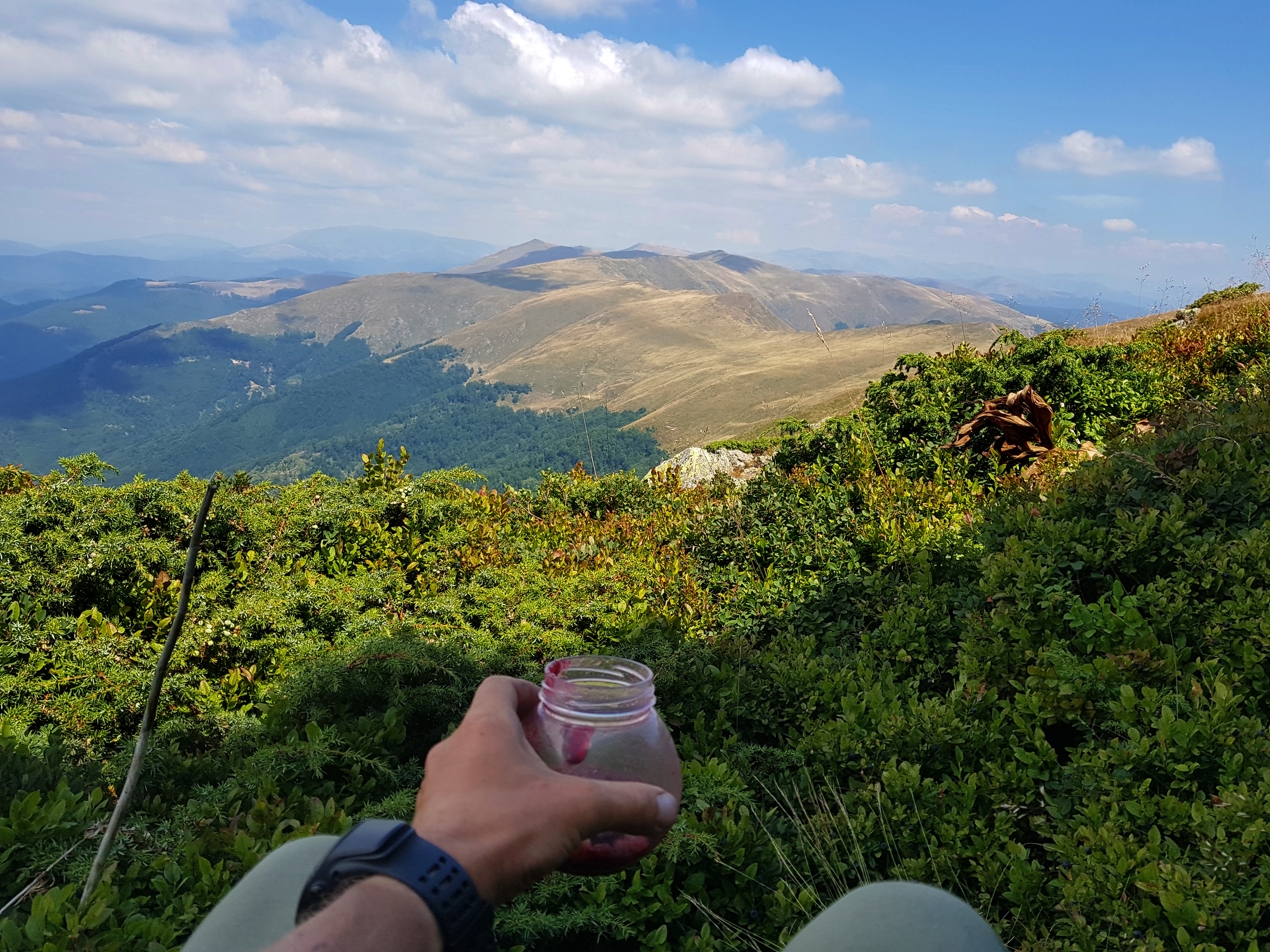
Some spots were untouched by blueberry pickers so I needed to pay attention while having lunch (as usual: full nutrition powder with blueberries) not to make my cloths dirty.
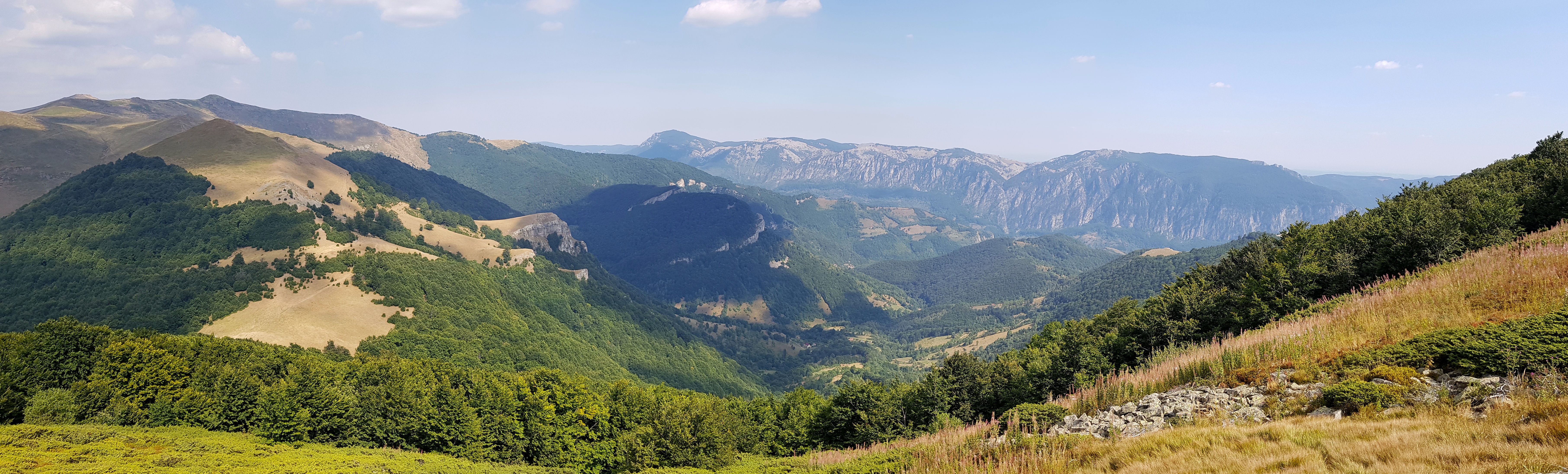
Beautiful views on the northern cliff of Munții Mehedinți opened close to the Prislop pass. There I could feel the closeness of Baile Herculane tourist centre meeting three one-day tourists and two motorcyclists. Instead of descending from the pass I wanted to see peaks of Arjana (1513) and Biliana (1362) as I could remember the torturous ascent on them in 2009. Slopes of Biliana were covered by cranberries, which slowed down my movement and filled my stomach.
Climbing down the difficult razor narrow rocky ridge I wondered if this is the best way, how to say good-bye to the Carpathians after two and half months of hiking.
My original plan was to continue through the Fertianu (1129) peak from the Poiana Lunga settlement but there seemed to be no footpath through abandoned pastures to the peak so I rather followed a dusty road and came on the trail coming from the Prislop pass unnecessarily walking up and down. I almost missed the footpath to the valley near a beautiful village church. Brown grass and dusty roads made apparent that this part of Romania had been missing rain for weeks.
I was a bit nervous where to stay overnight in the Cerna river valley but there was a nice camping spot right near the trail when I reached the river. Some celebration could be heard from a hotel on the other bank of the river and the temperature at 250m altitude was well above what was my down-filled sleeping bag constructed for so it was a bit difficult to fall asleep.
Dream fulfilled
I woke up when the stars were still shining in the dark on Wednesday 21st August. Ate and packed swiftly as I was not sure if camping is allowed in this place, though fireplaces and other tents 50 meters from me suggested people use this spot. It was about eight kilometers on asphalt road to the Şapte Izvoare thermals so I was happy a car leaving the nearby camp offered me a lift.
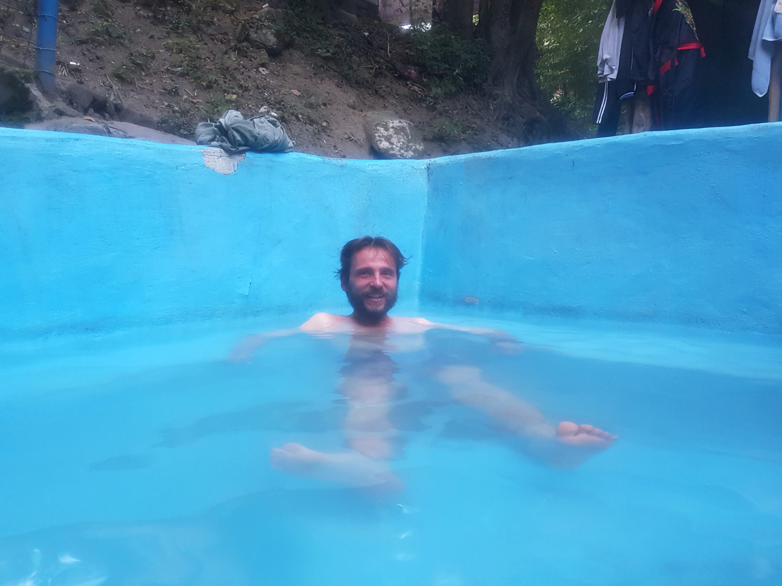
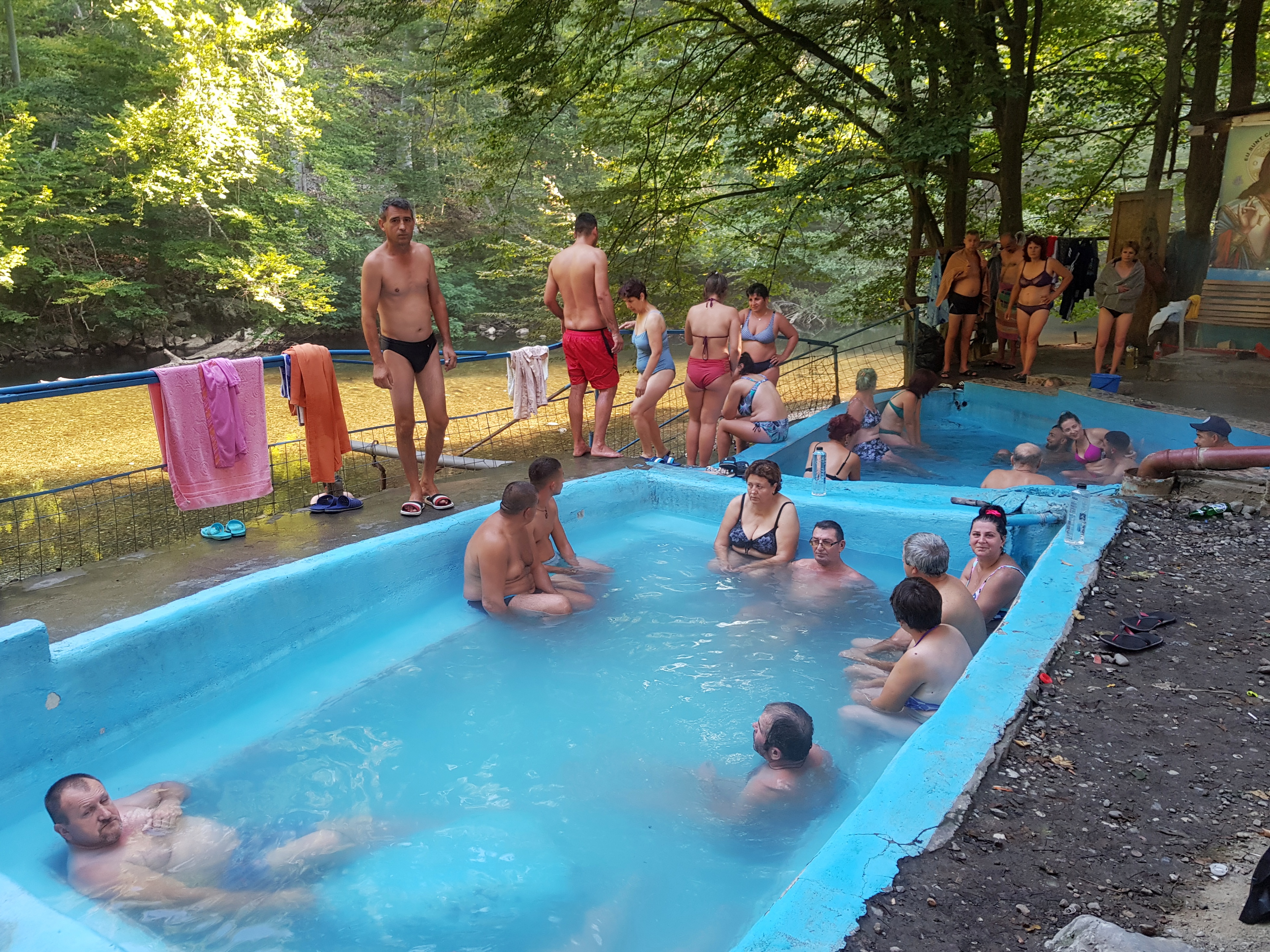
Thus it was just 7:30 am when came the long awaited moment – I was bathing in the 52° C hot water in the Baile Herculane thermal springs. The pools were not overcrowded at this hour and I needed to explain fellow bathers why I want one of them to take a photo of me. They cheered me and I was about to cry when remembering how many times I had been dreaming about this moment while walking in the rain, shivering in the cold, trying to find way through forests or scare bears. In my mind, for months this bath was the finishing tape of my journey.
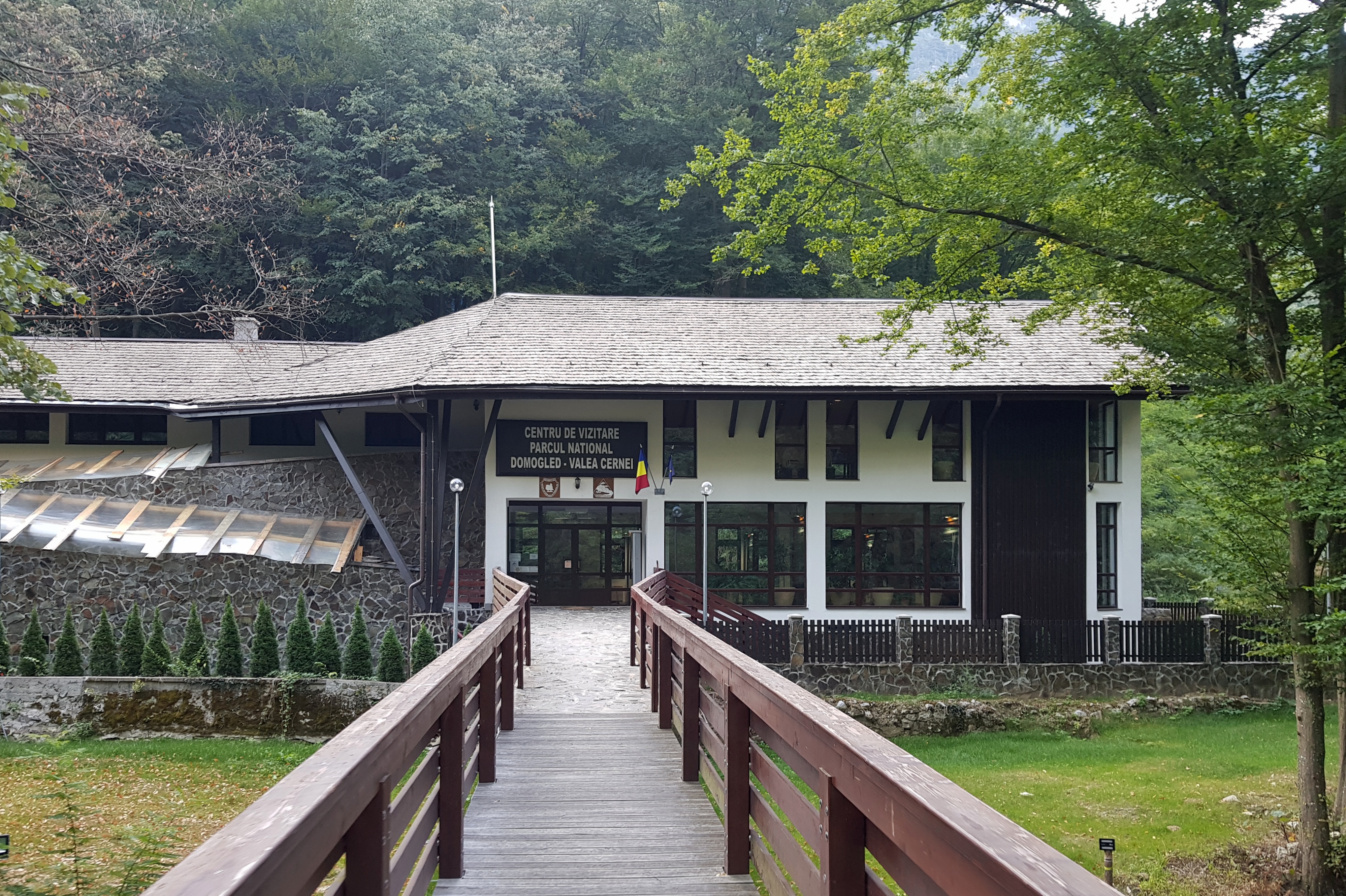
After two baths I used the warm water to launder my shirt and continued to Băile Herculane town. On the way I dropped in the national park visitor center to see an exhibition about the area. The EU funded exhibition was poor but I could charge my gadgets there. When I was leaving an officer approached me and we started conversation. He was responsible for environmental education in the park but after few years he realized the way he did it does not work. Fortunately, his boss did not care as soon as he could deliver him photos of activities. He was very opened so I invited him to our place to get some inspiration in the field. While talking he also proved my idea that fireballs are probably the best defense towards wild dogs in the mountains.
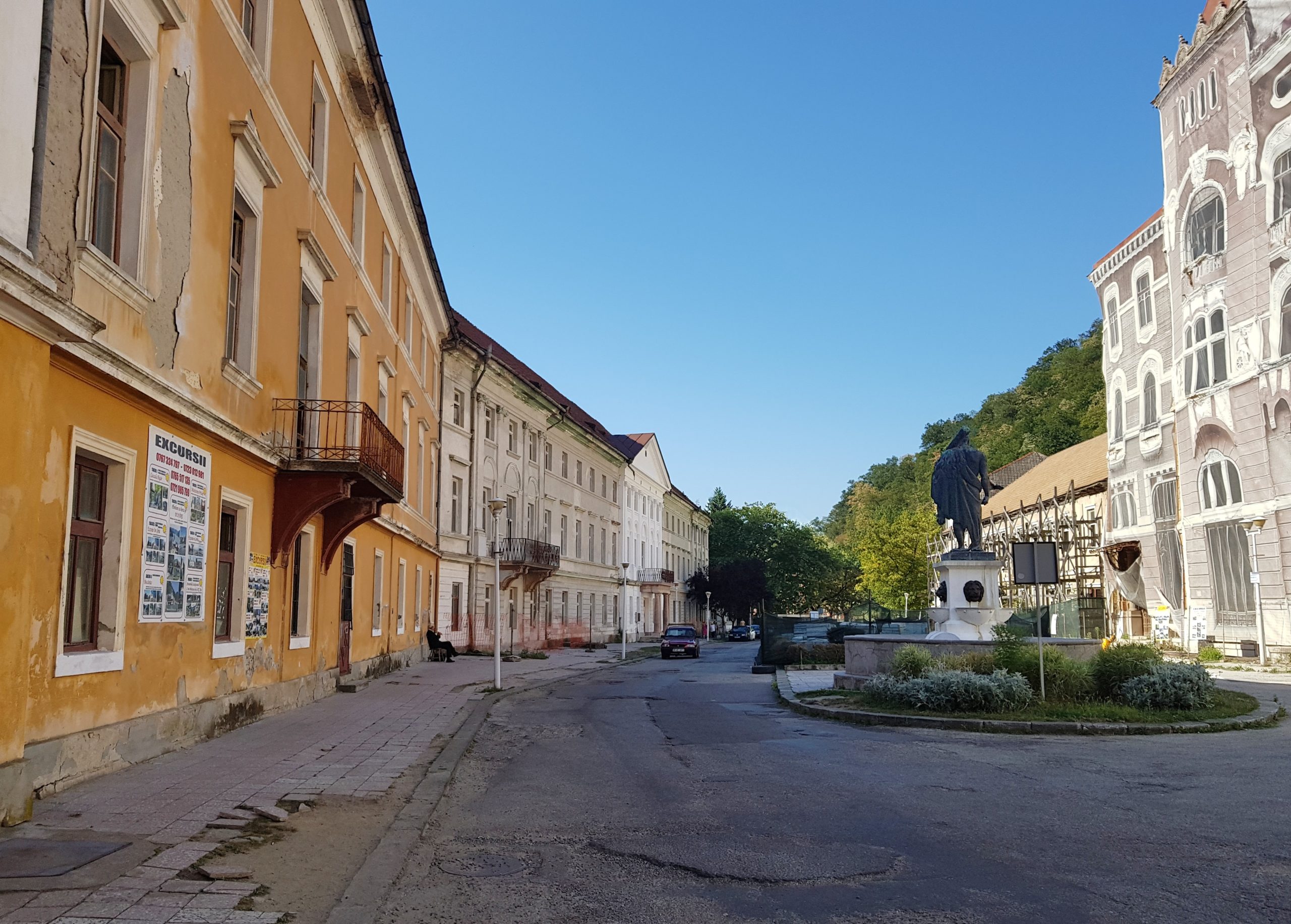
As usually, I tried to fuel with as much energy as possible in the town. I visited a supermarket, sweet shop, another supermarket and after realizing my smartphone needs some charge while leaving the town I went to a restaurant for a soup I almost could not eat as my stomach had been already full.
I followed the Cerna river that runs south to Orşova, where most of hikers either start of finish their Carpathian thru-hikes. I walked on an asphalt road with busy traffic in scorching sun. 11,5 kilometres from Orşova at 3:00 pm at the altitute of 100m I turned west and continued along a stream to the last mountain ranges in the Banat region. The railway runs near the road so I could see a special Czech train bringing my compatriots for a music festival in Eibenthal – one of the villages in the area settled by Czechs in the first half of 19th century.
Michał, the Polish hiker I was in contact with, reached Orşova 4:30 pm that day. I could have met him if not following further westwards.
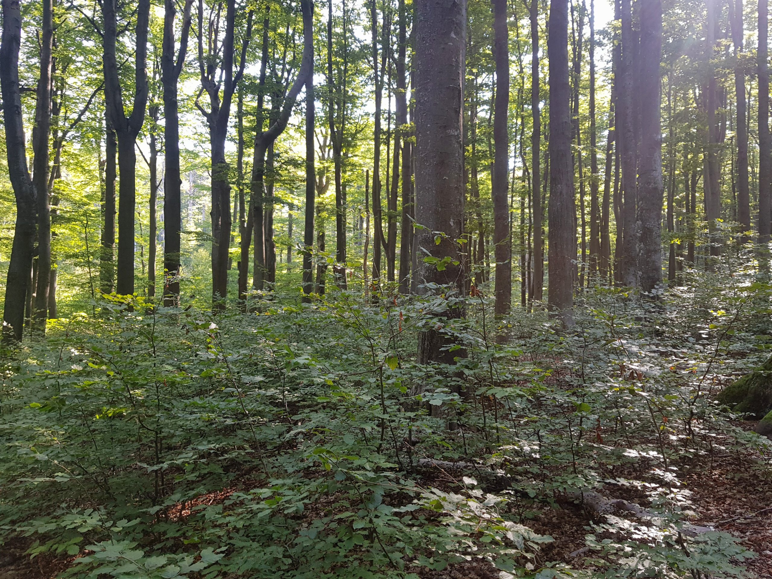
I comfortably ascended to the altitude of 1000 metres on a forest road running through the endless beech forests of Banat. A car approached me with a local charcoal maker I passed by in the village near the road to Orşova. He went few kilometres just to ask me where I am going. Similar situations happened with foresters and loggers I met. For all of them it was difficult to imagine I wanted to cross these forests towards Czech villages near the Danube. I soon realized why.

The sun was on horizon when I reached what seemed like a mountain pass on the map. The road almost disappeared and my planned trail that followed the ridge ran through dense forest planted about 15 years ago. Many signs indicated bear presence so I decided to go a bit downhill where I fortunately found a recently logged area. Litter told me the loggers and tree planting crews were working here not long ago.
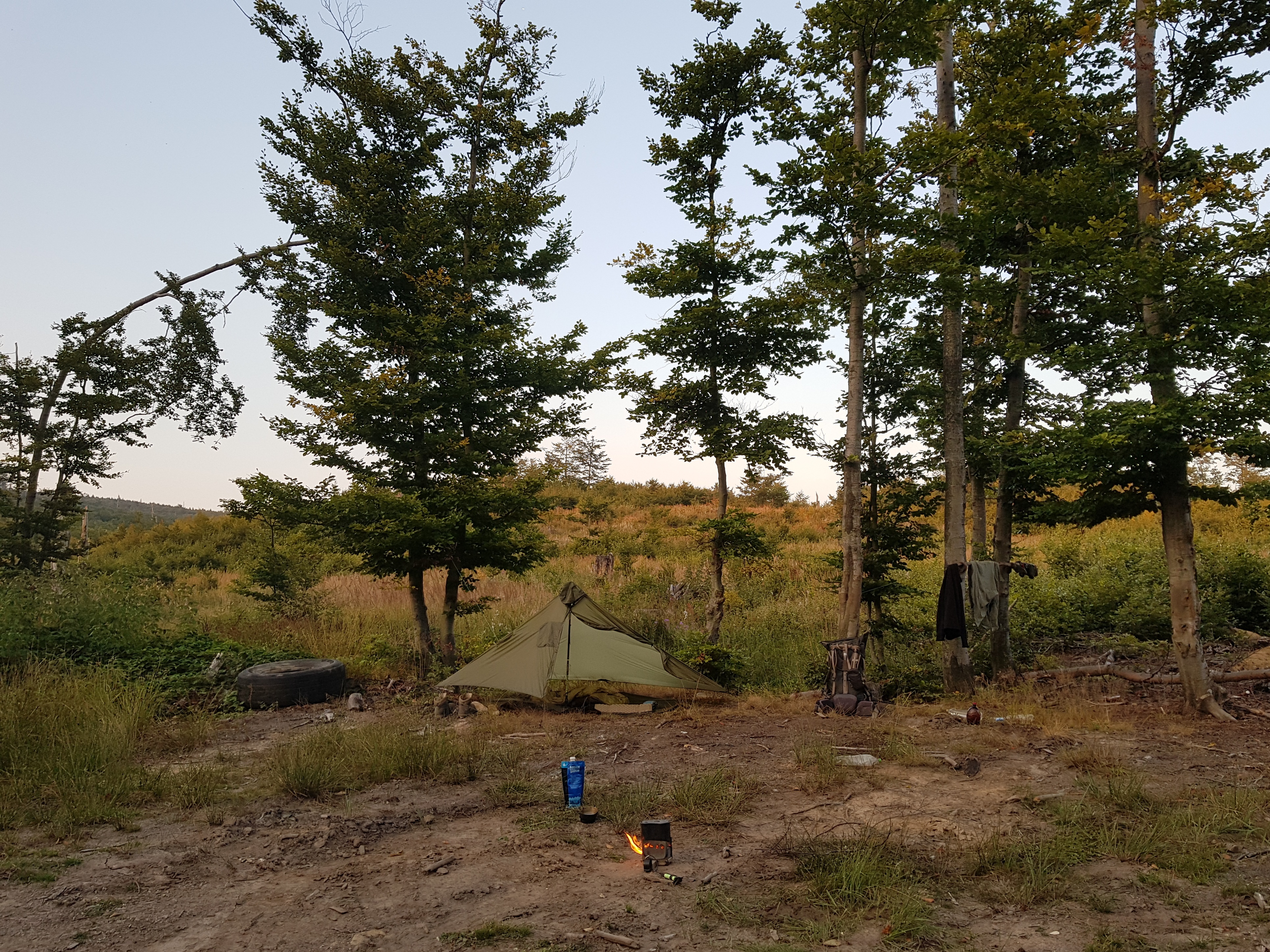
Back at home I would rather find a nice hidden place in the forest but here I preferred to camp near a road at area where logs are loaded on trucks, to be easily discovered by humans in case of an emergency. I left my smartphone playing music throughout the evening to distract bears as these young forests with berries are safeheaven for them. Night was calm, only two or three times I could hear noise of a moving animal so I rang the jingles I kept close to me. Though it may sound strange, I felt the fear something unfortunate might happen to me during these last kilometres.
Through the Banat highlands
I wanted to make it to the Czech village of Rovensko on Thursday 22nd August and I knew the most difficult part of the trail lies just within the first 5 kilometres before I reach a marked tourist trail. However, the blue sky seemed so promising that I used the nearby stream to wash my socks and dived into the forest only at about 8:30 am, an hour later than usually. At first I followed loggers’ roads but they disappeared soon and I was walking in old virgin forest crossing fallen trees and elbowed my way through younger growth. No trails, no signs of human activity apart from newly planted growth at one place that was really difficult to cross. I could not imagine myself walking across Carpathians without the GPS in my smartphone. After an hour or so I came to what once was a forest road marked with “H” which as far as I understand means boundary between forest districts in Romania. It led me to recently deforested areas unintentionally turned into blackberry plantations and finally to the marked trail.
The tourist marking was Czech standard because it was made by Czech volunteers. Reaching the marked trail was a huge relief and enabled me to walk fast but at 11 am I knew I could hardly make it to Rovensko before the evening.
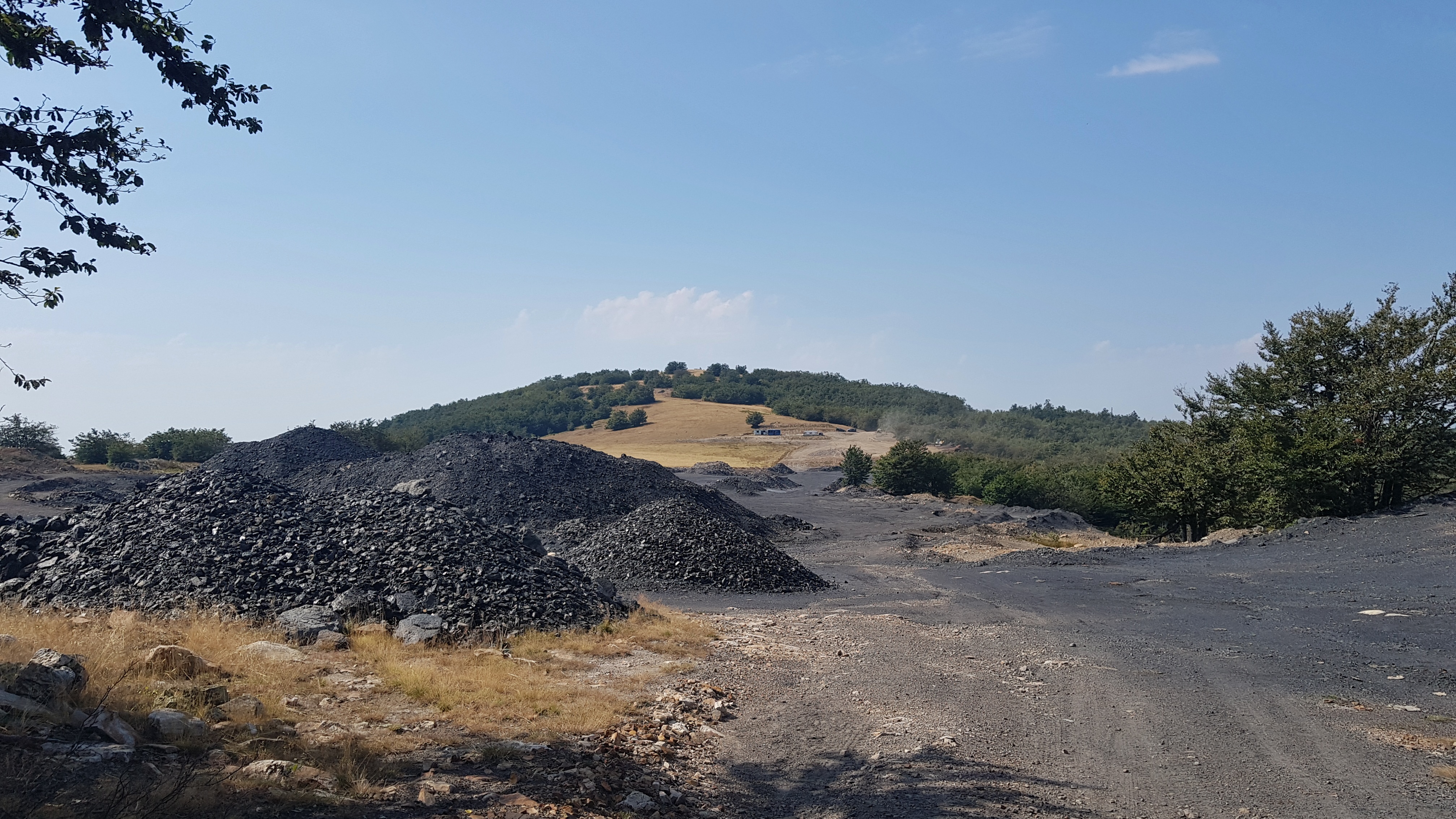
I went through an operating anthracite quarry in the middle of nowhere and reached a strong stream – beautiful place for a lunch break. Unfortunately, I put my socks on a young tree to dry and left them there. Thus I lost the only socks that went with me all the way long from Moravia.


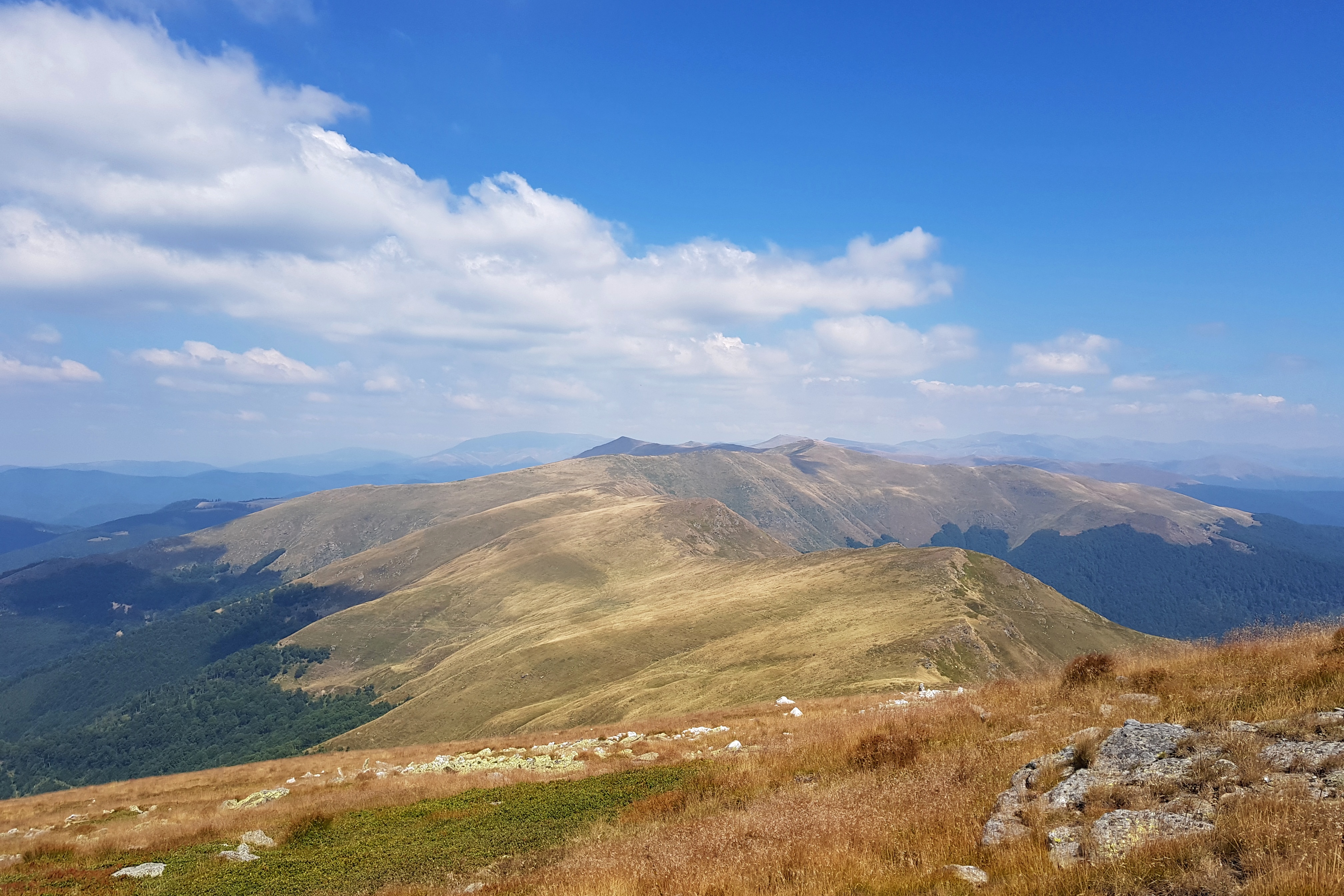
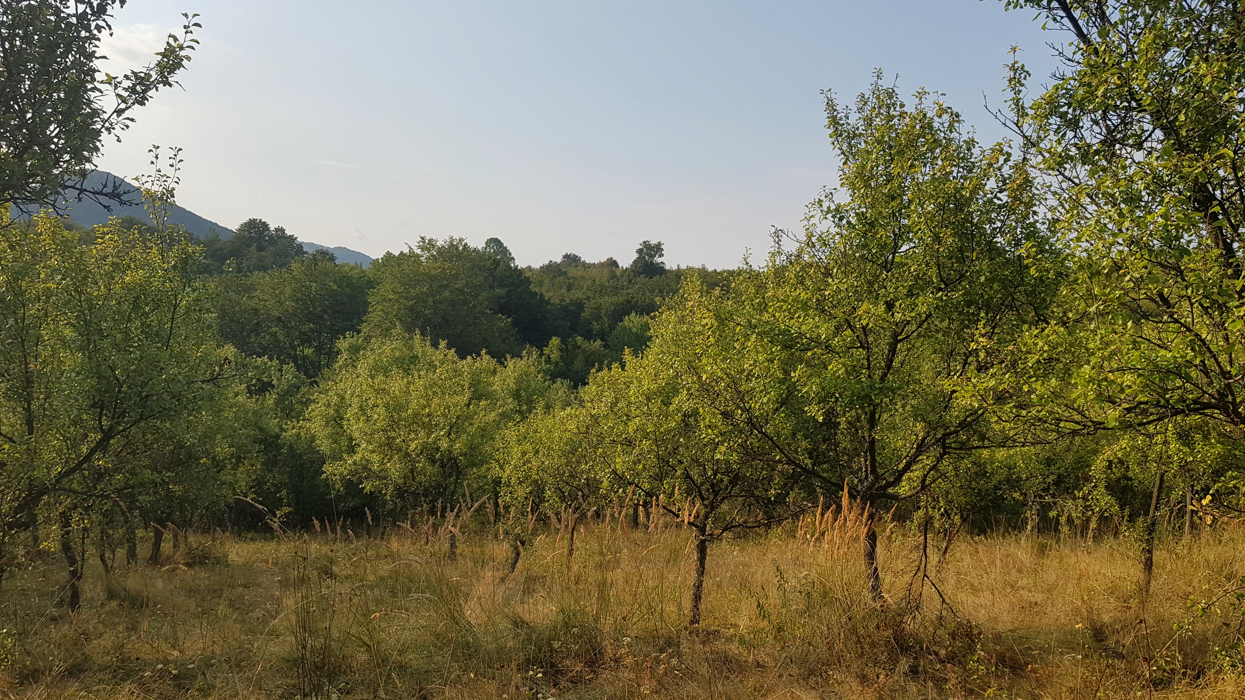
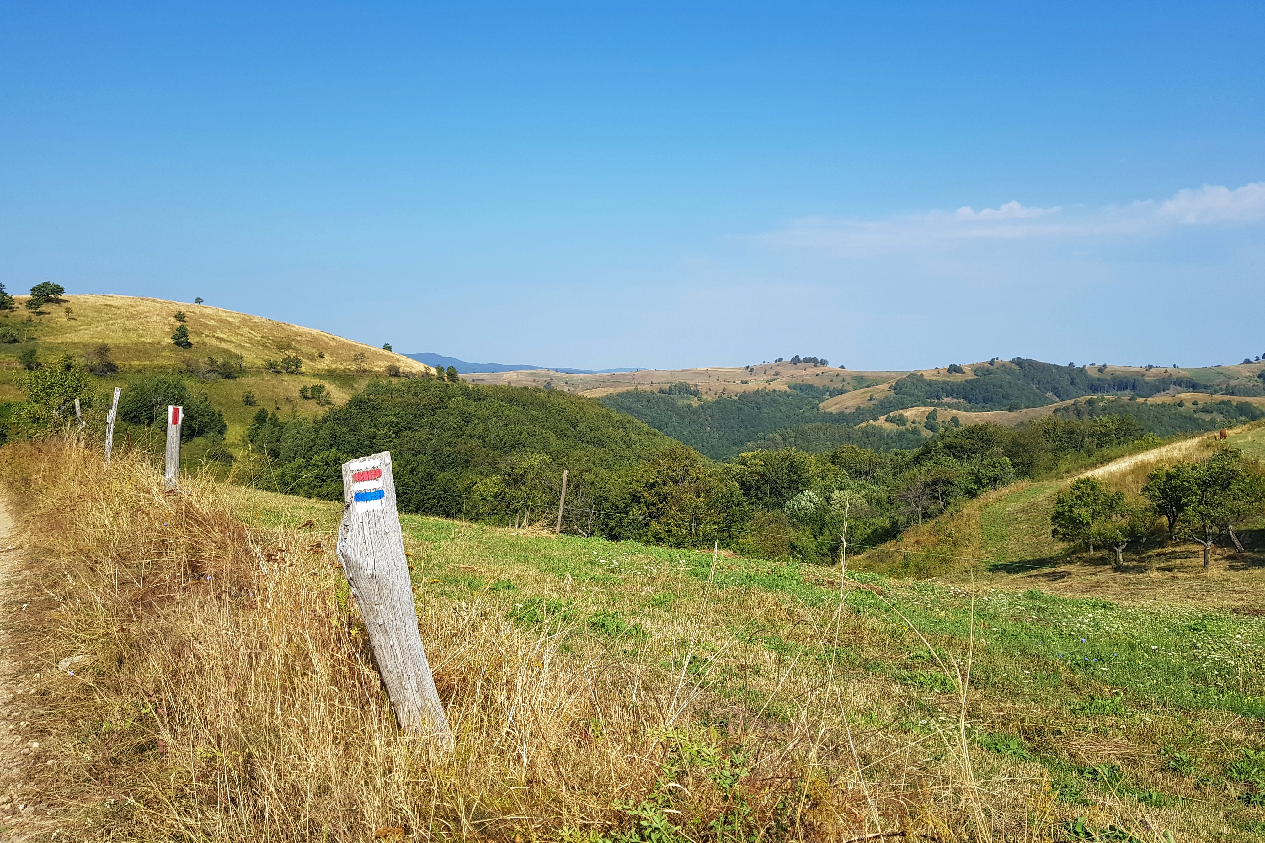
I sneaked by a shepherd’s farm and found couple of others already abandoned as the grass was dry. The tracks told me they had probably left with their herds couple of days ago. At one point near an unnamed hill with nice view (picture above) the marking disappeared and I was suspicious that it had been intentionally destroyed by a shepherd whose farm it was passing by. I use the term “farm” because shepherds’ houses in this region were closed yards used to keep also other domestic animals – summer farms different from what could be seen in other parts of Romania.
As I was coming closer to settled areas, I could see more and more abandoned old fruit orchards steadily turning into fruit forests. I even found my favorite old breed of Nancy mirabelle. About 13 kilometres before the Rovensko village the trail follows different way than is charted in the map and I lost my way near an abandoned quarry. It was the last time I was afraid of bears as I could see fresh tracks and signs of bear activity.
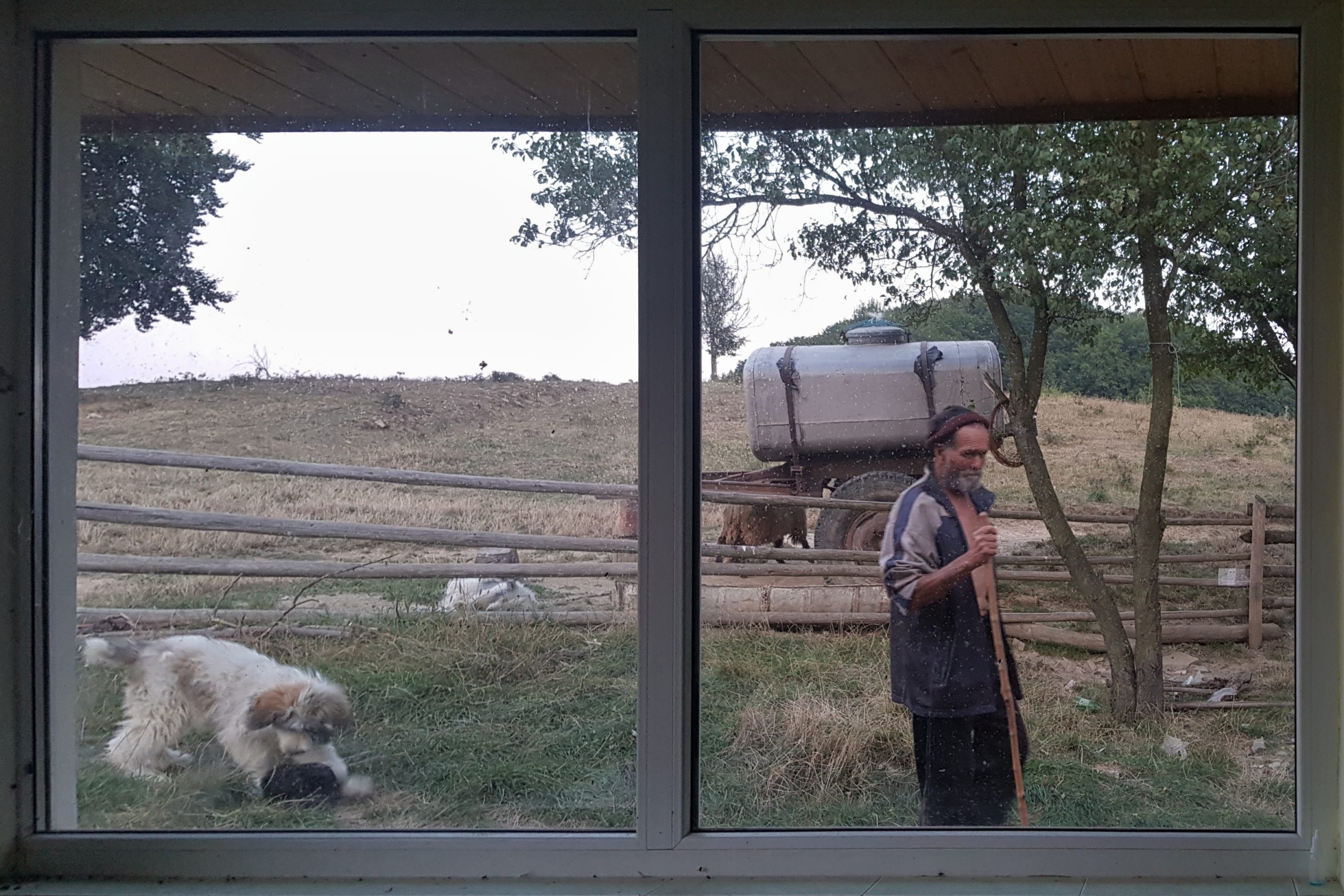
Water was scarce through the day and there were no signs of a water source when I met a shepherd with his herd. He immediately tried to calm his dogs and took me to his house to give me some water. He said there was some water on the way to Rovensko (about 8 km ahead) but was not specific where, though I was asking several times. The old man desperately wanted me to stay overnight with him, he even washed my feet. No wonder considering dogs are his only companions for 4 months a year. I did not want to be flea-bitten again but I also wanted to make the man happy, so I stayed in his guestroom.
Hearing Czech again
I packed my stuff at dark and started walking very early as I wanted to reach the Danube about 40 km ahead on Friday 23rd August. My nightmare came true and I was bitten both by fleas and bedbugs. The water spring was about 1 km away from the shepherd’s house, so if I was not socializing with the old man, I could have filled water there, stay even further on my trail and miss the itching souvenir.
The landscape in this region is different from others in the Carpathians. Nowhere else I could see the pattern of large orchards and meadows accompanied by small houses used by their keepers now and then because of their location far away from the village. Some plots were cared for, others were turning into strange type of fruit trees wilderness.
I came to Rovensko and took water at the first trough on the street. When I was putting dry vegetables and dry beef to my cold-soaking jar, a man in mid-sixties went out on the street from his house. I greeted him in Czech and he replied “Dobrý den” – good morning. Of course I knew there are the Czech villages over here, but hearing his greeting filled me with such a joy, I wanted to hug him. I must have said something like “This is unbelievable” in Czech because he turned to me and said “you wanted to say something?” with a soft accent. “You know, I left Moravia ten weeks ago and I cannot believe I can hear Czech again.” I replied. He gave me a polite smile showing his distance from tourists and walked away.
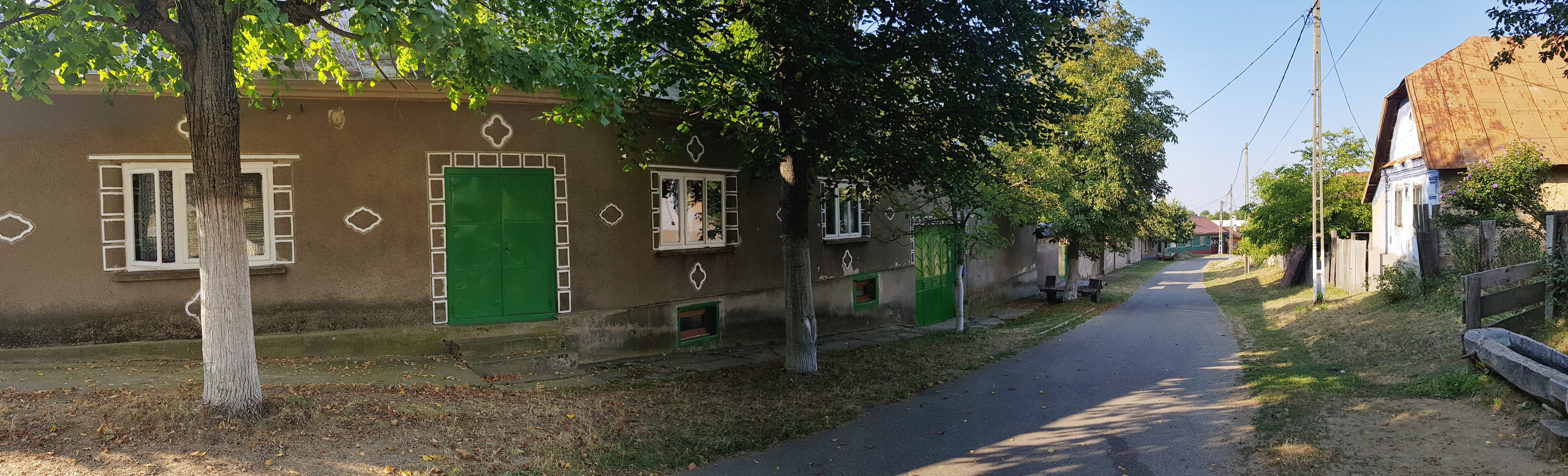
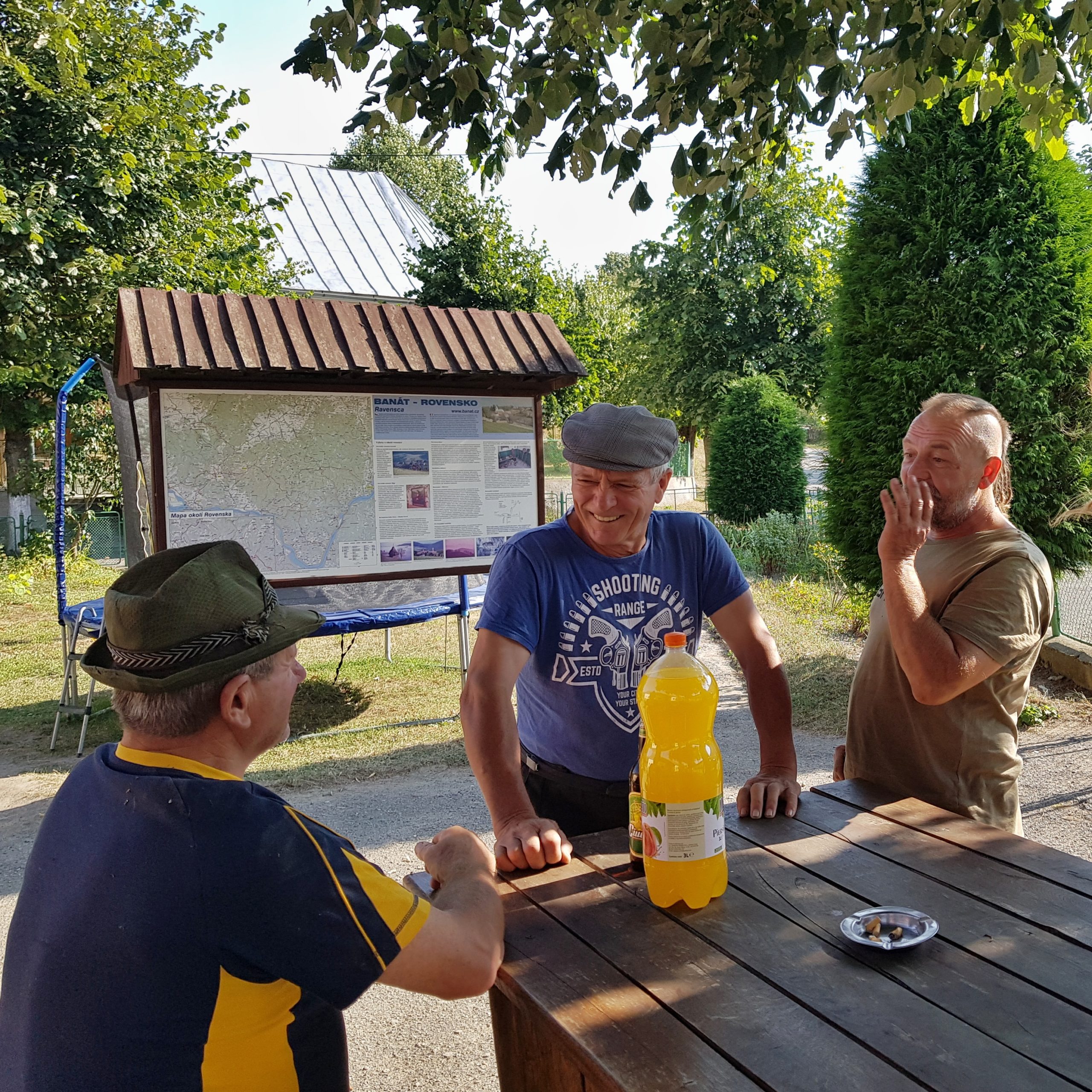
The “no photos” sign decorating the door of the small grocery shop indicated that locals are not fond of tourists. I bought a Coke and a big cake to rise my blood-sugar levels and joined a couple drinking beer in front of the shop. We started talking and the man (newcomer as he had been living here for 2 years only) explained to me the difficult relationship of locals towards tourists. Soon elderly men joined our party and started talking about local issues – some Romanians stolen corn, someone is moving to the Czech Republic and his farmland should be taken over by his neighbor. The music festival in Eibenthal has nothing to do with locals, it was imported and is too expensive for the “Pems” (Czechs living in Banat). The man who greeted me in the morning explained to the newcomer some stories from the local history. I noticed that when (Czech) tourists started coming to the shop, locals were mixing more Romanian words to their Czech conversations.
I was grateful for the insight but needed to continue to another Czech village – Gernik. The landscape was similar with apparent signs of drought – the locals told me, there had been no rain for two months. Blackberries along the way slowed my advance on the well-marked trails.
…
Gernik settlement is located on limestone bedrock and karst features are clearly visible around the village. The mighty karst stream of Gravenska a mile to the east from Gernic is a magic place. Tourists visit five old water mills, but I was also impressed by calcification of the water that leads to fast development of travertine. While having a bath and laundering my shirts, I admired fossilized leaves and twigs as well as a cascade.

Gernik was full of tourists that stayed here during the Czech music festival in Eibenthal. Locals tried to sell them homemade jams and honey. I bought some food and soup in the shop & restaurant of Josef Nedvěd and while leaving some Czech hikers asked me where I am coming from and going to. My answer shocked them. They urged me to stay longer and talk about the journey but this was not possible if I wanted to reach the Danube. Even Mr. Nedvěd joined us and offered me to stay with him as he needed “someone so fit to help him with his new cottage for tourists in the mountains.”
The minute of fame was over and I continued well-fed to St. Helena. Windmills dot the landscape around this Czech village making it to some a model sustainable landscape while to others ugly looking intrusion of civilization.

To my surprise I met only 6 Czech one-day hikers near Gernik and the group in the pub throughout the whole day. Not a person on the trail.
Svatá Helena is way more touristic than Gernik and Rovensko. Groups of Czech tourists at different stage of drunkenness were gathering around one of the local pubs and started frenetically taking photos when a lady walked up the street with her cows. I felt I am not fitting into this place so I walked away to find a camping place near the Danube.

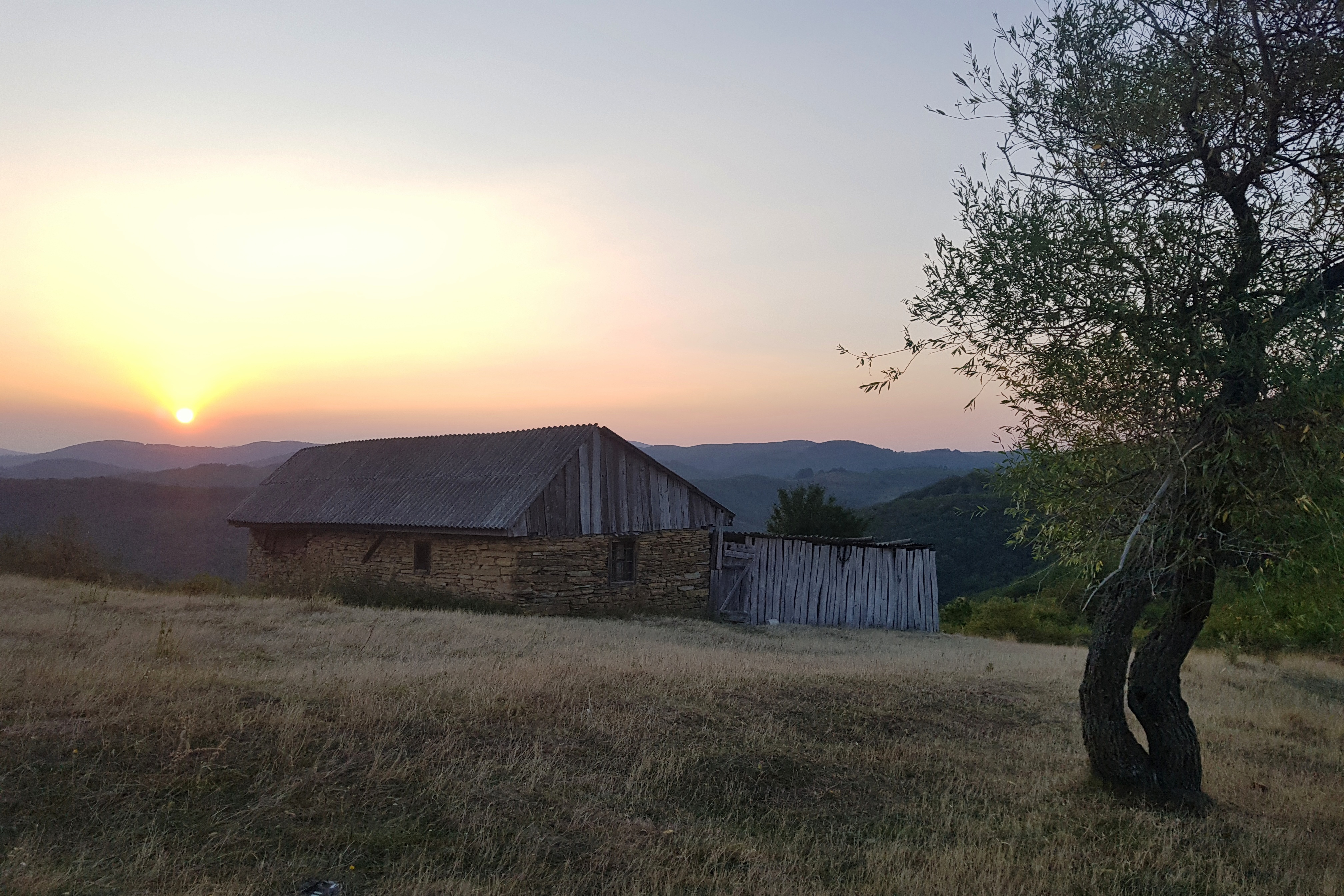
The spot was one of the most beautiful during the whole journey. It was a windy place, which distracted mosquitoes, with view over both the mightiness of the Danube and its entry to the narrow Iron Gate gorge.
I could not fall asleep as the flea and bedbug bites were hell-itching so I got lot of time for thinking about the coincidence that at the both ends of the Carpathian arc people speak Czech.
Departure from the Danube
Before I packed a herd of goats was passing by at dawn on Saturday 24th August. My plan was to catch the 11 am train from Orşova and make a visit to St. Ladislau castle ruins that were right below my camping spot.
The ruins were perfect for taking the closing videos of this journey. I must admit that I had been more emotional while dreaming about this moment in the weeks before than I was when it actually happened.
After descend to the Danube (77m) and necessary face washing in its water near the Coronini village, I started to hitch-hike towards Orşova. The traffic was not frequent so after an hour it became apparent I would not be able to catch the train in Orşova 96 km away so I started hitch-hike in the opposite direction to catch it in Timişoara (165 km away). After a while a truck loaded with wood took me on board. The driver apologized for going slowly but I was happy he could take me just 30 km from Timişoara and we got very nice talk together as he was also a lover of Romanian mountains and an experienced logging-trucks driver.

He suggested to leave me at the petrol station in Denta and I found out that there is a train going to Timişoara just 2 km from there in 15 minutes. He was not willing to help me approaching the railway station so I needed to run 2km through the hot village. I caught the train easily noticing my running speed increased over the hike.
The train to Budapest was delayed 50 minutes on arrival so it was obvious that instead of going home that day, I needed to find another solution. As there were no other connections from Budapest available, I booked a hostel near the railway station for the earliest morning train.
My impressions from Budapest were not particularly good. Hungarians often emphasize this used to be “Paris on the Danube” at the end of 19th century but in my opinion it is not coping with the challenges of the 21st century. The streets were dirty, many locals did not bother to learn English, the hostel did not accept credit cards and even at places like international railway station the information system is poor and in Hungarian only.
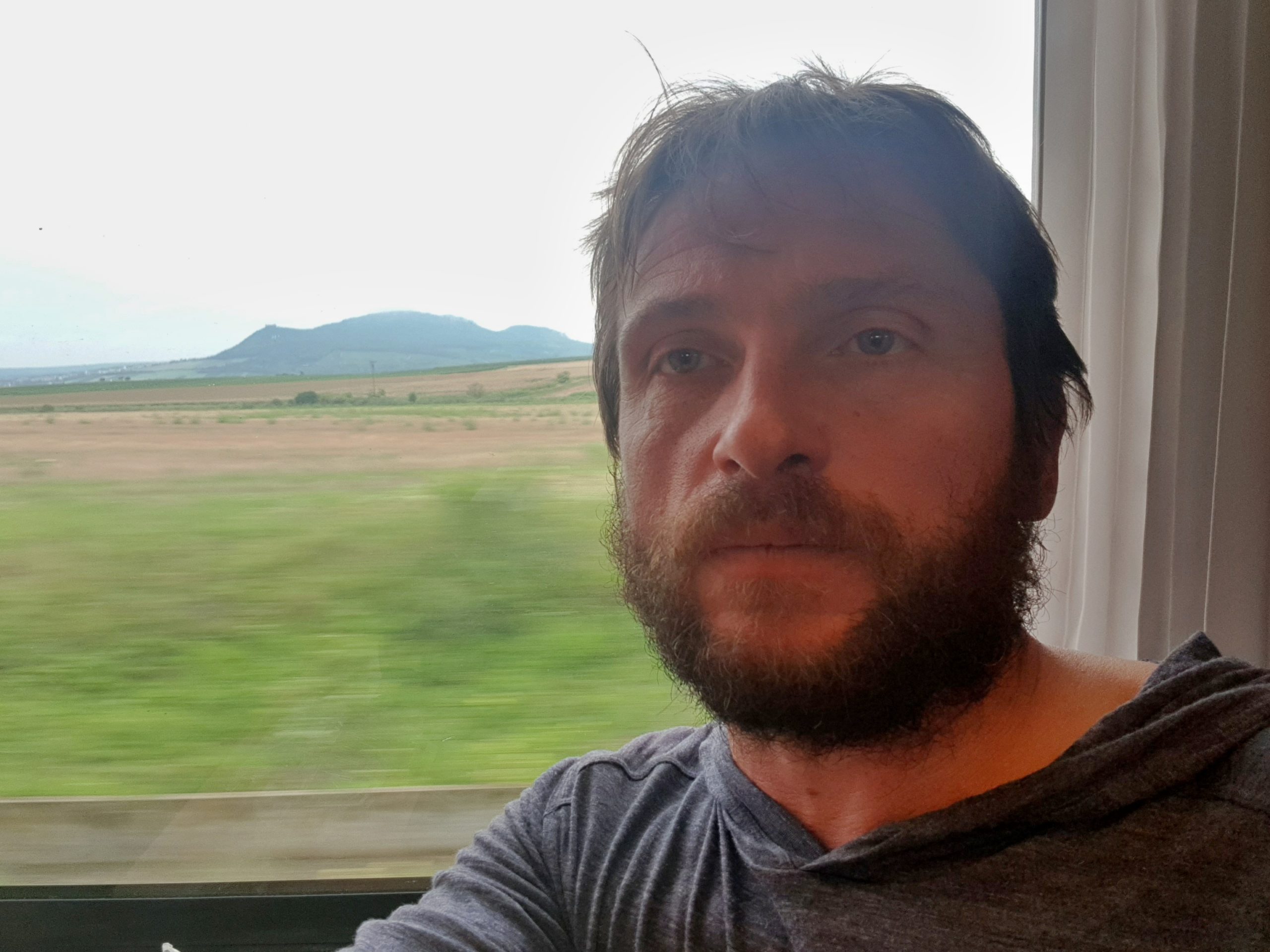
Anyway, after few hours of sleep I boarded a train back home. Passing by the Pálava, where from I started 2,5 months ago paralyzed by the great fear gave me feeling of an achievement. At 9 am on Sunday 25th August I hugged my wife Veronica and son Mojmír near the Brno railway station as they were coincidentaly just coming from Italy.
On Monday 10th June I was leaving from here with the heavy backpack, frightened by my own dream of the fearsome journey coming true. Now I was grateful I returned back sound 76 days later, 7,6 kilos lighter but still wondering how I managed to make this amazing dream coming true.